Search
You Searched For
Search Results
- Creator:
- National Geographic Society (U.S.). Cartographic Division
- Published / Created:
- 1914
- Call Number:
- 848 1914D
- Container / Volume:
- BRBL_00631
- Image Count:
- 1
- Resource Type:
- Maps, Atlases & Globes
- Found in:
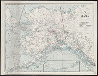
- Beinecke Rare Book and Manuscript Library > Map of Alaska : showing latest explorations by U.S. Geological Survey and U.S. Coast and Geodetic Survey.
- Creator:
- Geological Survey (U.S.)
- Published / Created:
- 1922
- Call Number:
- 848 In5 1922
- Container / Volume:
- BRBL_00633
- Image Count:
- 1
- Resource Type:
- Maps, Atlases & Globes
- Found in:
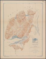
- Beinecke Rare Book and Manuscript Library > Topographic map of Iniskin-Chinitna Peninsula, Cook Inlet region, Alaska / United States Department of the Interior Geological Survey ; Alfred H. Brooks, geologist in charge of division ; topography by C.P. McKinley and Gerald Fitz-Gerald.
- Creator:
- Great Britain. War Office. General Staff. Geographical Section
- Published / Created:
- 1945
- Call Number:
- 5681 1945
- Container / Volume:
- BRBL_00300
- Image Count:
- 2
- Resource Type:
- Maps, Atlases & Globes
- Found in:
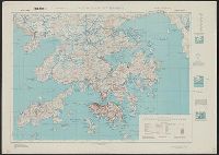
- Beinecke Rare Book and Manuscript Library > Hong Kong and New territory.
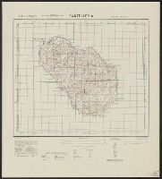
- Creator:
- Great Britain. Army. Royal Engineers. Fd. Survey Coy., 512
- Published / Created:
- 1943
- Call Number:
- 493 1943
- Container / Volume:
- BRBL_00270
- Image Count:
- 2
- Resource Type:
- Maps, Atlases & Globes
- Found in:
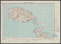
- Beinecke Rare Book and Manuscript Library > Malta and Gozo [cartographic material] / drawn at Ordnance Survey Office, Southampton, 1934 ; revised and reprinted by 512 Fd. Survey Coy., R.E. Feb., 1943.
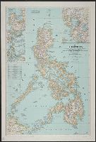
- Creator:
- Bouma, Donald G
Brehm, John J. B
Darley, James M. (James Morrison)
Holdstock, A. E
National Geographic Society (U.S.). Cartographic Division
- Published / Created:
- 1945
- Call Number:
- 28 1945
- Container / Volume:
- BRBL_00023E
- Image Count:
- 1
- Resource Type:
- Maps, Atlases & Globes
- Found in:
- Beinecke Rare Book and Manuscript Library > The Philippines / compiled and drawn in the Cartographic Section of the National Geographic Society ; James M. Darley, chief cartographer ; Apphia E. Holdstock & Donald G. Bouma, compilers ; relief by John J. Brehm.
- Creator:
- Great Britain. War Office. General Staff. Geographical Section
- Published / Created:
- 1943
- Call Number:
- 40 P19 1942
- Container / Volume:
- BRBL_00213
- Image Count:
- 1
- Resource Type:
- Maps, Atlases & Globes
- Found in:
- Beinecke Rare Book and Manuscript Library > Pantelleria [cartographic material] / drawn by GSGS, War Office 1940.
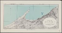
- Creator:
- Great Britain. Inter-service Topographical Dept
- Published / Created:
- 1943
- Call Number:
- 40 V652 1943
- Image Count:
- 1
- Resource Type:
- Maps, Atlases & Globes
- Found in:
- Beinecke Rare Book and Manuscript Library > Town plan of Vibo Valentia Marina [cartographic material] / compiled and drawn by Inter-Service Topographical Department ; produced under the Superintendence of Vice-Admiral John Edgell, hydrographer.
- Creator:
- United States. Army Map Service
- Published / Created:
- 1944
- Call Number:
- 50 1945M
- Container / Volume:
- BRBL_00273
- Image Count:
- 1
- Resource Type:
- Maps, Atlases & Globes
- Found in:
- Beinecke Rare Book and Manuscript Library > [AAF cloth chart]. Eastern Asia [cartographic material].
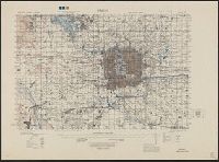
- Creator:
- Great Britain. War Office. General Staff. Geographical Section
- Published / Created:
- 1945
- Call Number:
- 56 P36 1945
- Container / Volume:
- BRBL_00297
- Image Count:
- 1
- Resource Type:
- Maps, Atlases & Globes
- Found in:
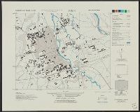
- Beinecke Rare Book and Manuscript Library > Eastern China 1:50,000. Sheet 16/2,200, Peking / Geographical Section, General Staff [cartographic material].
- Creator:
- Great Britain. War Office. General Staff. Geographical Section
- Published / Created:
- 1943
- Call Number:
- 56cbf 1942
- Container / Volume:
- BRBL_00297
- Image Count:
- 1
- Resource Type:
- Maps, Atlases & Globes
- Found in:
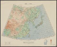
- Beinecke Rare Book and Manuscript Library > China and Japan [cartographic material] / compiled from G.S.G.S. 4065 and 2957.
- Creator:
- United States. Office of Strategic Services. Research and Analysis Branch
- Published / Created:
- 1944
- Call Number:
- 56cbf 1944
- Container / Volume:
- BRBL_00297
- Image Count:
- 1
- Resource Type:
- Maps, Atlases & Globes
- Found in:
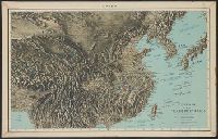
- Beinecke Rare Book and Manuscript Library > China, terrain and transportation [cartographic material] / compiled and drawn in the Branch of Research and Analysis, OSS.
- Creator:
- United States. Army Map Service
- Published / Created:
- 1945
- Call Number:
- 575 T57 1945
- Container / Volume:
- BRBL_00313
- Image Count:
- 1
- Resource Type:
- Maps, Atlases & Globes
- Found in:
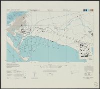
- Beinecke Rare Book and Manuscript Library > Formosa city plans 1: 6,000 : Toen / prepared under the direction of the Chief of Engineers by the Army Map Service (AM), U.S. Army.
- Creator:
- United States. Army Map Service
- Published / Created:
- 1944
- Call Number:
- 575 T574 1944
- Container / Volume:
- BRBL_00313
- Image Count:
- 1
- Resource Type:
- Maps, Atlases & Globes
- Found in:
- Beinecke Rare Book and Manuscript Library > Formosa city plans 1: 6,000 : Toko / prepared under the direction of the Chief of Engineers by the Army Map Service (AM), U.S. Army.
- Creator:
- United States. Army Map Service
- Published / Created:
- 1945
- Call Number:
- 575 T15 1945
- Container / Volume:
- BRBL_00313
- Image Count:
- 1
- Resource Type:
- Maps, Atlases & Globes
- Found in:
- Beinecke Rare Book and Manuscript Library > Formosa city plans 1: 8,000 : Tansui / prepared under the direction of the Chief of Engineers by the Army Map Service (AM), U.S. Army.