Search
You Searched For
Search Results
- Creator:
- United States. Army Map Service
- Published / Created:
- [1945]
- Call Number:
- 3897gm 1945
- Image Count:
- 1
- Resource Type:
- Maps, Atlases & Globes
- Found in:
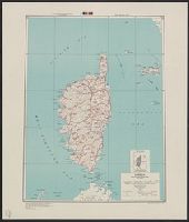
- Beinecke Rare Book and Manuscript Library > Corsica [cartographic material] : special strategic map / compiled by the Army Map Service.
- Creator:
- Great Britain. Inter-service Topographical Dept
- Published / Created:
- 1943
- Call Number:
- 38 D34 1944
- Container / Volume:
- BRBL_00157
- Image Count:
- 1
- Resource Type:
- Maps, Atlases & Globes
- Found in:
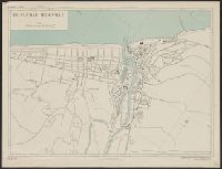
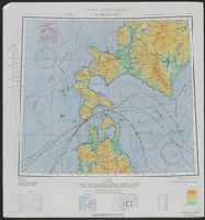
- Beinecke Rare Book and Manuscript Library > Deauville-Trouville [cartographic material] / compiled and drawn by Inter-Service Topographical Dept. ; produced under the Superintendence of Vice-Admiral John Edgell, hydrographer.
- Creator:
- Great Britain. Army. Middle East Forces
- Published / Created:
- 1943
- Call Number:
- 69 D44 1943
- Container / Volume:
- BRBL_00352
- Image Count:
- 1
- Resource Type:
- Maps, Atlases & Globes
- Found in:
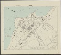
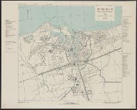
- Beinecke Rare Book and Manuscript Library > Derna, city plan.
- Creator:
- United States. Army Map Service
- Published / Created:
- 1942
- Call Number:
- 35fb 1939
- Container / Volume:
- BRBL_00103
- Image Count:
- 1
- Resource Type:
- Maps, Atlases & Globes
- Found in:
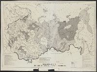
- Beinecke Rare Book and Manuscript Library > Divisions of the Union of Soviet Socialist Republics as of September, 1939 / compiled and drawn by Army Map Service.
- Creator:
- Great Britain. Inter-service Topographical Dept
- Published / Created:
- 1943, 1944 printing.
- Call Number:
- 38 D742 1944
- Container / Volume:
- BRBL_00157
- Image Count:
- 1
- Resource Type:
- Maps, Atlases & Globes
- Found in:
- Beinecke Rare Book and Manuscript Library > Douarnenez-Tréboul [cartographic material] : plan of port and town / compiled and drawn by Inter-Service Topographical Dept. ; produced under the Superintendence of Vice-Admiral John Edgell, hydrographer.
- Creator:
- Great Britain. Inter-service Topographical Dept
- Published / Created:
- 1943
- Call Number:
- 38 D92 1943
- Container / Volume:
- BRBL_00157
- Image Count:
- 1
- Resource Type:
- Maps, Atlases & Globes
- Found in:
- Beinecke Rare Book and Manuscript Library > Dunkerque [cartographic material] : plan of port & town / compiled and drawn by Inter-Service Topographical Dept. ; produced under the Superintendence of Vice-Admiral John Edgell, hydrographer.
- Creator:
- United States. Army Map Service
- Published / Created:
- 1945
- Call Number:
- 50 1945L
- Container / Volume:
- BRBL_00273
- Image Count:
- 2
- Resource Type:
- Maps, Atlases & Globes
- Found in:
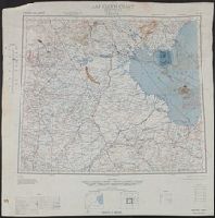
- Beinecke Rare Book and Manuscript Library > Eastern Asia 1:1,000,000 AAF cloth chart. Hakodate. NK54.
- Creator:
- United States. Army Map Service
- Published / Created:
- 1944
- Call Number:
- 50 1945N
- Container / Volume:
- BRBL_00273
- Image Count:
- 2
- Resource Type:
- Maps, Atlases & Globes
- Found in:
- Beinecke Rare Book and Manuscript Library > Eastern Asia 1:1,000,000 AAF cloth chart. Ryojun NJ-51.
- Creator:
- United States. Army Map Service
- Published / Created:
- 1943
- Call Number:
- 556 1944D
- Container / Volume:
- BRBL_00293
- Image Count:
- 2
- Resource Type:
- Maps, Atlases & Globes
- Found in:
- Beinecke Rare Book and Manuscript Library > Eastern Asia 1:1,000,000 [cartographic material] : AAF cloth chart. Hakodate. NK54.
- Creator:
- Great Britain. War Office. General Staff. Geographical Section
- Published / Created:
- 1945
- Call Number:
- 56 P36 1945
- Container / Volume:
- BRBL_00297
- Image Count:
- 1
- Resource Type:
- Maps, Atlases & Globes
- Found in:
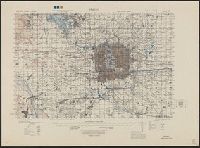
- Beinecke Rare Book and Manuscript Library > Eastern China 1:50,000. Sheet 16/2,200, Peking / Geographical Section, General Staff [cartographic material].