
1.
- Creator:
- Anglo-German Boundary Commission
- Published / Created:
- 1907
- Call Number:
- 633 1907
- Container / Volume:
- BRBL_00336
- Image Count:
- 1
- Resource Type:
- Maps, Atlases & Globes
- Alternative Title:
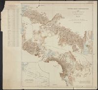
- Map of the country north and south of the Anglo German boundary reduced from the surveys of the British and German sections of the Commissions during the years 1904-1906
- Description:
- "Note. For information concerning the construction of this map, see the paper by Captain G.E. Smith, R.E., and the note by Captain T.T. Behrens, R.E., in the 'Geographical Journal' for March and July 1907."
- Publisher:
- Royal Geographical Society,
- Subject (Geographic):
- Kenya--Boundaries--Tanzania--Maps and Tanzania--Boundaries--Kenya--Maps
- Subject (Name):
- Smith, George Edward
- Found in:
- Beinecke Rare Book and Manuscript Library > Victoria Nyanza to Mt. Kilimanjaro. Map of the country north and south of the Anglo German boundary reduced from the surveys of the British and German sections of the Commissions during the years 1904-1906.