Skip to search
Skip to main content
Skip to first result
Search
You Searched For
"Interiors"
Access
Public
Language
English
Creator
Canada. Dept. of the Interior
New Search
Search Results
Creator:
Interior
Published / Created:
1904
Call Number:
18 1904
Container / Volume:
BRBL_00013
Image Count:
1
Resource Type:
Maps, Atlases & Globes
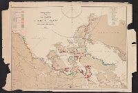
Description:
27 coastal sections with names of explorers; tracks of expedition.
Publisher:
Canada. Dept. of the Interior ,
Subject (Geographic):
Canada, Northern--Discovery and exploration--Maps
Subject (Name):
White, James, 1863-1928
Found in:
Beinecke Rare Book and Manuscript Library > Explorations in northern Canada and adjacent portions of Greenland and Alaska [map] / James White.
Creator:
Interior
Published / Created:
1904
Call Number:
74 1904B
Container / Volume:
BRBL_00394
Image Count:
1
Resource Type:
Maps, Atlases & Globes
Description:
27 coastal sections with names of explorers; tracks of expedition.
Publisher:
Canada. Dept. of the Interior ,
Subject (Geographic):
Canada, Northern--Discovery and exploration--Maps
Subject (Name):
White, James, 1863-1928
Found in:
Beinecke Rare Book and Manuscript Library > Explorations in northern Canada and adjacent portions of Greenland and Alaska [map] / James White.
Creator:
Interior
Published / Created:
1923
Call Number:
739 G45 1923
Container / Volume:
BRBL_00389
Image Count:
1
Resource Type:
Maps, Atlases & Globes
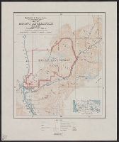
Description:
"Base map from Chief Geographer's map of Rocky and Selkirk mountains.", Includes location map., and Relief shown by contours and spot heights.
Publisher:
Dept. of the Interior , Canada,
Subject (Geographic):
Glacier National Park (B.C.)--Maps
Found in:
Beinecke Rare Book and Manuscript Library > Map of Glacier Park, British Columbia.
Creator:
Interior
Published / Created:
1923
Call Number:
739 M86 1923
Container / Volume:
BRBL_00390
Image Count:
1
Resource Type:
Maps, Atlases & Globes
Description:
Roads & trails; survey grid; inset: [Key map]; relief by contours & spot hts.
Publisher:
Canada. Dept. of the Interior ,
Subject (Geographic):
Mount Revelstoke National Park (B.C.)--Maps
Found in:
Beinecke Rare Book and Manuscript Library > Map of Mount Revelstoke Park, British Columbia [map].
Creator:
Interior
Published / Created:
1903
Call Number:
738 1903
Container / Volume:
BRBL_00387
Image Count:
1
Resource Type:
Maps, Atlases & Globes
Description:
Imperfect: Mutilated, with no loss of text and Survey grid; projected railway lines; land districts & land offices shown in red.
Publisher:
[Canada]. Dept. of the Interior ,
Subject (Geographic):
Saskatchewan--Maps
Found in:
Beinecke Rare Book and Manuscript Library > Saskatchewan [map].
Creator:
Interior
Published / Created:
1905
Call Number:
737 L14 1905
Container / Volume:
BRBL_00385
Image Count:
1
Resource Type:
Maps, Atlases & Globes
Description:
Relief shown by contours, hachures and spot heights.
Publisher:
Dept. of the Interior ,
Subject (Geographic):
Banff National Park (Alta.)--Maps
Subject (Name):
Davidson, George, 1825-1911. asn CU-BANC
Found in:
Beinecke Rare Book and Manuscript Library > Sketch map showing the vicinity of Lake Louise, Moraine Lake and Vermilion Pass / from photographic surveys by A.O. Wheeler ; assisted by M.P. Bridgland and H.C. Wheeler.
Creator:
Interior
Published / Created:
1902
Call Number:
736 1902
Container / Volume:
BRBL_00382
Image Count:
1
Resource Type:
Maps, Atlases & Globes
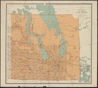
Description:
Land districts outlined in red., Relief shown by spot heights., and Shows railroads.
Publisher:
The Department,
Subject (Geographic):
Manitoba--Maps
Subject (Name):
White, James, 1863-1928
Found in:
Beinecke Rare Book and Manuscript Library > Manitoba / Department of the Interior ; James White, F.R.G.S. Geogrpaher.
Creator:
Interior
Published / Created:
1917
Call Number:
741 1917
Container / Volume:
BRBL_00395
Image Count:
1
Resource Type:
Maps, Atlases & Globes
Description:
Relief shown by spot heights.
Publisher:
The Department,
Subject (Geographic):
Yukon--Maps
Subject (Name):
Chalifour, J. E
Found in:
Beinecke Rare Book and Manuscript Library > Map of the Yukon Territory / Department of the Interior, Canada ; J.E. Chalifour, chief geographer.
Creator:
Interior
Published / Created:
1905
Call Number:
741 K71 1905
Container / Volume:
BRBL_00395
Image Count:
1
Resource Type:
Maps, Atlases & Globes
Description:
"From surveys by International Boundary Commission 1893-95, J.J. McArthur, 1900, A.C. Talbot, 1899, and J.B. Tyrrell, 1898." and Relief shown by form lines and spot heights.
Publisher:
The Department,
Subject (Geographic):
Yukon--Maps
Subject (Name):
White, James
Subject (Topic):
Geomorphology--Yukon--Maps
Found in:
Beinecke Rare Book and Manuscript Library > Yukon Territory, Kluane, White, and Alsek rivers / James White, F.R.G.S. Geographer ; Department of the Interior.
Creator:
Interior
Published / Created:
1924
Call Number:
739G 1924
Container / Volume:
BRBL_00392
Image Count:
1
Resource Type:
Maps, Atlases & Globes
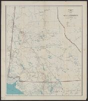
Abstract:
Map shows land ownership.
Description:
From head of title: Honourable Charles Stewart, Minister; W.W. Cory, Deputy Minister; Natural Resources Intelligence Service, F.C.C. Lynch, Director., Inset: [Victoria, Vancouver and surrounding area]., and Relief shown by spot heights.
Publisher:
The Dept.
Subject (Geographic):
British Columbia--Maps
Subject (Name):
Canada. Natural Resources Intelligence Service and Lynch, F. C. C. (Francis Christopher Chisholm), 1884-
Subject (Topic):
Land tenure--British Columbia--Maps
Found in:
Beinecke Rare Book and Manuscript Library > Southern British Columbia : showing disposition of lands within the railway belt / Department of the Interior, Canada.
Branch:v1.61.6 ,Deployed:2024-06-12T09:55:19-04:00