Search
You Searched For
Search Results
- Creator:
- Delarochette, L. (Louis), 1731-1802
- Published / Created:
- June 28th, 1780.
- Call Number:
- 39cea 1780
- Container / Volume:
- BRBL_00192
- Image Count:
- 1
- Resource Type:
- Maps, Atlases & Globes
- Found in:
- Beinecke Rare Book and Manuscript Library > A chart of the coasts of Spain and Portugal, with the Balearic Islands, and part of the coast of Barbary / by L.S. De la Rochette.
- Creator:
- Delarochette, L. (Louis), 1731-1802
- Published / Created:
- September 22d, 1796.
- Call Number:
- 85 1796A
- Container / Volume:
- BRBL_00693
- Image Count:
- 1
- Resource Type:
- Maps, Atlases & Globes
- Found in:
- Beinecke Rare Book and Manuscript Library > A general chart of the West India Islands with the adjacent coasts of the Spanish continent [cartographic material] / by L.S. de la Rochette.
- Creator:
- Delarochette, L. (Louis), 1731-1802
- Published / Created:
- [1769]
- Call Number:
- 40 1777
- Container / Volume:
- BRBL_00198
- Image Count:
- 1
- Resource Type:
- Maps, Atlases & Globes
- Found in:
- Beinecke Rare Book and Manuscript Library > A map of Italy / by Mr. Palairet with improvements & additions from the best authorities by L. Delarochette ; Tho Kitchin sculpt.
- Creator:
- Delarochette, L. (Louis), 1731-1802
- Published / Created:
- 1765
- Call Number:
- 71 1765
- Container / Volume:
- BRBL_00364
- Image Count:
- 1
- Resource Type:
- Maps, Atlases & Globes
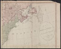
- Found in:
- Beinecke Rare Book and Manuscript Library > A map of North America / by J. Palairet, with considerable alterations & improvements from d'Anville, Mitchell & Bellin, by L. Delarochette.
- Creator:
- Delarochette, L. (Louis), 1731-1802
- Published / Created:
- 1st of March 1789.
- Call Number:
- 71 1789
- Container / Volume:
- BRBL_00366
- Image Count:
- 4
- Resource Type:
- Maps, Atlases & Globes
- Found in:
- Beinecke Rare Book and Manuscript Library > A map of North America and the West Indies / by L.S. de la Rochette.
- Creator:
- Delarochette, L. (Louis), 1731-1802
- Published / Created:
- 17--?]
- Call Number:
- 70 1770
- Container / Volume:
- BRBL_00356
- Image Count:
- 1
- Resource Type:
- Maps, Atlases & Globes
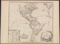
- Found in:
- Beinecke Rare Book and Manuscript Library > A map of the whole continent of America : according to D'Anville & Bellin / by L. Delarochette ; Bayly, sculpt.
- Creator:
- Delarochette, L. (Louis), 1731-1802
- Published / Created:
- [ca. 1771]
- Call Number:
- 71 1771
- Container / Volume:
- BRBL_00365
- Image Count:
- 1
- Resource Type:
- Maps, Atlases & Globes
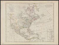
- Found in:
- Beinecke Rare Book and Manuscript Library > Bowles's new pocket map of North America : divided into its provinces, colonies, &c. / by J. Palairet, geographer ; lately revised and improved with many additions, from d'Anville, Mitchel, & Bellin, by L. Delarochette.
- Creator:
- Delarochette, L. (Louis), 1731-1802
- Published / Created:
- Jany. 1st, 1788.
- Call Number:
- 59 1788
- Container / Volume:
- BRBL_00316
- Image Count:
- 1
- Resource Type:
- Maps, Atlases & Globes
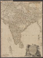
- Found in:
- Beinecke Rare Book and Manuscript Library > Hind, Hindoostan, or India / by L.S. de La Rochette ; Wm. Palmer sculp.
- Creator:
- Delarochette, L. (Louis), 1731-1802
Kitchin, Thomas, 1718-1784. New universal atlas. 1804
Laurie & Whittle
- Call Number:
- 36 1794B
- Container / Volume:
- BRBL_00119
- Image Count:
- 2
- Resource Type:
- Maps, Atlases & Globes
- Found in:
- Beinecke Rare Book and Manuscript Library > Map of the Empire of Germany : including all the states comprehended under that name: with the Kingdom of Prussia, &c. / by L. Delarochette ; T. Kitchin sculpt.