
You Searched For
1 - 4 of 4
Search Results

- Creator:
- Geological Survey (U.S.)
- Published / Created:
- [1918]
- Call Number:
- 844fcm Y83 1918
- Container / Volume:
- BRBL_00615
- Image Count:
- 1
- Resource Type:
- Maps, Atlases & Globes
- Alternative Title:
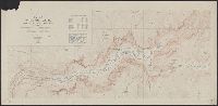
- Yosemite Valley, Yosemite National Park, California
- Description:
- "Surveyed in 1905-1906 in cooperation with the State of California.", At head of title: Department of the Interior., Contour interval 50 feet. Datum is mean sea level., Includes location map and table of "Elevations of principal points.", and Relief shown by contours and spot heights.
- Publisher:
- U.S. Geological Survey,
- Subject (Geographic):
- Yosemite Valley (Calif.)--Maps
- Subject (Name):
- Douglas, Edward Morehouse, 1855-1932, Marshall, R. B. (Robert Bradford), 1867-1949, Matthes, François, 1874-1948, and Urquhart, C. F
- Found in:
- Beinecke Rare Book and Manuscript Library > Map of Yosemite Valley, Yosemite National Park, California, Mariposa County / U.S. Geological Survey ; State of California ; E.M. Douglas, geographer ; R.B. Marshall, in charge of section ; topography by F.E. Matthes ; triangulation by C.F. Urquhart.
- Creator:
- Geological Survey (U.S.)
- Published / Created:
- 1917
- Call Number:
- 814 1917
- Container / Volume:
- BRBL_00557
- Image Count:
- 2
- Resource Type:
- Maps, Atlases & Globes
- Alternative Title:
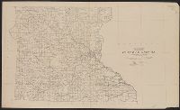
- State of Minnesota, northern part. and State of Minnesota, southern part.
- Description:
- "Compiled in 1910 and 1911.", In bottom margin of southern sheet: Advance sheet, subject to correction., and Northern part -- Southern part.
- Publisher:
- U.S. Geological Survey,
- Subject (Geographic):
- Minnesota--Maps
- Subject (Name):
- Hassan, A. F and Marshall, R. B. (Robert Bradford), 1867-1949
- Found in:
- Beinecke Rare Book and Manuscript Library > State of Minnesota / Department of the Interior, Franklin K. Lane, Secretary, Geological Survey, George Otis Smith, Director ; R.B. Marshall, Chief Geographer ; A.F. Hassan, Cartographer.

- Creator:
- Geological Survey (U.S.)
- Published / Created:
- 1917
- Call Number:
- BrSides Elephant Folio 2018 24
- Image Count:
- 2
- Resource Type:
- Maps, Atlases & Globes
- Description:
- In two sheets., Includes inset of The Hawaiian Islands., and Relief shown by contours and spot heights; contour interval 40 ft.
- Publisher:
- Dept. of the Interior, U.S. Geological Survey,
- Subject (Geographic):
- Hawaii--Oahu and Oahu (Hawaii)--Maps
- Subject (Name):
- Birdseye, C. H. (Claude Hale), 1878-1941, Davis, Geo. R. (George R.), Fowler, A. T, Hawaii. Territorial Survey., Marshall, R. B. (Robert Bradford), 1867-1949, and U.S. Coast and Geodetic Survey
- Found in:
- Beinecke Rare Book and Manuscript Library > Topographic map of the Island of Oahu [cartographic material] : city and county of Honolulu / surveyed 1909-1913 by the Engineer Troops, U.S. Army ; control by U.S. Coast and Geodetic Survey and Hawaiian Territorial Survey ; assembled and drawn by the U.S