
You Searched For
1 - 5 of 5
Search Results


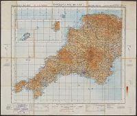
- Creator:
- Great Britain. Ordnance Survey
- Published / Created:
- 1920-21.
- Call Number:
- 32 1920B
- Container / Volume:
- BRBL_00745
- Image Count:
- 7
- Resource Type:
- Maps, Atlases & Globes
- Description:
- Altitudes given in feet., Contours at 200 feet vertical intervals., Copy 1: Imperfect: sheets 2-7 wanting. Accompanied by extra sheet 9 with minor corrections to 1925., Covers affixed verso not digitized., and Diagram showing adjoining sheets in margins.
- Subject (Geographic):
- England--Maps and Wales--Maps
- Found in:
- Beinecke Rare Book and Manuscript Library > Ordnance Survey of Great Britain 1/4 inch to one mile.
- Creator:
- Great Britain. Ordnance Survey
- Published / Created:
- 1940-
- Call Number:
- 32 1940
- Container / Volume:
- BRBL_00745
- Image Count:
- 1
- Resource Type:
- Maps, Atlases & Globes
- Alternative Title:
- England & Wales, G.S.G.S. ; no. 3957, and GSGS (Series) ; 3957.
- Description:
- Imperfect: all sheets but "England, south west ... war revision" wanting., Includes diagram of adjacent sheets., Relief shown by contours and spot heights. Depths shown by isolines., and Some maps identified as Military edition; some sheets identified as War revision 1940.
- Publisher:
- Ordnance Survey,
- Subject (Geographic):
- England--Maps and Wales--Maps
- Found in:
- Beinecke Rare Book and Manuscript Library > Ordnance Survey of Great Britain [cartographic material] : England & Wales.

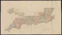
- Creator:
- Great Britain. Ordnance Survey
- Published / Created:
- Novr. 9th, 1843 [i.e. ca. 1853-1874?]
- Call Number:
- 32 1873
- Container / Volume:
- BRBL_00744
- Image Count:
- 8
- Resource Type:
- Maps, Atlases & Globes
- Description:
- "Printed from an electrotype.", Copy 2: Sheets 7, 10-11, 15, 17-18, 20 and 21 only. Hand colored., For a detailed description of the maps, see: The first Ordnance Survey map : a history and cartobibliography of the one-inch Old Series of England and Wales / Roger Hellyer and Richard Oliver. London : The Charles Close Society, 2015., Some sheets issued as quarter sheets., Statement of responsibility and imprint based on sheet 1., and Topographic series of England and Wales with relief shown by hachures.
- Publisher:
- Published by Colonel Colby ...,
- Subject (Geographic):
- England--Maps, Great Britain--Surveys--Maps, Military topography--Great Britain, and Wales--Maps
- Subject (Name):
- Colby, Thomas, 1784-1852, publisher
- Subject (Topic):
- Chron.--1853-1874
- Found in:
- Beinecke Rare Book and Manuscript Library > [Old series Ordnance Survey maps of England and Wales] / engraved at the Ordnance Map Office, Southampton ...
- Creator:
- Great Britain. Ordnance Survey
- Published / Created:
- Novr. 9th, 1843 [i.e. ca. 1853-1874?]
- Call Number:
- 32 1873
- Container / Volume:
- BRBL_00743
- Image Count:
- 35
- Resource Type:
- Maps, Atlases & Globes
- Description:
- "Printed from an electrotype.", Copy 1: Sheets 1-31 only. Accompanied by key sheet, "Index to the Ordnance Survey of Great Britain including the plate published.", For a detailed description of the maps, see: The first Ordnance Survey map : a history and cartobibliography of the one-inch Old Series of England and Wales / Roger Hellyer and Richard Oliver. London : The Charles Close Society, 2015., Some sheets issued as quarter sheets., Statement of responsibility and imprint based on sheet 1., and Topographic series of England and Wales with relief shown by hachures.
- Publisher:
- Published by Colonel Colby ...,
- Subject (Geographic):
- England--Maps, Great Britain--Surveys--Maps, Military topography--Great Britain, and Wales--Maps
- Subject (Name):
- Colby, Thomas, 1784-1852, publisher
- Subject (Topic):
- Chron.--1853-1874
- Found in:
- Beinecke Rare Book and Manuscript Library > [Old series Ordnance Survey maps of England and Wales] / engraved at the Ordnance Map Office, Southampton ...