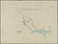
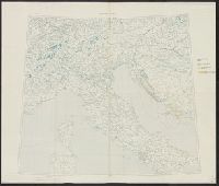
Jasin & Umba Valley boundary, no. 26, Map annexed to arrangement between Great Britain and Germany fixing the boundary at Jassin and in the bend of the Umba River, East Africa, and No. 26, Jasin and Umba Valley boundary
Description:
"Auf die Böhler'sche Karte K.V. no. 109 zu legen." and Panel title.
Publisher:
Ordnance Survey?,
Subject (Geographic):
Kenya--Boundaries--Tanzania--Maps and Tanzania--Boundaries--Kenya--Maps
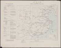
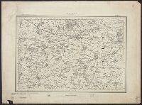
Jasin & Umba Valley boundary, no. 27, No. 27, Jasin and Umba Valley boundary, and Sketch map annexed to arrangement between Great Britain and Germany fixing the boundary at Jassin and in the bend of the Umba River, East Africa
Description:
"Aufzulegen auf Karte Int. Div. War Office no. 977." and Panel title.
Publisher:
Ordnance Survey?,
Subject (Geographic):
Kenya--Boundaries--Tanzania--Maps and Tanzania--Boundaries--Kenya--Maps
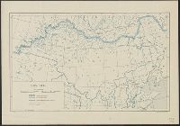
"Ordnance Survey, December 1918.", Includes index to boundaries and to adjoining sheets., and Ms. notes. Hand col. and pencil marks noting disposition of land areas.
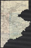
Altitudes given in feet., Contours at 200 feet vertical intervals., Copy 2: Includes sheets 1, 2A, 3, 4A, 6A, 7A, 9A (two copies), 10-11, and 12A, with various corrections between 1928 and 1930., and Diagram showing adjoining sheets in margins.
Altitudes given in feet., Contours at 200 feet vertical intervals., Copy 1: Imperfect: sheets 2-7 wanting. Accompanied by extra sheet 9 with minor corrections to 1925., Covers affixed verso not digitized., and Diagram showing adjoining sheets in margins.
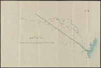
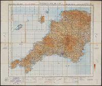
England & Wales, G.S.G.S. ; no. 3957, and GSGS (Series) ; 3957.
Description:
Imperfect: all sheets but "England, south west ... war revision" wanting., Includes diagram of adjacent sheets., Relief shown by contours and spot heights. Depths shown by isolines., and Some maps identified as Military edition; some sheets identified as War revision 1940.
Geological Survey of Great Britain Great Britain. Ordnance Survey
Published / Created:
1864
Call Number:
32625 1865
Container / Volume:
BRBL_00071
Image Count:
5
Resource Type:
Maps, Atlases & Globes
Description:
Maps numbered in upper margin at right:, Relief shown by contours and spot heights., and Statement of attribution for geological information differs: Surveyed by Captain Pratt -- Contoured by Lt. Colonel Bayly -- Engraved under the direction of Colonel Cameron.