Search
You Searched For
Search Results
- Creator:
- Great Britain. Ordnance Survey
- Published / Created:
- Novr. 9th, 1843 [i.e. ca. 1853-1874?]
- Call Number:
- 32 1873
- Container / Volume:
- BRBL_00744
- Image Count:
- 8
- Resource Type:
- Maps, Atlases & Globes
- Found in:
- Beinecke Rare Book and Manuscript Library > [Old series Ordnance Survey maps of England and Wales] / engraved at the Ordnance Map Office, Southampton ...
- Creator:
- Great Britain. Ordnance Survey
- Published / Created:
- Novr. 9th, 1843 [i.e. ca. 1853-1874?]
- Call Number:
- 32 1873
- Container / Volume:
- BRBL_00743
- Image Count:
- 35
- Resource Type:
- Maps, Atlases & Globes
- Found in:
- Beinecke Rare Book and Manuscript Library > [Old series Ordnance Survey maps of England and Wales] / engraved at the Ordnance Map Office, Southampton ...
- Creator:
- Geological Survey of Great Britain
Great Britain. Ordnance Survey
- Published / Created:
- 1856
- Call Number:
- 32632 1856
- Container / Volume:
- BRBL_00071
- Image Count:
- 6
- Resource Type:
- Maps, Atlases & Globes
- Found in:
- Beinecke Rare Book and Manuscript Library > Linlithgowshire.
- Creator:
- Geological Survey of Great Britain
Great Britain. Ordnance Survey
- Published / Created:
- 1864
- Call Number:
- 32625 1865
- Container / Volume:
- BRBL_00071
- Image Count:
- 5
- Resource Type:
- Maps, Atlases & Globes
- Found in:
- Beinecke Rare Book and Manuscript Library > Stirlingshire.
- Creator:
- Great Britain. Ordnance Survey
- Published / Created:
- [1886-1892]
- Call Number:
- 3218 1887
- Container / Volume:
- BRBL_00058
- Image Count:
- 6
- Resource Type:
- Maps, Atlases & Globes
- Found in:
- Beinecke Rare Book and Manuscript Library > Ordnance Survey of England / engraved and published at the Ordnance Survey Office.
- Creator:
- Great Britain. Ordnance Survey
- Published / Created:
- 1900]
- Call Number:
- 634 1900A
- Container / Volume:
- BRBL_00336
- Image Count:
- 2
- Resource Type:
- Maps, Atlases & Globes
- Found in:
- Beinecke Rare Book and Manuscript Library > No. 27, Jasin & Umba Valley boundary : sketch map annexed to arrangement between Great Britain and Germany, January, April, 1900 (no. 278, page 921) / Ordnance Survey.
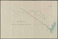
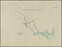
- Creator:
- Great Britain. Ordnance Survey
- Published / Created:
- 1900]
- Call Number:
- 634 1900
- Container / Volume:
- BRBL_00336
- Image Count:
- 2
- Resource Type:
- Maps, Atlases & Globes
- Found in:
- Beinecke Rare Book and Manuscript Library > No. 26, Jasin & Umba Valley boundary : map annexed to arrangement between Great Britain and Germany, January, April, 1900 (no. 278, page 921) / Ordnance Survey.
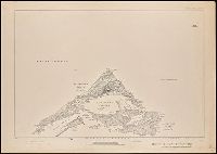
- Creator:
- Great Britain. Ordnance Survey
- Published / Created:
- 1901
- Call Number:
- 217 1899B
- Image Count:
- 6
- Resource Type:
- Maps, Atlases & Globes
- Found in:
- Beinecke Rare Book and Manuscript Library > Islands of Bermuda [cartographic material] / surveyed and contoured in 1898-9 by Lieut. A.J. Savage, R.E. ; heliozincographed and published at the Ordnance Survey Office.
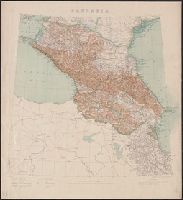
- Creator:
- Great Britain. Ordnance Survey
- Published / Created:
- 1908
- Call Number:
- 354 1906
- Container / Volume:
- BRBL_00112
- Image Count:
- 1
- Resource Type:
- Maps, Atlases & Globes
- Found in:
- Beinecke Rare Book and Manuscript Library > Caucasia.