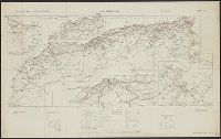
Skip to search
Skip to main content
Skip to first result
Search
You Searched For
Format
cartographic
Creator
Great Britain. War Office. General Staff. Geographical Section
Search Results
Creator:
Published / Created:
1943
Call Number:
60gm 1943
Container / Volume:
BRBL_00330
Image Count:
1
Resource Type:
Maps, Atlases & Globes
Alternative Title:
Geographical Section, General Staff ; no. 4209 and GSGS (Series) ; 4209.
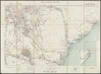
Description:
"Published by the War Office, 1941."
Publisher:
Army Map Service, U.S. Army,
Subject (Topic):
Transportation--Africa--Maps
Found in:
Beinecke Rare Book and Manuscript Library > Africa : communications.
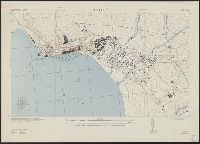
Creator:
Published / Created:
1942
Call Number:
66gmb 1942
Container / Volume:
BRBL_00348
Image Count:
1
Resource Type:
Maps, Atlases & Globes
Alternative Title:
[G.S.G.S.] 4256 and GSGS (Series) ; 4256.
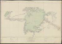
Description:
"Copied from a French (Michelin) map [sheet 151] dated 1939."
Publisher:
GSGS,
Subject (Geographic):
Africa, North--Maps
Subject (Name):
Pneu Michelin (Firm)
Subject (Topic):
Roads--Africa, North--Maps, Roads--Algeria--Maps, Roads--Morocco--Maps, and Roads--Tunisia--Maps
Found in:
Beinecke Rare Book and Manuscript Library > Africa road map 1:2,000,000 and 1:500,000, Maroc-Algerie-Tunisie.
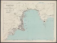
Creator:
Published / Created:
1942
Call Number:
67 Ag13 1942
Container / Volume:
BRBL_00348
Image Count:
1
Resource Type:
Maps, Atlases & Globes
Alternative Title:
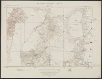
Morocco 10 000.
Description:
"Prepared under the direction of the chief of engineers, U. S. Army ... Compiled from base map of Ville d'Agadir, 1:10,000, Office of the military attache, Tangier, Morocco. Revised from U. S. H. O. chart no. 2239, R. A. F. aerial photos ... and Moroc...
Publisher:
Army Map Service, U. S. Army,
Subject (Geographic):
Agadir (Morocco)--Maps
Found in:
Beinecke Rare Book and Manuscript Library > Agadir; city plan.
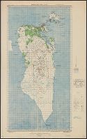
Creator:
Published / Created:
1943
Call Number:
3897 Aj12 1943
Container / Volume:
BRBL_00184
Image Count:
1
Resource Type:
Maps, Atlases & Globes
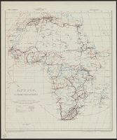
Alternative Title:
[G.S.G.S.] ; 4381 and Great Britain. War Office. General Staff. Geographical Section. G.S.G.S. ; 4381.
Description:
"Contours at 10 metres interval."
Publisher:
Army Map Service, U.S. Army,
Subject (Geographic):
Ajaccio (France)--Maps
Found in:
Beinecke Rare Book and Manuscript Library > Ajaccio, plan of port [cartographic material] / Drawn by War Office, 1943.
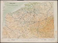
Creator:
Published / Created:
1910
Call Number:
335 1910
Container / Volume:
BRBL_00086
Image Count:
1
Resource Type:
Maps, Atlases & Globes
Alternative Title:
GSGS (Series) 2517
Description:
Shows canals, railways, roads and some military features.
Publisher:
Geographical Section, General Staff,
Subject (Geographic):
Belgium--Maps and France--Maps
Subject (Topic):
Transportation--Belgium--Maps and Transportation--Roads--Maps
Found in:
Beinecke Rare Book and Manuscript Library > Belgium and the north east of France G.S.G.S. 2517 [cartographic material].