Search
You Searched For
Search Results
- Creator:
- Hergesheimer, E. (Edwin)
- Published / Created:
- 1861
- Call Number:
- 754EG 1861
- Container / Volume:
- BRBL_00419
- Image Count:
- 1
- Resource Type:
- Maps, Atlases & Globes
- Found in:
- Beinecke Rare Book and Manuscript Library > Map showing the distribution of the slave population of the southern states of the United States, compiled from the census of 1860 / drawn by E. Hergesheimer ; engr. by Th. Leonhardt.
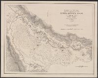
- Creator:
- Hergesheimer, E. (Edwin)
- Published / Created:
- 1871
- Call Number:
- 833 Y38 1871D
- Container / Volume:
- BRBL_00584
- Image Count:
- 1
- Resource Type:
- Maps, Atlases & Globes
- Found in:
- Beinecke Rare Book and Manuscript Library > Upper Geyser Basin, Fire Hole River, Wyoming Territory / surveyed by the party in charge of F.V. Hayden ; compiled and drawn from field notes and sketches of A. Schönborn by E. Hergesheimer.
- Creator:
- Hergesheimer, E. (Edwin)
- Published / Created:
- [1872]
- Call Number:
- 833 Y38 1871B
- Container / Volume:
- BRBL_00584
- Image Count:
- 1
- Resource Type:
- Maps, Atlases & Globes
- Found in:
- Beinecke Rare Book and Manuscript Library > Yellowstone Lake, Wyoming Territory / surveyed by the party in charge of F.V. Hayden ; compiled and drawn by E. Hergesheimer from field notes and sketches of A. Schönborn & H.W. Elliott.