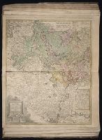
Gussefeld, F. L. (Franz Ludwig), 1744-1807 Homann Erben (Firm)
Published / Created:
1786
Call Number:
1983 Folio 23
Collection Title:
[Atlas factice of 50 maps, primarily by Johann Baptist Homann and/or issued by the Homann Erben
Image Count:
1
Alternative Title:
Carte geographique du Cercle de Haut-Rhin and Charte ueber die am Ober-Rhein zerstreut liegende Laender des Ober-Rheinischen Kreise
Publisher:
Bey denen Homaennischen Erben
Subject (Geographic):
Baden-Wu?rttemberg (Germany) --Maps --Early works to 1800, Hesse (Germany) --Maps --Early works to 1800, North Rhine-Westphalia (Germany) --Maps --Early works to 1800, and Rhineland-Palatinate (Germany) --Maps --Early works to 1800
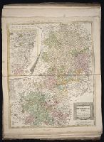
Gussefeld, F. L. (Franz Ludwig), 1744-1807 Homann Erben (Firm) Schmidt, I. M.
Published / Created:
1783
Call Number:
1983 Folio 23
Collection Title:
[Atlas factice of 50 maps, primarily by Johann Baptist Homann and/or issued by the Homann Erben
Image Count:
1
Alternative Title:
Carte geographique contenant le cours du Rhin, de la Meuse, & de la Moselle avec les cercles du haut- & bas-Rhin, le Duchee de Lorraine & d’Elsas & cc
Publisher:
Bey denen Homaen[n]ischen Erben
Subject (Geographic):
Germany, Southern --Maps --Early works to 1800, Hesse (Germany) --Maps --Early works to 1800, and Rhineland-Palatinate (Germany) --Maps --Early works to 1800
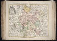
Gussefeld, F. L. (Franz Ludwig), 1744-1807 Homann Erben (Firm)
Published / Created:
1783
Call Number:
1983 Folio 23
Collection Title:
[Atlas factice of 50 maps, primarily by Johann Baptist Homann and/or issued by the Homann Erben
Image Count:
1
Alternative Title:
Circuli superioris Saxoniae pars meridionalis, Ducatum, Electoratum & Principatus Ducum Saxoniae, Princip. Anhalt. Comit. Schwarzburg, Mansfeld, Stolberg &cc
Publisher:
[Homann Erben]
Subject (Geographic):
Brandenburg (Germany) --Maps --Early works to 1800, Saxony (Germany) --Maps --Early works to 1800, Saxony-Anhalt (Germany) --Maps --Early works to 1800, and Thuringia (Germany) --Maps --Early works to 1800
Cross Collection no. 245., Imperfect: map of Jamaica cut-out. Two maps (Antigua and Barbados)., Includes explanatory notes and index., Relief shown pictorially., Scales in millaria Anglica communia and/or millaria Anglica statuta., and Sheet title in Latin and German. Individual map titles and text in German. Maps in English and German.
Publisher:
Homann Erben,
Subject (Geographic):
Antigua--Maps--Early works to 1800, B, Barbados--Maps--Early works to 1800, Jamaica--Maps--Early works to 1800, Saint Kitts and Nevis--Maps--Early works to 1800, and West Indies--Maps--Early works to 1800
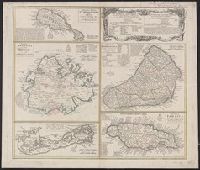
Cross Collection no. 253., Includes explanatory notes and index., Ms. notes in upper right corner., Relief shown pictorially., Scales in millaria Anglica communia and/or millaria Anglica statuta., Sheet title in Latin and German. Individual map titles and text in German. Maps in English and German., and Three maps (Antigua, Barbados, Jamaica). Mounted on linen.
Publisher:
Homann Erben,
Subject (Geographic):
Antigua--Maps--Early works to 1800, Barbados--Maps--Early works to 1800, Bermuda Islands--Maps--Early works to 1800, Jamaica--Maps--Early works to 1800, and Saint Kitts and Nevis--Maps--Early works to 1800
Iimage of the Saints Maurus and Placid surrounded by angels in lower left corner., Publisher statement precedes place of publication in imprint., Relief shown pictorially., and Watermark. Manuscript number in right corner: 42. From the Karpinski-von Wieser Map Collection.
Publisher:
Excusa per Haeredes Homan[n]ianos
Subject (Geographic):
Italy--Maps--Early works to 1800.
Subject (Name):
Benedictines and Benedictines--Italy--Maps--Early works to 1800
Subject (Topic):
Ecclesiastical geography and Ecclesiastical geography--Italy--Maps--Early works to 1800.
Guessefeld, F. L. (Franz Ludwig), 1744-1807 Homann Erben (Firm)
Published / Created:
1775
Call Number:
1983 Folio 23
Collection Title:
[Atlas factice of 50 maps, primarily by Johann Baptist Homann and/or issued by the Homann Erben
Image Count:
1
Publisher:
Impensis Homannianorum Haeredum
Subject (Geographic):
Bohemia (Czech Republic) --Maps --Early works to 1800, Galicia (Poland and Ukraine) --Maps --Early works to 1800, and Ukraine --Maps --Early works to 1800