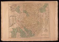
Bar scales given in "German miles 15 to a degree" and "English statute miles 69 & 1/2 to a degree"., Prime meridian: Ferro., Relief shown pictorially., Sheet measures 54.5 x 72.2 cm. No. 29 of 34 maps bound together., Title of inset map: East-Frieseland, lordship of Jever and the counties of Oldenburg and Delmenhorst., and Watermark.
Publisher:
Thomas Jefferys,
Subject (Geographic):
Lower Saxony (Germany)--Maps--Early works to 1800 and North Rhine-Westphalia (Germany)--Maps--Early works to 1800