Search
You Searched For
Search Results
- Creator:
- Jefferys, Thomas, d. 1771
- Published / Created:
- 1794
- Call Number:
- 795cea 1794
- Container / Volume:
- BRBL_00523
- Image Count:
- 1
- Resource Type:
- Maps, Atlases & Globes
- Found in:
- Beinecke Rare Book and Manuscript Library > The western coast of Louisiana and the coast of New Leon / by Thos. Jefferys, geographer to His Majesty.
- Creator:
- Jefferys, Thomas, d. 1771
- Published / Created:
- 20 Feby. 1775.
- Call Number:
- 792cea 1775
- Container / Volume:
- BRBL_00519
- Image Count:
- 1
- Resource Type:
- Maps, Atlases & Globes
- Found in:
- Beinecke Rare Book and Manuscript Library > The coast of West Florida and Louisiana [cartographic material] : the Peninsula and Gulf of Florida or Channel of Bahama with the Bahama Islands / by Thos. Jefferys ...
- Creator:
- Jefferys, Thomas, d. 1771
- Published / Created:
- 25 May, 1775.
- Call Number:
- 7345cea 1775
- Container / Volume:
- BRBL_00689
- Image Count:
- 1
- Resource Type:
- Maps, Atlases & Globes
- Found in:
- Beinecke Rare Book and Manuscript Library > An exact chart of the river St. Laurence : from Fort Frontenac to the island of Anticosti shewing the soundings, rocks, shoals & c with views of the lands and all necessary instructions for navigating that river to Quebec / by ... Thos. Jefferys.
- Creator:
- Jefferys, Thomas, d. 1771
- Published / Created:
- April 6, 1775.
- Call Number:
- 7311 1775
- Container / Volume:
- BRBL_00688
- Image Count:
- 1
- Resource Type:
- Maps, Atlases & Globes
- Found in:
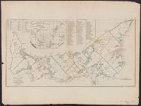
- Beinecke Rare Book and Manuscript Library > A map of the island of St. John in the Gulf of St. Laurence [cartographic material] : divided into counties & parishes and the lots as granted by government : to which are added the soundings round the coast & harbours / improv'd from the late survey of C
- Creator:
- Jefferys, Thomas, d. 1771
- Published / Created:
- 10th, May 1775.
- Call Number:
- 72 1775
- Container / Volume:
- BRBL_00688
- Image Count:
- 1
- Resource Type:
- Maps, Atlases & Globes
- Found in:
- Beinecke Rare Book and Manuscript Library > A general chart of the island of Newfoundland with the rocks & soundings / [cartographic material] / drawn from surveys taken by order of the Right Honourable the Lords Commissioners of the Admiralty by James Cook and Michael Lane, surveyors, and others.
- Creator:
- Jefferys, Thomas, d. 1771
- Published / Created:
- May 1755.
- Call Number:
- 755 1755B
- Container / Volume:
- BRBL_00427
- Image Count:
- 1
- Resource Type:
- Maps, Atlases & Globes
- Found in:
- Beinecke Rare Book and Manuscript Library > North America from the French of Mr. D'Anville : improved with the back settlements of Virginia and course of Ohio : illustrated with geographical and historical remarks.
- Creator:
- Jefferys, Thomas, d. 1771
- Published / Created:
- 1775 June 15
- Call Number:
- 755 1775D
- Container / Volume:
- BRBL_00429
- Image Count:
- 1
- Resource Type:
- Maps, Atlases & Globes
- Found in:
- Beinecke Rare Book and Manuscript Library > A general map of the middle British colonies in America : viz. Virginia, Maryland, Delaware, Pensilvania, New-Jersey, New-York, Connecticut, and Rhode-Island : of Aquanishuonîgy the country of the Confederate Indians comprehending Aquanishuonigy proper,
- Creator:
- Jefferys, Thomas, d. 1771
- Published / Created:
- 20, Feby. 1775.
- Call Number:
- 894 1775
- Container / Volume:
- BRBL_00697
- Image Count:
- 1
- Resource Type:
- Maps, Atlases & Globes
- Found in:
- Beinecke Rare Book and Manuscript Library > The Bay of Honduras [cartographic material] / by Thos. Jefferys, Geographer to His Majesty.
- Creator:
- Jefferys, Thomas, d. 1771
- Published / Created:
- 1762]
- Call Number:
- 71 1762
- Container / Volume:
- BRBL_00364
- Image Count:
- 3
- Resource Type:
- Maps, Atlases & Globes
- Found in:
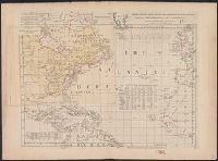
- Beinecke Rare Book and Manuscript Library > Chart of the Atlantic Ocean, with the British, French, & Spanish settlements in North America, and the West Indies, as also on the coast of Africa / by Thos. Jefferys, geographer to His Majesty.