Search
You Searched For
Search Results
- Creator:
- Jefferys, Thomas, d. 1771
- Published / Created:
- 1775
- Call Number:
- 1977 Folio 96
- Collection Title:
- The West-India atlas: or, A compendious description of the West-Indies: illustrated with forty
- Image Count:
- 1
- Resource Type:
- Maps, Atlases & Globes
- Found in:
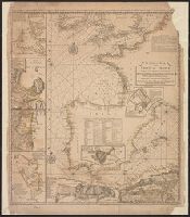
- Beinecke Rare Book and Manuscript Library > Turks Islands, from a survey made in 1753, by the the sloops l'Aigle and l'Emeraude, by order of the French Governor of Hispaniola, with improvements from observations, made in 1770, in the Sr. Edward Hawke Kings Schooner
- Creator:
- Jefferys, Thomas, d. 1771
- Published / Created:
- 1794
- Call Number:
- 795cea 1794
- Container / Volume:
- BRBL_00523
- Image Count:
- 1
- Resource Type:
- Maps, Atlases & Globes
- Found in:
- Beinecke Rare Book and Manuscript Library > The western coast of Louisiana and the coast of New Leon / by Thos. Jefferys, geographer to His Majesty.
- Creator:
- Jefferys, Thomas, d. 1771
- Published / Created:
- 1st January 1789.
- Call Number:
- 655 1789
- Container / Volume:
- BRBL_00345
- Image Count:
- 1
- Resource Type:
- Maps, Atlases & Globes
- Found in:
- Beinecke Rare Book and Manuscript Library > The western coast of Africa, from Cape Blanco to Cape Virga, exhibiting Senegambia proper / by T. Jefferys.
- Creator:
- Jefferys, Thomas, d. 1771
- Published / Created:
- August 12th, 1768.
- Call Number:
- 655 1768
- Container / Volume:
- BRBL_00345
- Image Count:
- 1
- Resource Type:
- Maps, Atlases & Globes
- Found in:
- Beinecke Rare Book and Manuscript Library > The western coast of Africa, from Cape Blanco to Cape Virga, exhibiting Senegambia proper / by T. Jefferys.
- Creator:
- Jefferys, Thomas, d. 1771
- Published / Created:
- 1758
- Call Number:
- 38hc 1758
- Container / Volume:
- BRBL_00172
- Image Count:
- 1
- Resource Type:
- Maps, Atlases & Globes
- Found in:
- Beinecke Rare Book and Manuscript Library > The seat of war on the coast of France : being a new chart of the coasts of Holland, Flanders, France, Spain & Portugal, with the adjacent Islands, part of Barbary, England and Ireland / drawn from the latest surveys, and regulated by astronomical observa
- Creator:
- Bowen, Emanuel, d. 1767
Jefferys, Thomas, d. 1771
- Published / Created:
- 1758
- Call Number:
- 1977 Folio 177
- Image Count:
- 3
- Resource Type:
- Maps, Atlases & Globes
- Found in:
- Beinecke Rare Book and Manuscript Library > The seat of war on the coast of France : being a new chart of the coasts of Holland, Flanders, France, Spain & Portugal, with the adjacent Islands, part of Barbary, England and Ireland / drawn from the latest surveys, and regulated by astronomical observa
- Creator:
- Jefferys, Thomas, d. 1771
- Published / Created:
- Oct. 28, 1756.
- Call Number:
- 1977 Folio 177
- Image Count:
- 3
- Resource Type:
- Maps, Atlases & Globes
- Found in:
- Beinecke Rare Book and Manuscript Library > The routs of the Prussian Armies into Bohemia [cartographic material] : with the post roads & distances from the original map publish'd at Berlin / by Thos. Jefferys ...
- Creator:
- Jefferys, Thomas, d. 1771
- Call Number:
- C6 033c
- Collection Title:
- The natural and civil history of the French dominions in North and South America : with an
- Image Count:
- 1
- Resource Type:
- Maps, Atlases & Globes
- Found in:
- Beinecke Rare Book and Manuscript Library > The island of Hispaniola called by the French St. Domingo. Subject to France and Spain. from the best authorities by Thomas Jeffreys, geographer to his Royal Highness the Prince of Wales
- Creator:
- Jefferys, Thomas, d. 1771
- Call Number:
- 1977 Folio 96
- Collection Title:
- The West-India atlas: or, A compendious description of the West-Indies: illustrated with forty
- Image Count:
- 1
- Resource Type:
- Maps, Atlases & Globes
- Found in:
- Beinecke Rare Book and Manuscript Library > The harbour of Bluefields.
- Creator:
- Jefferys, Thomas, d. 1771
- Published / Created:
- 20 Feby. 1775.
- Call Number:
- 792cea 1775
- Container / Volume:
- BRBL_00519
- Image Count:
- 1
- Resource Type:
- Maps, Atlases & Globes
- Found in:
- Beinecke Rare Book and Manuscript Library > The coast of West Florida and Louisiana [cartographic material] : the Peninsula and Gulf of Florida or Channel of Bahama with the Bahama Islands / by Thos. Jefferys ...