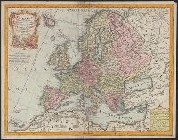
L'Isle, Guillaume de, 1675-1726 Lotter, Tobias Conrad, 1717-1777
Published / Created:
176-?]
Call Number:
30 1720A
Container / Volume:
BRBL_00029
Image Count:
1
Resource Type:
Maps, Atlases & Globes
Description:
Cartouche with Apollo and Athena at bottom., Includes eight bar scales., Prime meridian: Ferro., Relief shown pictorially., and Sheet measures 48.5 x 61.6 cm.
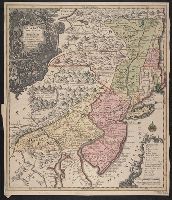
Also covers New England (distorted) and northern Chesapeake region., Later state of Seutter map with Seutter's name replaced by Lotter's., Relief shown pictoria, and Sheet measures 59 x 51 cm. Verso: Stamped "Yale Horace Brown 1900S"; "106" in ink ms.
Publisher:
Seutter
Subject (Geographic):
Middle Atlantic States--Maps--Early works to 1800 and New England--Maps--Early works to 1800
Subject (Name):
Seutter, Matthaeus, 1678-1756. Pensylvania, Nova Jersey et Nova York
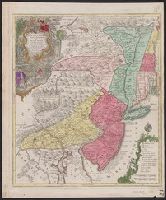
Also covers New England (distorted) and northern Chesapeake region., Includes notes in map area, ill. in title cartouche, and coat-of-arms at head of title., Later state of Seutter map with Seutter's name replaced by Lotter's., Latin, German and English., Relief shown pictorially., and Sheet measures 64.3 x 54.8 cm. Ms. no.: 15. Cross Collection no. 184.
Publisher:
Seutter
Subject (Geographic):
Middle Atlantic States--Maps--Early works to 1800 and New England--Maps--Early works to 1800
Subject (Name):
Seutter, Matthaeus, 1678-1756. Pensylvania, Nova Jersey et Nova York
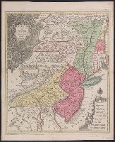
Also covers New England (distorted) and northern Chesapeake region., Includes notes in map area, ill. in title cartouche, and coat-of-arms at head of title., Later state of Seutter map with Seutter's name replaced by Lotter's., Latin, German and English., Relief shown pictorially., and Sheet measures 65.5 x 53.5 cm. Franklin Collection.
Publisher:
Seutter
Subject (Geographic):
Middle Atlantic States--Maps--Early works to 1800 and New England--Maps--Early works to 1800
Subject (Name):
Seutter, Matthaeus, 1678-1756. Pensylvania, Nova Jersey et Nova York