Search
You Searched For
Search Results
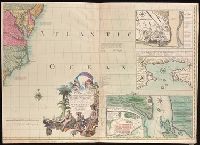
- Creator:
- Mitchell, John, 1711-1768
- Published / Created:
- [1757]
- Call Number:
- BrSides Double Folio 2019 82
- Image Count:
- 4
- Resource Type:
- Maps, Atlases & Globes
- Found in:
- Beinecke Rare Book and Manuscript Library > A map of the British and French dominions in North America : with the roads, distances, limits, and extent of the settlements / by Jno. Mitchell, D.F. with improvements.
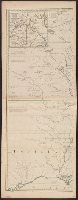
- Creator:
- Mitchell, John, 1711-1768
- Published / Created:
- [1755]
- Call Number:
- 71 1755D
- Image Count:
- 8
- Resource Type:
- Maps, Atlases & Globes
- Found in:
- Beinecke Rare Book and Manuscript Library > A map of the British and French dominions in North America : with the roads, distances, limits, and extent of the settlements, humbly inscribed to the Right Honourable the Earl of Halifax, and the other Right Honourable the Lords Commissioners for Trade &
- Creator:
- Mitchell, John, 1711-1768
- Published / Created:
- [1755]
- Call Number:
- 71 1755D
- Container / Volume:
- BRBL_00363
- Image Count:
- 8
- Resource Type:
- Maps, Atlases & Globes
- Found in:
- Beinecke Rare Book and Manuscript Library > A map of the British and French dominions in North America : with the roads, distances, limits, and extent of the settlements, humbly inscribed to the Right Honourable the Earl of Halifax, and the other Right Honourable the Lords Commissioners for Trade &
- Creator:
- Mitchell, John, 1711-1768
- Published / Created:
- [1773]
- Call Number:
- 71 1773
- Container / Volume:
- BRBL_00365
- Image Count:
- 4
- Resource Type:
- Maps, Atlases & Globes
- Found in:
- Beinecke Rare Book and Manuscript Library > A map of the British and French dominions in North America : with the roads, distances, limits, and extent of the settlements, humbly inscribed to the Right Honourable the Earl of Halifax, and the other Right Honourable the Lords Commissioners for Trade &
- Creator:
- Mitchell, John, 1711-1768
- Published / Created:
- [1775?]
- Call Number:
- 71 1755A
- Container / Volume:
- BRBL_00363
- Image Count:
- 8
- Resource Type:
- Maps, Atlases & Globes
- Found in:
- Beinecke Rare Book and Manuscript Library > A map of the British colonies in North America : with the roads, distances, limits, and extent of the settlements, humbly inscribed to the Right Honourable the Earl of Halifax, and the other Right Honourable the Lords Commissioners for Trade & Plantations
- Creator:
- Mitchell, John, 1711-1768
- Published / Created:
- 1776]
- Call Number:
- 71 1776D
- Container / Volume:
- BRBL_00365
- Image Count:
- 8
- Resource Type:
- Maps, Atlases & Globes
- Found in:
- Beinecke Rare Book and Manuscript Library > Amérique septentrionale avec les routes : distances en miles, villages, et etablissements françois et anglois / par le docteur Mitchel ; traduit de l'Anglois à Paris par Le Rouge, ingr. géographe du roy, Rue des Grands Augustins 1756.
- Creator:
- Mitchell, John, 1711-1768
- Published / Created:
- 1777?]
- Call Number:
- 71 1777C
- Container / Volume:
- BRBL_00365
- Image Count:
- 4
- Resource Type:
- Maps, Atlases & Globes
- Found in:
- Beinecke Rare Book and Manuscript Library > Amérique septentrionale avec les routes: distances en miles, villages et etablissements françois et anglois / par le docteur Mitchel ; traduit de l'Anglois à Paris par Le Rouge, ingr. géographe du roy, rue des Grands Augustins 1777.
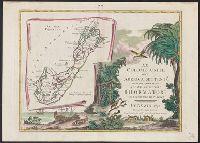
- Creator:
- Mitchell, John, 1711-1768
Zatta, Antonio, fl. 1757-1797
- Published / Created:
- 1778
- Call Number:
- 217 1778
- Image Count:
- 1
- Resource Type:
- Maps, Atlases & Globes
- Found in:
- Beinecke Rare Book and Manuscript Library > Le colonie unite dell' America settentr[iona]le di nuova projezione [cartographic material] / ass.ee. li Signori Riformatori dello studio di Padova, Venezia 1778 presso Antonio Zatta.