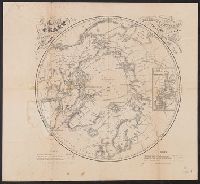
1. A chart of the arctic regions : projected from Berghaus & Petermann, the charts of E.K. Kane Creator: Berghaus, Heinrich Karl Wilhelm, 1797-1884Boell, WilliamBowen & CoKane, Elisha Kent, 1820-1857Petermann, A. (August), 1822-1878 Published / Created: [1860] Call Number: 18 1860A Container / Volume: BRBL_00013 Image Count: 1 Resource Type: Maps, Atlases & Globes Found in: Beinecke Rare Book and Manuscript Library > A chart of the arctic regions : projected from Berghaus & Petermann, the charts of E.K. Kane, materials in the British Hydrographic office, etc. / eng. by W. Boell.