Search
You Searched For
Search Results
- Creator:
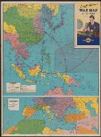
- Rand McNally and Company
- Published / Created:
- [1942]
- Call Number:
- 556 1941B
- Container / Volume:
- BRBL_00293
- Image Count:
- 2
- Resource Type:
- Maps, Atlases & Globes
- Found in:
- Beinecke Rare Book and Manuscript Library > Lowell Thomas' war map of the world [cartographic material] : [compliments of] Sunoco.
- Creator:
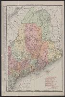
- Rand McNally and Company
- Published / Created:
- c1911.
- Call Number:
- 761gme 1911
- Container / Volume:
- BRBL_00449
- Image Count:
- 1
- Resource Type:
- Maps, Atlases & Globes
- Found in:
- Beinecke Rare Book and Manuscript Library > Maine / Rand McNally & Co.
- Creator:
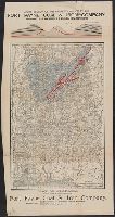
- Rand McNally and Company
- Published / Created:
- c 1888.
- Call Number:
- 793gfc P293 1888
- Container / Volume:
- BRBL_00520
- Image Count:
- 2
- Resource Type:
- Maps, Atlases & Globes
- Found in:
- Beinecke Rare Book and Manuscript Library > Map of Alabama : showing location of property owned by the Fort Payne Coal & Iron Company.
- Creator:
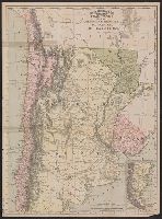
- Rand McNally and Company
- Published / Created:
- c1891.
- Call Number:
- 935 1891
- Container / Volume:
- BRBL_00674
- Image Count:
- 1
- Resource Type:
- Maps, Atlases & Globes
- Found in:
- Beinecke Rare Book and Manuscript Library > Map of Argentine Republic, Paraguay, Uruguay and Chile [cartographic material].
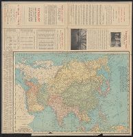
- Creator:
- Rand McNally and Company
- Published / Created:
- 1900
- Call Number:
- 50 1900
- Container / Volume:
- BRBL_00273
- Image Count:
- 2
- Resource Type:
- Maps, Atlases & Globes
- Found in:
- Beinecke Rare Book and Manuscript Library > Map of Asia : Printed for the New York Central's "Four-Track Series".
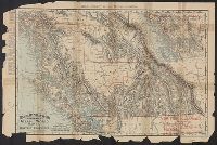
- Creator:
- Rand McNally and Company
- Published / Created:
- 1898
- Call Number:
- 739 1898A
- Container / Volume:
- BRBL_00388
- Image Count:
- 1
- Resource Type:
- Maps, Atlases & Globes
- Found in:
- Beinecke Rare Book and Manuscript Library > Map of British Columbia : [cartographic material] Rand, McNally & Co.'s indexed atlas of the world map of British Columbia / Rand, McNally, & Co.
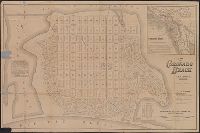
- Creator:
- Rand McNally and Company
- Published / Created:
- [1886?]
- Call Number:
- 844 C77 1886
- Container / Volume:
- BRBL_00604
- Image Count:
- 1
- Resource Type:
- Maps, Atlases & Globes
- Found in:
- Beinecke Rare Book and Manuscript Library > Map of Coronado Beach, San Diego, California / Rand McNally & Co., engravers, Chicago.
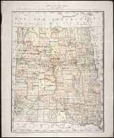
- Creator:
- Rand McNally and Company
- Published / Created:
- c1884
- Call Number:
- BrSides Zc35 876rae
- Image Count:
- 1
- Resource Type:
- Maps, Atlases & Globes
- Found in:
- Beinecke Rare Book and Manuscript Library > Map of Dakota / printed expressly for E.P. Gates, president Merchants Bank and negotiator of farm loans, Grand Forks, Dakota
- Creator:
- Rand McNally and Company
- Published / Created:
- 1900
- Call Number:
- 771 N49 1900A
- Container / Volume:
- BRBL_00489
- Image Count:
- 2
- Resource Type:
- Maps, Atlases & Globes
- Found in:
- Beinecke Rare Book and Manuscript Library > Map of New York City : showing portions of Brooklyn, Jersey City, and Westchester Co. ; Rand, McNally & Co.'s road map of the New York and New Jersey suburbs, showing the boundary lines of the Greater New York with the good roads specially marked.
- Creator:
- Rand McNally and Company
- Published / Created:
- 1901
- Call Number:
- 771 N49 1901
- Image Count:
- 2
- Resource Type:
- Maps, Atlases & Globes
- Found in:
- Beinecke Rare Book and Manuscript Library > Map of New York City : showing portions of Brooklyn, Jersey City, and Westchester Co. ; Rand, McNally & Co.'s road map of the New York and New Jersey suburbs, showing the boundary lines of the Greater New York with the good roads specially marked.