Skip to search
Skip to main content
Skip to first result
Yale University Library
Ask Yale Library
Reserve Rooms
Places to Study
Research
Quicksearch
Search Library Catalog (Orbis)
Search Law Library Catalog (MORRIS)
Search Borrow Direct
Search WorldCat
Search Articles+
Search Digital Collections
Search Archives at Yale
Research Guides
Find Databases by Title
Find eJournals by Title
Guide to Using Special Collections
Services
Your Personal Librarian
Subject Specialists
Research Support and Workshops
Citation Tools
OverDrive: Popular Audio and eBooks
Get It @ Yale (Borrow Direct, Interlibrary Loan, Scan & Deliver)
Course Reserves
Off-Campus Access
EliScholar
OverDrive: Popular Audio and eBooks
Bass Media Equipment
Libraries & Collections
Arts Library
Bass Library
Beinecke Library
Classics Library
Divinity Library
Film Study Center
Fortunoff Archive
Humanities Collections
International Collections
Law Library
Lewis Walpole Library
Library Collection Services
Manuscripts & Archives
Map Collection
Marx Science & Social Science Library
Medical Library
Music Library
Sterling Library
Yale Center for British Art
Information & Policies
Library Hours
Departments & Staff
Borrowing & Circulation
Services for Persons with Disabilities
Copyright Basics
Scanning, Printing & Copying
Computers & Wireless
Library Policies
About the Library
Giving to the Library
Purchase Request
Working at the Library
Terms Governing Use of Materials
Search in
All Fields
Creator
Title
Call Number
Date
Subject
Orbis ID
Full Text
Description
Full text
search for
Search
Search
Advanced Search
Digital Collections
Search
You Searched For
Format
cartographic
Creator
Sanborn Map Company, issuing body
New Search
« Previous
|
1
-
99
of
263
|
Next »
Sort
by Year (descending)
relevance
Creator (A --> Z)
Creator (Z --> A)
Title (A --> Z)
Title (Z --> A)
Year (ascending)
Year (descending)
Number of results to display per page
99
per page
9
per page
30
per page
60
per page
99
per page
View results as:
List
List
Gallery
Gallery
Search Results
New Milford, Litchfield County, Connecticut.
Insurance maps of Milford, New Haven County, Connecticut, including Woodmont, Merwin's Point, Bay
Insurance maps of Manchester, including part of Highland Park and Manchester Green, Hartford Co
Colchester, New London Co., Connecticut.
Insurance maps of Norwalk, Connecticut.
Insurance maps of Bridgeport, Connecticut.
Insurance maps of New Britain, Hartford County, Connecticut.
Insurance maps of Bridgeport, Connecticut.
Insurance maps of New Britain, Hartford County, Connecticut.
Insurance maps of Bridgeport, Connecticut.
Winsted, Litchfield County, Connecticut.
Insurance maps of Winsted, Litchfield County, Connecticut.
Windsor Locks, Hartford County, Connecticut.
Windsor Locks, Hartford Co., Connecticut.
Windsor, Hartford County, Connecticut.
Willimantic, including South Coventry, Storrs, South Windham, and Mansfield Center, Windham County
Insurance maps of Willimantic, Windham County, Connecticut.
Wethersfield, Hartford County Connecticut.
Insurance maps of Westport, Fairfield County, Connecticut.
Westport, Fairfield County, Connecticut.
Watertown, Litchfield County, Conn.
Insurance maps of Waterbury, New Haven Co., Connecticut. Volume 2.
Insurance maps of Waterbury, New Haven Co., Connecticut. Volume 1.
Warehouse Point, Conn.
Wallingford, including Yalesville, New Haven County, Connecticut.
Wallingford, New Haven County, Connecticut.
Wallingford, New Haven County, Conn.
Unionville, Hartford County, Connecticut.
Unionville, Hartford County, Connecticut
Torrington, Litchfield County, Connecticut.
Insurance maps of Torrington, Litchfield Co., Connecticut.
Thompsonville, (Town of Enfield), Hartford County, Connecticut.
Insurance maps of Thompsonville, Hartford County, Connecticut.
Thompsonville, Hartford County, Connecticut.
Thomaston, Litchfield County, Connecticut.
Thomaston, Litchfield Co., Connecticut.
Terryville, Litchfield County, Connecticut.
Terryville, Litchfield Co., Conn.
Suffield, Hartford County, Connecticut.
Insurance maps of Stratford, including Lordship Manor, Fairfield County, Connecticut.
Stratford, Fairfield County, Connecticut.
Stonington, New London County, Connecticut.
Stonington, New London Co., Conn.
Southport, Fairfield County, Connecticut.
Southport, Fairfield Co., Connecticut.
Stafford Springs, Tolland County, Connecticut.
Southington, including Plantsville and Milldale, Hartford County, Connecticut.
Insurance maps of Southington, Hartford County, Connecticut.
Insurance maps of South Norwalk, including East Norwalk, Rowayton, Bell Island, and Roton Point
Insurance maps of South Norwalk, East Rowayton and Bell Island, Norwalk, Fairfield County
Sharon, Litchfield County, Connecticut.
Simsbury, Hartford County, Connecticut.
Shelton, Fairfield County, Connecticut.
Seymour, New Haven County, Connecticut.
Seymour, New Haven Co., Connecticut.
Sandy Hook, Fairfield County, Connecticut.
Salisbury, Litchfield County, Connecticut.
Salisbury, Litchfield Co., Connecticut.
Rocky Hill, Hartford County, Connecticut.
Rockville, Tolland County, Connecticut.
Insurance maps of Rockville, Tolland County, Connecticut.
Rockville, Tolland County, Connecticut.
Ridgefield, Fairfield County, Connecticut.
Ridgefield, Fairfield Co., Conn.
Putnam, Windham County, Connecticut.
Insurance maps of Putnam, Windham County, Connecticut.
Putnam, Windham County, Connecticut.
PREVIOUS
«
1
2
3
»
NEXT
Limit your search
Extent of Digitization
Unspecified
258
Completely digitized
5
Access
Public
235
Yale Community Only
28
Repository
Beinecke Rare Book and Manuscript Library
263
Format
cartographic
✖
[remove]
263
still image
1
Genre
Atlases
120
Cadastral maps
120
Connecticut
120
Fire insurance maps
120
local
120
Bristol
5
East Hartford
5
East Haven
5
Killingly (Town)
5
Annotations (Provenance)--19th century.--CtY-BR
4
more
Genre
»
Resource Type
Maps, Atlases & Globes
262
Language
English
259
Creator
Sanborn Map Company, issuing body
✖
[remove]
263
Subject (Topic)
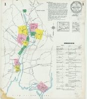
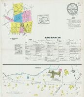
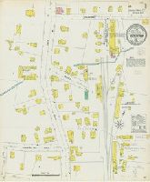
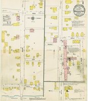
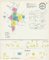
Fire risk assessment--Connecticut--Bridgeport--Maps
7
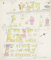
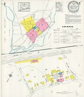
Fire risk assessment--Connecticut--Killingly (Town)--Maps
7
Real property--Connecticut--Bridgeport--Maps
7
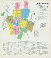
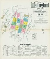
Real property--Connecticut--Killingly (Town)--Maps
7
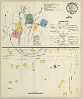
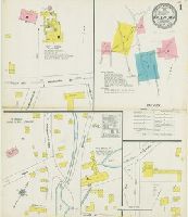
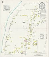
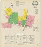
Fire risk assessment--Connecticut--East Haven--Maps
6
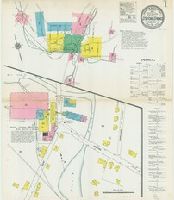
Fire risk assessment--Connecticut--Norwalk--Maps
6
Fire risk assessment--Connecticut--Salisbury--Maps
6
Real property--Connecticut--East Haven--Maps
6
Real property--Connecticut--Norwalk--Maps
6
Real property--Connecticut--Salisbury--Maps
6
more
Subject (Topic)
»
Subject (Name)
Library of Congress Stamp
233
Library of Congress. Map Division Stamp
30
Library of Congress Ownership
14
Library of Congress--Stamp
3
Library of Congress Stamp.
1
Library of Congress--Ownership
1
Library of Congress. Map Divison Stamp
1