Search
You Searched For
Search Results
- Creator:
- Sayer, Robert, 1725-1794
- Published / Created:
- 20 Feby. 1782.
- Call Number:
- BrSides Folio 2019 82
- Image Count:
- 1
- Resource Type:
- Maps, Atlases & Globes
- Found in:
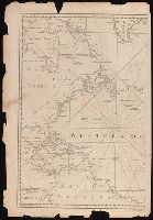
- Beinecke Rare Book and Manuscript Library > A chart of the Atlantic Ocean : I. sheet.
- Creator:
- Sayer, Robert, 1725-1794
- Published / Created:
- July the 1st, 1787.
- Call Number:
- 90 1787
- Container / Volume:
- BRBL_00661
- Image Count:
- 2
- Resource Type:
- Maps, Atlases & Globes
- Found in:
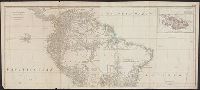
- Beinecke Rare Book and Manuscript Library > A map of South America : containing Tierra-Firma, Guayana, New Granada, Amazonia, Brasil, Peru, Paraguay, Chaco, Tucuman, Chili and Patagonia : from Mr. d'Anville with several improvements and additions, and the newest discoveries.
- Creator:
- Sayer, Robert, 1725-1794
- Published / Created:
- 1 Jan. 1788.
- Call Number:
- 734 1788
- Container / Volume:
- BRBL_00379
- Image Count:
- 1
- Resource Type:
- Maps, Atlases & Globes
- Found in:
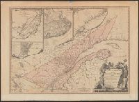
- Beinecke Rare Book and Manuscript Library > A new and correct map of the Province of Quebec, with the adjacent states and provinces / from the French surveys connected with those made by Captain Carver, and other officers, in His Majesty's service.
- Creator:
- Bennett, John
Sayer, Robert, 1725-1794
- Call Number:
- 1977 Folio 78
- Collection Title:
- A New and accurate chart of the West-India Islands and coast, with the gulf passage through the New
- Image Count:
- 1
- Resource Type:
- Maps, Atlases & Globes
- Found in:
- Beinecke Rare Book and Manuscript Library > A new general chart of the West Indies from the latest marine journals and surveys. Regulated and ascertained by astronomical observations
- Creator:
- Sayer, Robert, 1725-1794
- Published / Created:
- Jany. 1st , 1793.
- Call Number:
- 1977 Folio 177
- Image Count:
- 2
- Resource Type:
- Maps, Atlases & Globes
- Found in:
- Beinecke Rare Book and Manuscript Library > A new map of France divided into eighty three departments according to the decree of the National Assembly in 1790.
- Creator:
- Sayer, Robert, 1725-1794
- Published / Created:
- [between 1750 and 1769?]
- Call Number:
- 71 1760C
- Container / Volume:
- BRBL_00364
- Image Count:
- 1
- Resource Type:
- Maps, Atlases & Globes
- Found in:
- Beinecke Rare Book and Manuscript Library > A new map of North America : with the British, French, Spanish, Dutch & Danish dominions on that great continent; and the West India Islands / done from the latest geographers, with great improvements from the Sieurs d'Anville & Robert.
- Creator:
- Kitchin, Thomas, d. 1784, creator
Sayer, Robert, 1725-1794
- Published / Created:
- 1787 January 1
- Call Number:
- 1982 Folio 10
- Image Count:
- 1
- Found in:
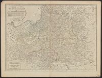
- Beinecke Rare Book and Manuscript Library > A new map of the Kingdom of Poland with its dismembered provinces
- Creator:
- Kitchin, Thomas, d. 1784
Kitchin, Thomas, d. 1784. General atlas describing the whole universe
Sayer, Robert, 1725-1794
- Published / Created:
- January 1st, 1787.
- Call Number:
- 356 1787
- Container / Volume:
- BRBL_00114
- Image Count:
- 1
- Resource Type:
- Maps, Atlases & Globes
- Found in:
- Beinecke Rare Book and Manuscript Library > A new map of the Kingdom of Poland with its dismembered provinces / [by Thomas Kitchin].
- Creator:
- Anville, Jean Baptiste Bourguignon d', 1697-1782
Boulton, S., creator
Sayer, Robert, 1725-1794
- Published / Created:
- 1787 January 6
- Call Number:
- 1982 Folio 10
- Image Count:
- 2
- Found in:
- Beinecke Rare Book and Manuscript Library > Africa : with all its states, kingdoms, republics, regions, islands, & ca., improved and inlarged from D'Anville's map : to which have been added a particular chart of the Gold Coast wherein are distinguished all the European forts and factories
- Creator:
- Bowen, Emanuel, d. 1767
Gibson, J. (John)
Overton, Henry, fl. 1706-1764
Sayer, Robert, 1725-1794
- Published / Created:
- [between 1755 and 1775?]
- Call Number:
- 2003 Folio 85
- Image Count:
- 1
- Found in:
- Beinecke Rare Book and Manuscript Library > An accurate map of North America: describing and distinguishing the British, Spanish and French dominions on this great continent; exhibiting the present seat of war, and the French encroachments. Also all the West India Islands belonging to, and possesse