
You Searched For
1 - 9 of 9
Search Results


- Creator:
- Kitchin, Thomas, d. 1784, creator
Sayer, Robert, 1725-1794 - Published / Created:
- 1787 January 1
- Call Number:
- 1982 Folio 10
- Image Count:
- 1
- Description:
- Also appeared in Kitchin's General atlas describing the whole universe. London : Printed for Robert Sayer, [1780]., Ms. notes in contemporary hand., No. 23 of 43 maps bound together in composite atlas., Relief shown pictorially., Scale [ca. 1:2,450,000]., and Shows vegetation, marshes, etc.
- Publisher:
- Robert Sayer
- Subject (Geographic):
- Europe, Eastern --Maps --Early works to 1800, Lithuania --Boundaries --Maps --Early works to 1800, Lithuania --Maps --Early works to 1800, Poland --Boundaries --Maps --Early works to 1800, and Poland --Maps --Early works to 1800
- Found in:
- Beinecke Rare Book and Manuscript Library > A new map of the Kingdom of Poland with its dismembered provinces
3.

- Creator:
- Anville, Jean Baptiste Bourguignon d', 1697-1782
Boulton, S., creator
Sayer, Robert, 1725-1794 - Published / Created:
- 1787 January 6
- Call Number:
- 1982 Folio 10
- Image Count:
- 2
- Description:
- Also appeared in Kitchin's General atlas describing the whole universe. London : Printed for Robert Sayer, [1780]., By S. Boulton ; and also a summary description relative to the trade and natural produce, manners and customs of the African continent and islands., Insets: A particular chart of the Gold Cost. -- Azores or Western Islands., No. 35 of 43 maps bound together in composite atlas., Scale [ca. 1:8,500,000]., Sheets pasted together to create 1 map on 2 sheets., and With descriptive text.
- Publisher:
- Printed for Robert Sayer
- Subject (Geographic):
- Africa --Maps --Early works to 1800 and Ghana --Maps --Early works to 1800
- Found in:
- Beinecke Rare Book and Manuscript Library > Africa : with all its states, kingdoms, republics, regions, islands, & ca., improved and inlarged from D'Anville's map : to which have been added a particular chart of the Gold Coast wherein are distinguished all the European forts and factories

- Creator:
- Bowen, Emanuel, d. 1767
Gibson, J. (John)
Overton, Henry, fl. 1706-1764
Sayer, Robert, 1725-1794 - Published / Created:
- [between 1755 and 1775?]
- Call Number:
- 2003 Folio 85
- Image Count:
- 1
- Description:
- BEIN 2003 Folio 85: No. 4 of 45 maps bound together with binder's spine title: Atlas of America; ms. table of contents. Bookplate of Paul Mellon., by Eman. Bowen, geogr. to His Majesty, and John Gibson, engraver., Hand-colored., Includes text and insets of A particular map of Baffin and Hudson's Bay and The passage by land to California, discovered by Father Eusebius Francis Kino ...., Relief shown pictorially., Scale [ca. 1:5,500,000]., and Shows boundaries, cities and towns, roads, forts, missions, some industries, trails, trade routes, portages, and vegetation. Also shows Indian villages and tribal territories, routes of navigation in the Gulf of Mexico, and navigational hazards along the coast.
- Publisher:
- Printed for Robt. Sayer opposite Fetter Lane Fleet Street
- Subject (Geographic):
- North America -- Maps -- Early works to 1800
- Found in:
- Beinecke Rare Book and Manuscript Library > An accurate map of North America: describing and distinguishing the British, Spanish and French dominions on this great continent; exhibiting the present seat of war, and the French encroachments. Also all the West India Islands belonging to, and possesse
5.

- Creator:
- Anville, Jean Baptiste Bourguignon d', 1697-1782
Cook, James, 1728-1779
Kitchin, Thomas, d. 1784, creator
Sayer, Robert, 1725-1794 - Published / Created:
- 1787 January 6
- Call Number:
- 1982 Folio 10
- Image Count:
- 2
- Description:
- Also appeared in Kitchin's General atlas describing the whole universe. London : Printed for Robert Sayer, [1780]., No. 29 of 43 maps bound together in composite atlas., Relief shown pictorially., Scale [ca. 1:11,100,000]., Sheets mounted together to form 2 sheets., Shows boundaries, rivers, settlements, islands; includes descriptive notes., and Title cartouche depicts local produce, a palm tree and a camel.
- Publisher:
- Printed for Robert Sayer
- Subject (Geographic):
- Asia --Maps --Early works to 1800
- Found in:
- Beinecke Rare Book and Manuscript Library > Asia and its islands according to d'Anville : divided into empires, kingdoms, states, regions, & ca. with the European possessions and settlements in the East Indies and an exact delineation of all the discoveries made in the eastern parts by the English

- Creator:
- Kitchin, Thomas, d. 1784, creator
Sayer, Robert, 1725-1794 - Published / Created:
- 1787 January 1
- Call Number:
- 1982 Folio 10
- Image Count:
- 2
- Description:
- Also appeared in Kitchin's General atlas, describing the whole universe. London : Printed and sold for R. Sayer and J. Bennet, 1780., By Thos. Kitchin, hydrographer to the king ; with many additions and improvements from the latest surveys and observations., No. 4 of 43 maps bound together in composite atlas., Pictorial relief., Scale [ca. 1:4,800,000]., and Western part of the northern states including the British Islands, Norway, Denmark and part of Sweden -- Eastern part of the northern states, including the eastern part of Sweden; European Russia, &c. -- Western part of the Mediterranean Sea with the coasts of Spain, France, Italy, Barbary -- Eastern part of the Mediterranean Sea with the coasts of Turky [sic], Anatolia, Syria, Egypt and Barbary.
- Publisher:
- Robert Sayer
- Subject (Geographic):
- Africa, North --Maps --Early works to 1800, Europe --Maps --Early works to 1800, and Middle east --Maps --Early works to 1800
- Found in:
- Beinecke Rare Book and Manuscript Library > Europe divided into its empires, kingdoms, states, republics, & ca
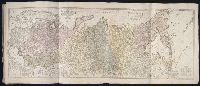
- Creator:
- Imperatorskaia akademia nauk (Russia)
Kitchin, Thomas, d. 1784, creator
Sayer, Robert, 1725-1794 - Published / Created:
- 1788 May 1
- Call Number:
- 1982 Folio 10
- Image Count:
- 2
- Alternative Title:
- Asiatic part of the Russian empire : from the maps published by the Imperial Academy of St. Petersburg with the new discoveries of Captn. Cook &c
- Description:
- Also appeared in Kitchin's General atlas describing the whole universe. London : Printed R. Sayer and J. Bennet, 1780., No. 25 of 43 maps bound together in composite atlas., Prime meridian: Ferro., Relief shown pictorially., Scale [ca. 1:8,000,000]., Sheets mounted together to form 1 sheet., and Shows vegetation, sailing and explorers tracks, etc.
- Publisher:
- Printed for Robert Sayer
- Subject (Geographic):
- Russia --Maps --Early works to 1800
- Found in:
- Beinecke Rare Book and Manuscript Library > The European part of the Russian empire : from the maps published by the Imperial Academy at St. Petersburg, with the new provinces on the Black Sea ; The Asiatic part of the Russian empire : from the maps published by the Imperial Academy of St. Petersbu

- Creator:
- Anville, Jean Baptiste Bourguignon d', 1697-1782
Compagnie des Indes
Jefferys, Thomas, d. 1771, creator
Kitchin, Thomas, d. 1784
Robert Laurie and James Whittle
Sayer, Robert, 1725-1794 - Published / Created:
- 1789 January 1
- Call Number:
- 1982 Folio 10
- Image Count:
- 1
- Description:
- Also appeared in Kitchin's General atlas describing the whole universe. London : Printed for Robert Sayer, [1780]., Has illustrated cartouche and includes text., No. 36 of 43 maps bound together in composite atlas., Norwich, O.I. Norwich's maps of Africa., Prime meridians: Ferro and London., Relief shown pictorially; depths by soundings., Scale [ca. 1:1,850,000]., and This map is copied from an original drawn by Monsr. D'Anville at the expense of the French East India Company, & published at Paris. The country thorough [sic] which the R. Senegal runs has been improved & corrected from a large & curious survey of that river found in the Fort of Senegal.
- Publisher:
- Printed for by Robert Sayer
- Subject (Geographic):
- Africa, West --Maps --Early works to 1800
- Subject (Topic):
- Coasts --Africa, West --Maps --Early works to 1800
- Found in:
- Beinecke Rare Book and Manuscript Library > The western coast of Africa, from Cape Blanco to Cape Virga, exhibiting Senegambia proper
9.

- Creator:
- Chernyshov, Ivan Georgievich
Dury, Andrew., creator
Sayer, Robert, 1725-1794 - Published / Created:
- 1787 October 24
- Call Number:
- 1982 Folio 10
- Image Count:
- 1
- Alternative Title:
- Map of the present seat of war, between the Russians, Poles, and Turk
- Description:
- Also shows parts of Hungary and Poland., Includes paste-on addition to northwestern sheet depicting Bosnia, Herzegovina, and the Dalmatian Coast., No. 26 of 43 maps bound together in composite atlas., Prime meridian: Ferro., Relief shown pictorially., Scale [ca. 1:2,500,000]., and Sheets mounted together to form 2 sheets.
- Publisher:
- Wm. Faden
- Subject (Geographic):
- Black Sea --Maps --Early works to 1800 and Russia --Maps --Early works to 1800
- Subject (Topic):
- Russo-Turkish War, 1787-1792 --Maps --Early works to 1800
- Found in:
- Beinecke Rare Book and Manuscript Library > To his excellency the Count of Czernichew, commander in chief of her Majesty the Empress of all the Russia's fleet and gallies ... : map of the present seat of war, between the Russians, Poles, and Turks is most humbly inscribed