Search
You Searched For
Search Results
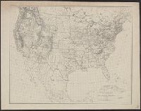
- Creator:
- U.S. Coast and Geodetic Survey
- Published / Created:
- 1880
- Call Number:
- 75AK 1880
- Container / Volume:
- BRBL_00407A
- Image Count:
- 1
- Resource Type:
- Maps, Atlases & Globes
- Subject (Geographic):
- United States--Maps
- Found in:
- Beinecke Rare Book and Manuscript Library > Base-map of the United States / Drawn and engraved by A. and H. Lindenkohl.
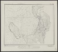
- Creator:
- U.S. Coast and Geodetic Survey
United States. Army Map Service
- Published / Created:
- 1944
- Call Number:
- 28 Ap11 1944
- Container / Volume:
- BRBL_00023E
- Image Count:
- 1
- Resource Type:
- Maps, Atlases & Globes
- Found in:
- Beinecke Rare Book and Manuscript Library > Philippine Islands city plans. Aparri.
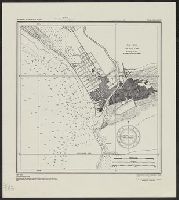
- Creator:
- U.S. Coast and Geodetic Survey
United States. Army Map Service
- Published / Created:
- 1944
- Call Number:
- 28 SA522 1944
- Container / Volume:
- BRBL_00024
- Image Count:
- 1
- Resource Type:
- Maps, Atlases & Globes
- Found in:
- Beinecke Rare Book and Manuscript Library > Philippine Islands city plans. San Fernando.
- Creator:
- U.S. Coast and Geodetic Survey
United States. Army Map Service
- Published / Created:
- 1944
- Call Number:
- 28 T11 1944
- Container / Volume:
- BRBL_00024
- Image Count:
- 1
- Resource Type:
- Maps, Atlases & Globes
- Found in:
- Beinecke Rare Book and Manuscript Library > Philippine Islands city plans. Taal and Lemery.
- Creator:
- U.S. Coast and Geodetic Survey
- Published / Created:
- 1944
- Call Number:
- 50 1945I
- Container / Volume:
- BRBL_00273
- Image Count:
- 2
- Resource Type:
- Maps, Atlases & Globes
- Subject (Name):
- United States. Army Map Service
- Found in:
- Beinecke Rare Book and Manuscript Library > AAF cloth chart. No. 133, Kun-Ming, Yunnan, China to Chabua, Assam, India Forces / prepared under the direction of the Commanding General, Army Air Forces, for the Aeronautical Chart Service, by the U.S. Coast and Geodetic Survey, Washington, D.C., Januar