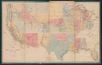
1. Map of the Public Land States and territories [cartographic material] / constructed from the Public Creator: United States. General Land Office Published / Created: 1864 Call Number: 75fcm 1864 Container / Volume: BRBL_00410 Image Count: 1 Resource Type: Maps, Atlases & Globes Found in: Beinecke Rare Book and Manuscript Library > Map of the Public Land States and territories [cartographic material] / constructed from the Public Surveys and other official sources in the General Land Office ; drawn by J.H. Hawes, principal draughtsman [and] T. Franks, assistant.