Skip to search
Skip to main content
Skip to first result
Search
You Searched For
Creator
United States. Office of Strategic Services
New Search
Search Results
Creator:
Published / Created:
1943
Call Number:
71gm 1943
Container / Volume:
BRBL_00371
Image Count:
1
Resource Type:
Maps, Atlases & Globes
Description:
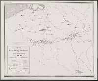
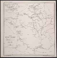
"26 March 1943.", "Map No.2014.", and Shows air routes, highways, projected highways, railroads, trails, and oil pipe lines under construction.
Publisher:
U.S. Office of Strategic Services,
Subject (Name):
United States. Board of Economic Warfare
Subject (Topic):
Railroads--Canada--Maps, Railroads--Northern Hemisphere--Maps, Transportation--Alaska--Maps, Transportation--Canada--Maps, and Transportation--Russia (Federation)--Siberia, Eastern--Maps
Found in:
Beinecke Rare Book and Manuscript Library > Transport facilities linking Canada, Alaska, and Eastern Siberia : Board of Economic Warfare, Project No.EP-17, O.E.W.A.
Creator:
Published / Created:
1943
Call Number:
38gma 1943
Container / Volume:
BRBL_00170
Image Count:
1
Resource Type:
Maps, Atlases & Globes
Description:
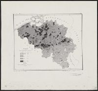
"No. 683.", Includes inset northern regions., and Includes legend on sheet.
Publisher:
O.S.S.,
Subject (Geographic):
France--Maps
Subject (Topic):
Waterways--France--Maps
Found in:
Beinecke Rare Book and Manuscript Library > France Navigable Waterways [cartographic material].
Creator:
Published / Created:
1943
Call Number:
36gma 1943
Container / Volume:
BRBL_00130
Image Count:
1
Resource Type:
Maps, Atlases & Globes
Description:
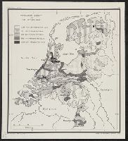
"Map no. 1994, 25 August 1943." and 1. Northwestern waterways -- 2. Berlin -- 3. Magdeburg.
Publisher:
Lithographed in the Reproduction Branch, OSS,
Subject (Geographic):
Europe, Central--Maps and Germany--Maps
Subject (Topic):
Inland navigation--Europe, Central--Maps and Inland navigation--Germany--Maps
Found in:
Beinecke Rare Book and Manuscript Library > "Greater Germany" inland waterways.
Creator:
Published / Created:
1944
Call Number:
573gm 1944
Container / Volume:
BRBL_00311
Image Count:
1
Resource Type:
Maps, Atlases & Globes
Description:
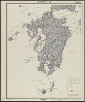
"No. 3951--R & A, OSS.", "Provisional edition.", and Relief shown by shading.
Publisher:
Office of Strategic Services],
Subject (Geographic):
Kyūshū Region (Japan)--Maps
Found in:
Beinecke Rare Book and Manuscript Library > Kyushu.
Creator:
Published / Created:
1944
Call Number:
57gm T578 1944A
Container / Volume:
BRBL_00307
Image Count:
1
Resource Type:
Maps, Atlases & Globes
Description:
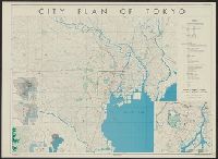
"17 October 1944.", "Base map: "Map of greater Tōkyō," published by Tōkyō Geographical Association, Jan. 15 1936.", "Lithographed in the reproduction branch, OSS.", "No. 5279--R & A, OSS.", and Includes 5 inset maps, and text.
Publisher:
OSS,
Subject (Geographic):
Tokyo (Japan)--Maps and Tokyo Metropolitan Area (Japan)--Maps
Found in:
Beinecke Rare Book and Manuscript Library > City plan of Tōkyō.
Branch:v1.62.5 ,Deployed:2024-07-17T14:11:02-04:00