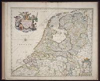
[Atlas nouveau contenant toutes les parties du monde ou sont exactement marques les empires
Image Count:
1
Resource Type:
Maps, Atlases & Globes
Abstract:
Factitious collection of about 549 maps taken from the atlases of the 17th and the beginning of the 18th century, put together with the title "Atlas" and bound in 6 volumes. These volumes originally bore the imprint: Amstelaedamii apvd Reiniervm & Josvam Ottens. Over these words on the title pages of volumes 1-2 and 4-6 is the name of Henrik de Leth who painted them.
Description:
Verso blank.
Subject (Geographic):
British Isles --Maps --Early works to 1800
Subject (Name):
Leth, Hendrik de, 1703-1766, Reiner et Josua Ottens (Firm), Schenck, Peter, 1661-1715, Schenck, Peter, ca. 1698-1752, Valck, G. (Gerard), 1651 or 2-1726, and Wit, Frederik de
Subject (Topic):
Atlases --Early works to 1800
Collection Created:
[A Amsterdam, chez J. Covens & C. Mortier, ca. 1730-ca. 1800]
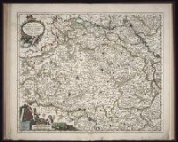
Bar scales given in "Milliaria Germanica communia" and "Milliaria Gallica communia"., Date inferred from C. Koeman's Atlantes Neerlandici, v. 3, p. 165 (Vis 10, map 7)., Prime meridian: Ferro., Relief shown pictorially., and Sheet measures 49.6 x 58.8
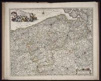
BEIN 1973 Folio 10: Sheet measures 61.2 x 52 cm. Bookplate of José M. Rodriguez. No. 7 of 63 maps bound together., BEIN 1981 Folio 7: Stamp of Albany Institute. No. 58 of 79 maps bound together., Relief shown pictorially., Shows grid, rivers and tributaries, lochs (shaded), trees, place and county names, settlements (symbols classified by importance in legend), territorial boundaries., Scale statement reads: "Milliaria Germanica Communia 15 in uno Gradu", with scale bar graded [0]-10; "Milliaria Scotica Communia quorum 50 in uno Gradu", with scale bar graded [0]-34; "Milliaria Gallica quae et Horae Itineris 20 in uno Gradu", with scale bar graded [0]-14., The four cardinal points are written in the borders., Features include ornate title cartouche (top left) with cherubs, male and female figures and royal coat-of-arms supported by lion and unicorn, arms of Scotland supported by cherubs (above scale cartouche at top right), compass indicator and coasts shaded outwards., "Bat. cum Privil. Ordin. Gener, Belgii Faederati"--Title cartouche., Shows Scotland including the Hebrides and Orkney islands., and In Latin with some place names in English; explanations and title for index to places in Dutch and English.