[Atlas factice of 42 maps, produced by the Homann Erben firm]
Image Count:
1
Alternative Title:
Etats de l’Eglise & du Grand Duche de Toscane, Etats de l’Eglise & du Grand Dvche de Toscane, and Status Ecclesiastici nec non Magni Ducatus Toscanae nova tabula geographica
Publisher:
Curantibus Homannianis Heredibus
Subject (Geographic):
Papal States --Maps --Early works to 1800 and Tuscany (Italy) --Maps --Early works to 1800
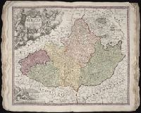
Bar scales given in milliaria Germanica communia and milliaria Gallica communia., Ferro meridian., No. 54 of 69 maps bound together in composite atlas., Relief shown pictorially., and Scale [ca 1:1 330 000].
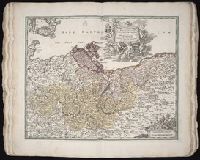
Bar scales in Mill. Germanica Comm 15 in uno gradu and Mill. Gallica et Livonica quae horae itineris., Ferro meridian., No. 38 of 69 maps bound together in composite atlas., Relief shown pictorially., and Scale [ca. 1:910 000].
Subject (Geographic):
Estonia --Maps --Early works to 1800 and Latvia --Maps --Early works to 1800
United Provinces of the Netherlands viz the Dutchy of Gelderland, the counties of Holland, Zeeland, Zutphen ... described by Sanson, corrected and amended by Will. Berry
Description:
Bar scales in Italian miles, common leagues of France, great leagues of France, common leagues of Germany, great leagues of Germany, and leagues of an hours travell., Dedicated To the most serene and most sacred majesty Charles II ... by William Berry., Ferro meridian., No. 43 of 69 maps bound together in composite atlas., Relief shown pictorially., and Scale [ca. 1:640 000].
Publisher:
Sold by William Berry at the sign of ye Globe betweene Charing-Cross and White-Hall
Circle and elector of the Rhine, in which are the archbishopricks and electors of Mayence, Treves, and Colen ... described by Sanson, corrected and amended by William Berry
Description:
Bar scales in Italian miles, common leagues of France, great leagues of France, common leagues of Germany, great leagues of Germany, and leagues of one houers travelling., Ferro meridian., Includes advertisement There are these mapps published all in two large sheets by William Berry ... at bottom., No. 32 of 69 maps bound together in composite atlas., Relief shown pictorially., and Scale [ca. 1:560 000].
Publisher:
Sold by William Berry at the signe of the Globe between Charing-Cross, and White Hall
Subject (Geographic):
Rhine Province (Germany) --Maps --Early works to 1800
Circle of Bavaria, in which are the Dukdom, Palatinat, and Electorat of Bavaria, the Arch-Bishoprick of Saltzbourg, the Bishopricks of Ratisbone, Frisingue, Passaw, the Abbays of St. Emerian, of high and low Monstiers ... described by Sanson, corrected and amended by William Berry
Description:
Bar scales in Italian miles, common leagues of France, great leagues of France, common leagues of Germany, great leagues of Germany, and leagues of one hours travelling., Dedicated To the most serene and most sacred majesty James II ... by William Berry., Ferro meridian., No. 29 of 69 maps bound together in composite atlas., Relief shown pictorially., and Scale [ca. 1:590 000].
Publisher:
Sold by William Berry at the signe of the Globe between Charing-Cross, and White-Hall