Skip to search
Skip to main content
Skip to first result
Search
You Searched For
Extent of Digitization
Completely digitized
Format
cartographic
Genre
Atlases
Language
Latin
New Search
Search Results
Creator:
Published / Created:
1746
Call Number:
1975 Folio 31
Collection Title:
[Atlas factice of 42 maps, produced by the Homann Erben firm]
Image Count:
1
Alternative Title:
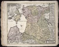
Ducatus Silesiae tabula altera superiorem Silesiam exhibens and Haute Silesie, qui comprend les Principautes de Neise, de Munsterberg, de Laegerndorf, de Troppau, d’Oppeln, de Ratibor, de Teschen dessinee par les Heritiers de Homann, l’an 1746
Publisher:
Homann Erben
Subject (Geographic):
Silesia, Upper (Poland and Czech Republic) --Maps --Early works to 1800
Subject (Topic):
Atlases, German --Early works to 1800
Collection Created:
[Nuremberg,
Found in:
Beinecke Rare Book and Manuscript Library > Dvcatvs Silesiae tabvla altera svperiorem Silesiam exhibens / [cartographic material] / ex mappa Hasiana majore desumta & excusa per Homan[n]ianos Heredes
Creator:
Published / Created:
1745
Call Number:
1975 Folio 31
Collection Title:
[Atlas factice of 42 maps, produced by the Homann Erben firm]
Image Count:
1
Alternative Title:
Basse Silesie qui comprend les Principautes de Schweidnitz, de Iauer, de Glogau, de Breslau, de Liegnitz, de Brieg, de Wolau, de Oels & de Sagan and Ducatus Silesiae tabula geographica prima inferiorem eius partem
Publisher:
Homann Erben
Subject (Geographic):
Silesia, Lower (Poland and Germany) --Maps --Early works to 1800
Subject (Topic):
Atlases, German --Early works to 1800
Collection Created:
[Nuremberg,
Found in:
Beinecke Rare Book and Manuscript Library > Dvcatvs Silesiae tabvla geographica prima inferiorem eivs partem, seu novem principatvs, quorum insignia hic adjecta sunt, secundum statum recentissimium complectens / [cartographic material] / ad mentem Hasiani avtographi majoris legitime delineata et ed
Creator:
Published / Created:
ca. 1750
Call Number:
1973 Folio 30
Collection Title:
[Atlas factice of 32 maps and 1 distance table, produced by the Homann Erben firm]
Image Count:
2
Publisher:
[Tobias Conrad Lotter?]
Subject (Geographic):
Chemnitz (Germany : Landkreis) --Maps --Early works to 1800 and Zwickau (Germany : Landkreis) --Maps --Early works to 1800
Subject (Topic):
Atlases, German --Early works to 1800
Collection Created:
[Nuremberg : s.n., 1701-1760]
Found in:
Beinecke Rare Book and Manuscript Library > Dynastiae comitat[us] Schoenbuirgici Penig, Remissa, Rochsburg, Wechselburg [cartographic material] : in clientela Elect. Saxon Glaucha, Hartenstein, Lichtenst. Stein, Waldenburg Praedia Benefic. S.R. Imp. ad circulum S.R.I. Saxoniae superiorem pertinente
Creator:
Published / Created:
ca. 1757
Call Number:
1973 Folio 30
Collection Title:
[Atlas factice of 32 maps and 1 distance table, produced by the Homann Erben firm]
Image Count:
2
Publisher:
[Tobias Conrad Lotter]
Subject (Geographic):
Saxony (Germany) --Maps --Early works to 1800
Subject (Topic):
Atlases, German --Early works to 1800
Collection Created:
[Nuremberg : s.n., 1701-1760]
Found in:
Beinecke Rare Book and Manuscript Library > Electoratus Saxonici Praefecturae Annaburgensis, Pretzschens[is] Torgaviensis, Schweinicensis, Muehlbergensis studio geographico / [cartographic material] / ita depictae, ut urbes, oppida, vici, pagi, aedes solitar cum vicinia accurate distingui possint a
Creator:
Published / Created:
[ca. 1758]
Call Number:
1973 Folio 30
Collection Title:
[Atlas factice of 32 maps and 1 distance table, produced by the Homann Erben firm]
Image Count:
2
Publisher:
Anjezo im Verlag bey Tobias Conrad Lotter, Geogr. ...
Subject (Geographic):
Saxony-Anhalt (Germany) --Maps --Early works to 1800
Subject (Topic):
Atlases, German --Early works to 1800
Collection Created:
[Nuremberg : s.n., 1701-1760]
Found in:
Beinecke Rare Book and Manuscript Library > Episcopatus Numburgensis et cizensis delineatio geographica adjectis praefecturis Portensi, Pegaviensi, Tautenburg et finitimis / [cartographic material] / cura Matth. Seutteri Geogr. Caes
Creator:
Published / Created:
[ca. 1680]
Call Number:
1973 Folio 10
Image Count:
1
Resource Type:
Maps, Atlases & Globes
Description:
No. 45 of 69 maps bound together in composite atlas., Oriented with north to bottom right., Place-names in Dutch., and Scale not given.
Publisher:
Gedruckt tot Amsterdam by Fredrick de Wit ...
Subject (Geographic):
Amsterdam (Netherlands) --Aerial views --Early works to 1800 and Amsterdam (Netherlands) --Maps --Early works to 1800
Found in:
Beinecke Rare Book and Manuscript Library > Exactissima Amstelodami veteris et novissimi delineatio
Branch:v1.61.8 ,Deployed:2024-06-20T11:15:04-04:00