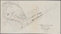
Atlas accompanying volumes I & IV, Geological survey of Wisconsin., Atlas accompanying volumes I and IV, Geological survey of Wisconsin., Geology of Wisconsin, survey of 1873-1879., and Wisconsin geological survey.
Description:
Cover title: Atlas accompanying volumes I & IV, Geological survey of Wisconsin., Includes index., Reissue of selected plates originally published as Atlas of the geological survey of Wisconsin, which accompanied Geology of Wisconsin, survey of 1873-1879., and Running title: Wisconsin geological survey.
Publisher:
Milwaukee Litho. & Engr. Co.,
Subject (Geographic):
Wisconsin--Maps
Subject (Name):
Chamberlin, Thomas C. (Thomas Chrowder), 1843-1928, Irving, R. D, and Strong, Moses McCure
Atlas accompanying volumes I & IV, Geological survey of Wisconsin., Atlas accompanying volumes I and IV, Geological survey of Wisconsin., Geology of Wisconsin, survey of 1873-1879., and Wisconsin geological survey.
Description:
Cover title: Atlas accompanying volumes I & IV, Geological survey of Wisconsin., Imperfect: Wanting 21 plates., Includes index., and Reissue of selected plates originally published as Atlas of the geological survey of Wisconsin, which accompanied Geology of Wisconsin, survey of 1873-1879.
Publisher:
Milwaukee Litho. & Engr. Co.,
Subject (Geographic):
Wisconsin--Maps
Subject (Name):
Chamberlin, Thomas C. (Thomas Chrowder), 1843-1928, Irving, R. D, and Strong, Moses McCure
Atlas accompanying volumes I & IV, Geological survey of Wisconsin., Atlas accompanying volumes I and IV, Geological survey of Wisconsin., Geology of Wisconsin, survey of 1873-1879., and Wisconsin geological survey.
Description:
Cover title: Atlas accompanying volumes I & IV, Geological survey of Wisconsin., Includes index., Reissue of selected plates originally published as Atlas of the geological survey of Wisconsin, which accompanied Geology of Wisconsin, survey of 1873-1879., and Running title: Wisconsin geological survey.
Publisher:
Milwaukee Litho. & Engr. Co.,
Subject (Geographic):
Wisconsin--Maps
Subject (Name):
Chamberlin, Thomas C. (Thomas Chrowder), 1843-1928, Irving, R. D, and Strong, Moses McCure
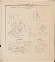
Atlas accompanying geological survey of Wisconsin. and Geology of Wisconsin. Survey of 1873-1879.
Description:
Accompanies: Geology of Wisconsin. Survey of 1873-1879. 4 v. ; 27 cm., Cover title: Atlas accompanying ... geological survey of Wisconsin., Imperfect: library has only plates 3, 4, 5, 6, and 7 (Moses Strong) and plates 3 and 9 (T.C., and Includes cross-sections.
Publisher:
Wisconsin Geological Survey,
Subject (Geographic):
Wisconsin--Maps
Subject (Name):
Chamberlin, Thomas C. (Thomas Chrowder), 1843-1928, Irving, Roland Duer, 1847-1888, Milwaukee Lith. & Engr. Co, and Strong, Moses, 1846-1877
Subject (Topic):
Geology--Wisconsin--Maps and Mines and mineral resources--Wisconsin--Maps
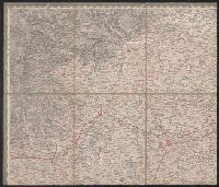
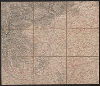
Copy 2: Imperfect: disbound; all sheets but Belluno, Trient, Padua, and Verona wanting; trimmed along neat line, with loss of marginal data. Sheets dissected and mounted on cloth. Stamps on verso: K.K. Un and Relief shown by hachures and spot heights.
Publisher:
Im Verlage der Herder'schen Kunst und Buchhandlung,
Copy 1: Imperfect: disbound; all sheets but Padua, Verona, and Milano wanting; trimmed along neat line, with loss of marginal data. Sheets dissected and mounted on cloth. and Relief shown by hachures and spot heights.
Publisher:
Im Verlage der Herder'schen Kunst und Buchhandlung,
Ferro meridian., From Bleau's Atlas major (German ed.). Zu Amsterdam : Bey Johannem Blaeu, [ca. 1670]., No. 58 of 69 maps bound together in composite atlas., Relief shown pictorially., and Scale [ca. 1:4 000 000].
Homann Erben (Firm) Mayer, Tobias, 1723-1762 Schneider, R. A.
Published / Created:
1747 [i.e. 1748?]
Call Number:
1975 Folio 31
Collection Title:
[Atlas factice of 42 maps, produced by the Homann Erben firm]
Image Count:
1
Alternative Title:
Carte des XVII. provinces ou de l’Allemagne inferievre, dressee suivant la projection stereographique, et appueyee par les mesures faites de Mess. Cassini, Snellius et Mouschenbrok, par Mr. Tob. Majer de la Societe geographique, et publiee par les Heritiers de Homann, l’An 1748
Publisher:
Cura et Studio Homannianorum Heredum
Subject (Geographic):
Belgium --Maps --Early works to 1800, Benelux countries --Maps --Early works to 1800, Luxembourg --Maps --Early works to 1800, and Netherlands --Maps --Early works to 1800
[Atlas factice of 32 maps and 1 distance table, produced by the Homann Erben firm]
Image Count:
2
Alternative Title:
Carte des XVII. provinces ou de l’Allemagne inferievre, dressee suivant la projection stereographique, et appueyee par les mesures faites de Mess. Cassini, Snellius et Mouschenbrok, par Mr. Tob. Majer de la Societe geographique, et publiee par les Heritiers de Homann, l’An 1748
Publisher:
Cura et Studio Homannianorum Heredum
Subject (Geographic):
Belgium --Maps --Early works to 1800, Benelux countries --Maps --Early works to 1800, Luxembourg --Maps --Early works to 1800, and Netherlands --Maps --Early works to 1800