Search
You Searched For
Search Results
- Creator:
- Gunnell, A. H
- Published / Created:
- 1911
- Call Number:
- 846gbc J777 1911
- Container / Volume:
- BRBL_00623
- Image Count:
- 1
- Resource Type:
- Maps, Atlases & Globes
- Found in:
- Beinecke Rare Book and Manuscript Library > Map of Waldo Consolidated Gold Mining Co. of Oregon : property in Waldo Mining District, Josephine County , Ore. / by A.H. Gunnell.
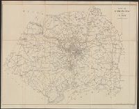
- Creator:
- White, Charles A. (Charles Abiathar), 1826-1910
- Published / Created:
- 1870
- Call Number:
- 847 1870
- Container / Volume:
- BRBL_00625
- Image Count:
- 4
- Resource Type:
- Maps, Atlases & Globes
- Found in:
- Beinecke Rare Book and Manuscript Library > Map of Washington Territory : west of the Cascade Mountains / compiled from the government surveys by Chas. A. White, C.E.
- Creator:
- Geological Survey (U.S.)
- Published / Created:
- 1882]
- Call Number:
- 779 1882
- Container / Volume:
- BRBL_00505
- Image Count:
- 1
- Resource Type:
- Maps, Atlases & Globes
- Found in:
- Beinecke Rare Book and Manuscript Library > Map of Washington and vicinity / prepared at the office of the U.S. Geological Survey, 1882.
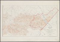
- Creator:
- Canada. Office of the Surveyor General
- Published / Created:
- 1918
- Call Number:
- 737 W31 1914
- Container / Volume:
- BRBL_00385
- Image Count:
- 1
- Resource Type:
- Maps, Atlases & Globes
- Found in:
- Beinecke Rare Book and Manuscript Library > Map of Waterton Lakes Park, Alberta [map] / from photographic surveys by M. P. Bridgland, D.L.S. and A. O. Wheeler, B.C.L.S. ; drawn and printed at the Surveyor General's Office.
- Creator:
- Morey, E. H., creator
- Published / Created:
- January 1912.
- Call Number:
- 824 1912
- Container / Volume:
- BRBL_00570
- Image Count:
- 1
- Resource Type:
- Maps, Atlases & Globes
- Found in:
- Beinecke Rare Book and Manuscript Library > Map of Watson Ranch tracts near city of Kearney for Kearney Land Company / E.H. Morey, C.E.
- Published / Created:
- 1870
- Call Number:
- 783gme 1870
- Container / Volume:
- BRBL_00510
- Image Count:
- 1
- Resource Type:
- Maps, Atlases & Globes
- Found in:
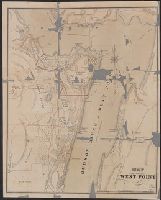
- Beinecke Rare Book and Manuscript Library > Map of West Point Harbor and rail road lines.
- Call Number:
- 771 W528 1867
- Container / Volume:
- BRBL_00492
- Image Count:
- 1
- Resource Type:
- Maps, Atlases & Globes
- Found in:
- Beinecke Rare Book and Manuscript Library > Map of West Point.
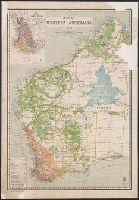
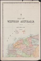
- Creator:
- Western Australia. Department of Lands and Surveys
- Published / Created:
- 1904
- Call Number:
- 2651 1904
- Container / Volume:
- BRBL_00023
- Image Count:
- 1
- Resource Type:
- Maps, Atlases & Globes
- Found in:
- Beinecke Rare Book and Manuscript Library > Map of Western Australia / Harry F. Johnston, surveyor general ; [Signed:] J. M. K.
- Creator:
- Western Australia. Department of Lands and Surveys
- Published / Created:
- 1905
- Call Number:
- 2651 1905
- Container / Volume:
- BRBL_00023
- Image Count:
- 1
- Resource Type:
- Maps, Atlases & Globes
- Found in:
- Beinecke Rare Book and Manuscript Library > Map of Western Australia / Harry F. Johnston, surveyor general.
- Creator:
- Western Australia. Department of Lands and Surveys
- Published / Created:
- 1903
- Call Number:
- 2651 1903
- Container / Volume:
- BRBL_00023
- Image Count:
- 4
- Resource Type:
- Maps, Atlases & Globes
- Found in:
- Beinecke Rare Book and Manuscript Library > Map of Western Australia / Harry F. Johnston, surveyor general.