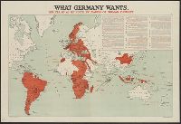
Includes "the Pan-German Plan as realized by War in Europe and in Asia, March 16, 1918"; shows colored map of Central Europe and its annexes in the Near East (Germany, Austria-Hungary, Bulgaria, Turkey); territory occupied or controlled by Central Powers;
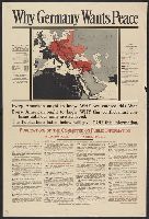
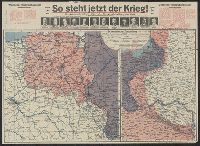
Includes ill. maps and text: "Printed about 1915 ... what would happen if the Allies won, a fearsome propaganda picture for the common German soldier ... were contained in an envelope which said The Map of Europe, how our enemies want to shape it and how
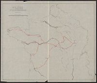
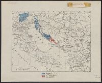
"B.4." in upper left margin., "Teilweise berichtigt bis I. V. 1915.", and Stamped "American Geographical Society" above left margin and "Loaned by the American Geographical Society, Broadway at 136th St., New York to The Peace Conference at Versailles 1918-1919