Skip to search
Skip to main content
Skip to first result
Search
You Searched For
Date
-
"Missouri"
Extent of Digitization
Completely digitized
Format
cartographic
Language
English
New Search
Search Results
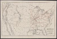
Creator:
Published / Created:
(Chicago : and [1886], c1883
Call Number:
75gme 1883B
Container / Volume:
BRBL_00413
Image Count:
2
Resource Type:
Maps, Atlases & Globes
Alternative Title:
Missouri Pacific Railway for Kansas
Description:
"Form 1. C D--1-15, 86.", Includes list of agents, fare chart, text and illus., Relief shown by hachures., and Timetables and tourist information on verso ([18] p.).
Publisher:
Missouri Pacific Railway,
Subject (Name):
Missouri Pacific Railway Company
Subject (Topic):
Railroads--Mexico--Maps and Railroads--United States--Maps
Found in:
Beinecke Rare Book and Manuscript Library > Map of the South West railway system : Missouri Pacific Ry., Central Branch U.P.R.R., Missouri, Kansas & Texas Ry., Texas and Pacific Ry., St. Louis, Iron Mountn. and Southern Ry., International and Great Northern Ry. and their connections / Rand McNally
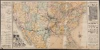
Creator:
Published / Created:
1911
Call Number:
816 1911
Container / Volume:
BRBL_00561
Image Count:
1
Resource Type:
Maps, Atlases & Globes
Alternative Title:
atlas map of Missouri .
Description:
business atlas map of Missouri . Copyright 1911
Publisher:
Rand McNally & Co.,
Subject (Geographic):
Missouri --Maps
Subject (Topic):
Railroads--Missouri --Maps
Found in:
Beinecke Rare Book and Manuscript Library > Missouri.
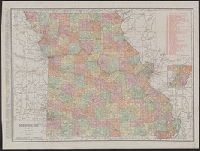
Creator:
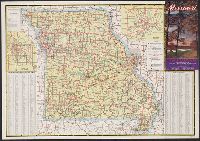
Missouri . State Highway Commission
Published / Created:
[1940]
Call Number:
816gmb 1940
Container / Volume:
BRBL_00564
Image Count:
2
Resource Type:
Maps, Atlases & Globes
Description:
Includes index, text, col. ill., and insets of Kansas City and St. Louis areas., On verso: 31 color ill. of natural features and buildings., and Panel title.
Publisher:
Missouri State Highway Commission,
Subject (Geographic):
Missouri --Maps
Subject (Topic):
Roads--Missouri --Maps
Found in:
Beinecke Rare Book and Manuscript Library > Missouri : 1940 highway map / compliments Missouri State Highway Commission.
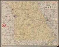
Creator:
Published / Created:
[1932?]
Call Number:
816gmb 1932
Container / Volume:
BRBL_00564
Image Count:
2
Resource Type:
Maps, Atlases & Globes
Alternative Title:
Missouri
Description:
"Texaco road map, 1932, United States," local route maps of Kansas City and St. Louis, distance table, indexes, ill., and text on verso., Date inferred from stamp below title: Apr 28 1932., and In lower right: A4.2716.
Publisher:
Rand McNally and Co.,
Subject (Geographic):
Missouri --Maps
Subject (Name):
Texas Company
Subject (Topic):
Roads--Missouri --Maps
Found in:
Beinecke Rare Book and Manuscript Library > Texaco road map, Missouri.
Branch:v1.61.6 ,Deployed:2024-06-12T09:55:19-04:00