[Atlas factice of 42 maps, produced by the Homann Erben firm]
Image Count:
1
Resource Type:
Maps, Atlases & Globes
Alternative Title:
Belgium Catholicum seu decem provinciae Germaniae inferioris and Carte des Pais Bas catholiques ou des X provinces de l’Allegmagne inferieure, etc. dessinee au juste selon les exactes observations astronomiques et operations geometriques des Messur. Cassini, Snellius, Muschenbrok, etc. dressee par Sr. Tobias Maier, mathematicien; aux depens des Heritiers de Homann
Publisher:
Edentibus Homannianis heredib
Subject (Geographic):
Belgium --Maps --Early works to 1800 and Luxembourg --Maps --Early works to 1800
[Atlas factice of 32 maps and 1 distance table, produced by the Homann Erben firm]
Image Count:
2
Alternative Title:
Belgium Catholicum seu decem provinciae Germaniae inferioris and Carte des Pais Bas catholiques ou des X provinces de l’Allegmagne inferieure, etc. dessinee au juste selon les exactes observations astronomiques et operations geometriques des Messur. Cassini, Snellius, Muschenbrok, etc. dressee par Sr. Tobias Maier, mathematicien; aux depens des Heritiers de Homann
Subject (Geographic):
Belgium --Maps --Early works to 1800 and Luxembourg --Maps --Early works to 1800
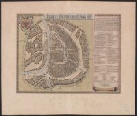
Appears in Blaeu's Atlas major, Fre, Hand col. Sheet measures 54 x 63 cm. Lanman Collection., Russian, Latin and French., Title text in cyrillic; transliteration in Koeman., and Verso: Title "Moskow, ville metropolitaine de Moscovie"; pg. no. 20,b; signature F 2.
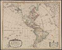
America accurate in imperia, regna, status, et populos divisa, ad usum Ludovici XV. Galliarum Regis
Description:
In French, with additional title in Latin., Includes "Avertissement"., Relief shown pictorially., and Sheet measures 51.5 x 63 cm. Numbered "108" in ink ms. Franklin Collection.
Publisher:
Chez Covéns & Mortier & Covéns Junior,
Subject (Geographic):
America--Maps--Early works to 1800
Subject (Name):
Anville, Jean Baptiste Bourguignon d', 1697-1782, Condet, Johannes, 1711-1781, engraver, and Covens et Mortier et Covens, junior
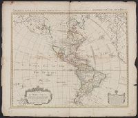
America accurate in imperia, regna, status, et populos divisa, ad usum Ludovici XV. Galliarum Regis
Description:
In French, with additional title in Latin., Includes "Avertissement"., Relief shown pictorially., and Sheet measures 58.5 x 69 cm. Stamp on verso: "Yale Horace Brown 1900S".
Publisher:
Chez Covéns & Mortier & Covéns Junior,
Subject (Geographic):
America--Maps--Early works to 1800
Subject (Name):
Anville, Jean Baptiste Bourguignon d', 1697-1782, Condet, Johannes, 1711-1781, engraver, and Covens et Mortier et Covens, junior
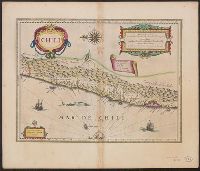
Cross Collection no. 347., From Blaeu's Le theatre du monde ... Amsterdami : Apud Guiljelmum et Iohannem Blaeu, 1635., Hand col., In French on verso, with caption title "Chili" and signature 7M., and Oriented with north to the left.
Publisher:
Guiljelmus Blaeuw excudit,
Subject (Geographic):
Chile--Maps--Early works to 1800
Subject (Name):
Blaeu, Joan, 1596-1673. Theatrum orbis terrarum. French and Blaeu, Willem Janszoon, 1571-1638. Theatrum orbis terrarum. French
Hase, Johann Matthias, 1684-1742 Homann Erben (Firm)
Published / Created:
1746
Call Number:
1975 Folio 31
Collection Title:
[Atlas factice of 42 maps, produced by the Homann Erben firm]
Image Count:
1
Alternative Title:
Ducatus Silesiae tabula altera superiorem Silesiam exhibens and Haute Silesie, qui comprend les Principautes de Neise, de Munsterberg, de Laegerndorf, de Troppau, d’Oppeln, de Ratibor, de Teschen dessinee par les Heritiers de Homann, l’an 1746
Publisher:
Homann Erben
Subject (Geographic):
Silesia, Upper (Poland and Czech Republic) --Maps --Early works to 1800
Hase, Johann Matthias, 1684-1742 Homann Erben (Firm) Mayer, Tobias, 1723-1762
Published / Created:
1745
Call Number:
1975 Folio 31
Collection Title:
[Atlas factice of 42 maps, produced by the Homann Erben firm]
Image Count:
1
Alternative Title:
Basse Silesie qui comprend les Principautes de Schweidnitz, de Iauer, de Glogau, de Breslau, de Liegnitz, de Brieg, de Wolau, de Oels & de Sagan and Ducatus Silesiae tabula geographica prima inferiorem eius partem
Publisher:
Homann Erben
Subject (Geographic):
Silesia, Lower (Poland and Germany) --Maps --Early works to 1800