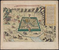
Has watermarks., Includes text and ill. of Noah's ark on Mount Ararat, angels, animals, Adam and Eve, and Cain slaying Abel., Oriented with north to the upper right., Perspective map., Relief shown pictorially., and Shows the Garden of Eden between the Tigris and
Publisher:
s.n.,
Subject (Topic):
Geographical myths--Maps--Early works to 1800, Noah's ark, and Paradise
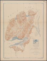
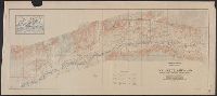
"Surveyed in 1909 and 1913 ; topography by Alaskan Branch, R.H. Sargent, topographic engineer.", Includes regional location map., and Relief shown by contours and spot heights.
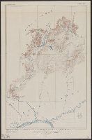
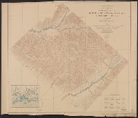
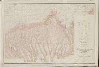
"R.B. Marshall, chief geographer. Sledge Tatum, geographer in charge. Topography by R.W. Berry and C.A. Ecklund. Control by C.F. Urquhart, M.R. McDanal, and R.M. Copeland.", "Surveyed in 1910-11.", and Includes inset showing "Railroad lines leading to Mesa Verde National Park."
Publisher:
U.S. Geological Survey,
Subject (Geographic):
Mesa Verde National Park (Colo.)--Maps
Subject (Name):
Berry, R. W, Copeland, R. M, Ecklund, C. A, Marshall, R. B. (Robert Bradford), 1867-1949, McDanal, M. R, Tatum, Sledge, and Urquhart, C. F