Map of the Northern Pacific Railroad, showing the intercontinental routes, oceanic currents and steamboat lines around the world. and Profiles of the Northern Pacific and the Central and Union Pacific Railroads, showing the difference in configuration of the country along the respective routes.
Description:
Imperfect: chipped along folds, with some loss of text. Backed with paper., Includes inset of "Map of the Northern Pacific Railroad, showing the intercontinental routes, oceanic currents and steamboat lines around the world," text, and "Profiles of the Northern Pacific and the Central and Union Pacific Railroads, showing the difference in configuration of the country along the respective routes.", Prime meridians: Greenwich and Washington., and Relief shown by hachures and spot heights.
Subject (Geographic):
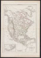
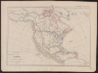
NorthAmerica--Maps.
Subject (Name):
Northern Pacific Railroad Company--Maps.
Subject (Topic):
Railroads--Canada--Maps. and Railroads--United States--Maps.
According to Sellers and Van Ee, this map is the 2nd state., At lower margin "London, printed for R. Sayer & J. Bennett, map & sea chartseller, no. 53, Fleet Street, as the act directs, Augst. 17th 1776., Includes a list of British colonies and territories., and Relief shown pictorially.
Publisher:
[Printed and sold by R. Sayer and J. Bennett, map and print seller, no. 53, Fleet St. 1776]
Subject (Geographic):
NorthAmerica--Maps--Early works to
Subject (Name):
Carver, Jonathan, 1710-1780, Jefferys, Thomas, d. 1771. American atlas, and Robert Sayer and John Bennett (Firm)
"Dedié au Roy par son très humble, très obeissant, très fidele suget et serviteur. Hubert Iaillot, géographe de Sa Majeste.", Appears in Jaillot's Atlas françois., Boundaries hand colored., Includes eight bar scales., Relief shown pictorially., and Sheet mea
Subject (Geographic):
NorthAmerica--Maps--Early works to
Subject (Name):
Albany Institute Stamp, Cordier, Louis, -1711, engraver, and Jaillot, Alexis Hubert, 1632?-1712. Atlas françois
Mounted on linen., Relief shown pictorially., and Variant without inset of "Fort Frederick oder Crown Point"; see B.B. McCorkle, Early printed maps of New England 1513-1800, 755.34.
Chart of the West-Indies or the islands of America in the North Sea
Description:
"P. 734, v. 11.", Covers North and South American coastline from Albemarle Sound to the mouth of the Orinoco R., and Includes text and inset of "La Veracruz."
Publisher:
s.n., 1745?]
Subject (Geographic):
Caribbean Area--Maps--Early works to 1800 and West Indies--Maps--Early works to 1800
Map showing the communication of the lakes and the rivers between Lake Superior and Slave Lake in North America
Description:
"Gent. Mag. March 1790, Pl. I, p. 197" in upper right hand corner., Mounted on linen. Sheet measures 20.7 x 24.3 cm. Cross Collection no. 178., Prime meridian: London., and Relief shown by hachures.