Search
You Searched For
Search Results
- Creator:
- Mercator, Gerhard, 1512-1594, cartographer
- Published / Created:
- [19--]
- Call Number:
- 11 1538B
- Image Count:
- 1
- Resource Type:
- Maps, Atlases & Globes
- Found in:
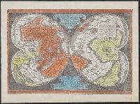
- Beinecke Rare Book and Manuscript Library > [Mapamundi of 1538] [cartographic material].
- Creator:
- Mercator, Gerhard, 1512-1594
- Published / Created:
- [192-?]
- Call Number:
- 11 1538
- Image Count:
- 1
- Resource Type:
- Maps, Atlases & Globes
- Found in:
- Beinecke Rare Book and Manuscript Library > [Double cordiform map of the world, 1538] / [cartographic material] / Joanni Drosio suo Gerardus Rupelmudan deducabat.
- Creator:
- Geological Survey (U.S.)
- Published / Created:
- [188-?]
- Call Number:
- 833fcm Y38 1885
- Container / Volume:
- BRBL_00585
- Image Count:
- 1
- Resource Type:
- Maps, Atlases & Globes
- Found in:
- Beinecke Rare Book and Manuscript Library > Yellowstone National Park and north western Wyoming / U.S. Geological Survey ; Henry Gannett, Chief Geographer ; J.H. Renshawe, Geographer in Charge ; triangulation by H.S. Chase ; topography by J.H. Renshawe, Frank Tweedy, and S.A. Aplin, Jr.
- Creator:
- Geological Survey (U.S.)
- Published / Created:
- [1901]
- Call Number:
- 833gc N431 1899
- Container / Volume:
- BRBL_00586
- Image Count:
- 1
- Resource Type:
- Maps, Atlases & Globes
- Found in:
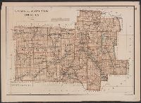
- Beinecke Rare Book and Manuscript Library > Wyoming-South Dakota, Newcastle quadrangle : land classification and density of standing timber / U.S. Geological Survey ; E.M. Douglas, geographer in charge ; triangulation by Frank Tweedy and R.H. Chapman ; topography by W.H. Herron ; Henry Gannett, geo
- Creator:
- Geological Survey (U.S.)
- Published / Created:
- [1900].
- Call Number:
- 833gc D337 1899
- Container / Volume:
- BRBL_00586
- Image Count:
- 1
- Resource Type:
- Maps, Atlases & Globes
- Found in:
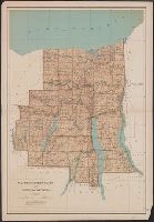
- Beinecke Rare Book and Manuscript Library > Wyoming, Dayton quadrangle : land classification and density of standing timber / U.S. Geological Survey ; E.M. Douglas, geographer in charge ; triangulation by W.S. Post ; topography by Frank Tweedy ; Henry Gannett, geographer in charge ; land classifica
- Creator:
- Bien, Joseph R
- Published / Created:
- c1895.
- Call Number:
- 771 W944 1895
- Container / Volume:
- BRBL_00492
- Image Count:
- 1
- Resource Type:
- Maps, Atlases & Globes
- Found in:
- Beinecke Rare Book and Manuscript Library > Wyoming and Livingston counties.
- Creator:
- Bien, Joseph R
- Published / Created:
- 1895].
- Call Number:
- EEgk64 895
- Container / Volume:
- BRBL_00492
- Image Count:
- 1
- Resource Type:
- Maps, Atlases & Globes
- Found in:
- Beinecke Rare Book and Manuscript Library > Wayne, Ontario, Yates and Seneca counties / [cartographic material] / copyright Julius Bien & Company, N.Y.
- Creator:
- Bien, Joseph R
- Published / Created:
- 1902
- Call Number:
- 766 1902
- Container / Volume:
- BRBL_00467
- Image Count:
- 4
- Resource Type:
- Maps, Atlases & Globes
- Found in:
- Beinecke Rare Book and Manuscript Library > The standard map of Connecticut / prepared under the direction of Joseph R. Bien, E.M., from original surveys and the triangulations and surveys of the U.S. Geological Survey and U.S. Coast and Geodetic Survey.
- Published / Created:
- 1885]
- Call Number:
- 80gc 1884
- Container / Volume:
- BRBL_00537
- Image Count:
- 1
- Resource Type:
- Maps, Atlases & Globes
- Found in:
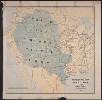
- Beinecke Rare Book and Manuscript Library > The range and ranch cattle area of the United States : 1884.
- Creator:
- Thayer, H. L
- Published / Created:
- 189-?]
- Call Number:
- 834 D437 1880
- Container / Volume:
- BRBL_00589
- Image Count:
- 2
- Resource Type:
- Maps, Atlases & Globes
- Found in:
- Beinecke Rare Book and Manuscript Library > The city of Denver / published by H.L. Thayer, Denver, Colo.