Skip to search
Skip to main content
Skip to first result
Search
You Searched For
Extent of Digitization
Completely digitized
Access
Public
Format
cartographic
New Search
Search Results
Creator:
Published / Created:
between 1719 and 1781?]
Call Number:
71 17XXA
Container / Volume:
BRBL_00367
Image Count:
1
Resource Type:
Maps, Atlases & Globes
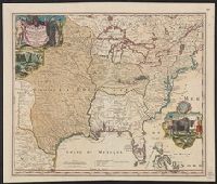
Description:
Includes ill. and text., Lowery refers to this version appearing in Homann's Atlas geographicvs maior exhibens tellurem seu globum terraqueum in mappis generalibus & specialibus ... (1759-[1781]), described in Phillips 622. Cf. Lowery 475., and Reference: Antiq
Publisher:
[s.n.,
Subject (Geographic):
Louisiana--Maps--Early works to 1800, Mississippi River Valley--Maps--Early works to 1800, and North America--Maps--Early works to 1800
Found in:
Beinecke Rare Book and Manuscript Library > Amplissimae regionis Mississipi seu Provinciae Ludovicianae â R.P. Ludovico Hennepin Francisc. Miss. in America Septentrionali anno 1687 / detectae nunc Gallorum Coloniis et actionum negotiis toto orbe celeberrimae, nova tabula edita à Io. Bapt. Homanno
Published / Created:
[176-?]
Call Number:
795 176X
Container / Volume:
BRBL_00730
Image Count:
1
Resource Type:
Maps, Atlases & Globes
Subject (Geographic):
North America--Maps--Early works to 1800
Found in:
Beinecke Rare Book and Manuscript Library > Amplissimæ regionis Mississipi seu Provinciæ Ludovicianæ â R.P. Ludovico Hennepin ...
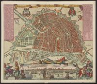
Published / Created:
[1675]
Call Number:
331 Am88 1675
Container / Volume:
BRBL_00079
Image Count:
1
Resource Type:
Maps, Atlases & Globes
Publisher:
Gedruckt by Carel Allardt.,
Subject (Geographic):
Amsterdam (Netherlands)--Maps--Early works to 1800
Found in:
Beinecke Rare Book and Manuscript Library > Amstelodamum vetus et novissimum per Carolum Allardt.
Published / Created:
[1898?]
Call Number:
331 Am88 1898
Container / Volume:
BRBL_00079
Image Count:
1
Resource Type:
Maps, Atlases & Globes
Description:
Sheet No. 1 of the set "Bradshaw's Continental Railway Guide".
Publisher:
Henry Blacklock & Co.,
Subject (Geographic):
Amsterdam (Netherlands)--Maps
Found in:
Beinecke Rare Book and Manuscript Library > Amsterdam / Bradshaw's Continental Railway Guide.
Published / Created:
ca. 1890?]
Call Number:
331 Am88 1890
Container / Volume:
BRBL_00079
Image Count:
1
Resource Type:
Maps, Atlases & Globes
Alternative Title:
Bradshaw's continental railway guide.
Description:
In Dutch and English., No. on recto: 1., and Running title in top margin: Bradshaw's continental railway guide.
Publisher:
George Bradshaw,
Subject (Geographic):
Amsterdam (Netherlands)--Maps
Subject (Topic):
Railroad stations--Netherlands--Amsterdam--Maps and Railroads--Netherlands--Amsterdam--Maps
Found in:
Beinecke Rare Book and Manuscript Library > Amsterdam [cartographic material] / Henry Blacklock & Co., Ltd.
Creator:
Published / Created:
1880
Call Number:
331 Am88 1880
Container / Volume:
BRBL_00079
Image Count:
2
Resource Type:
Maps, Atlases & Globes
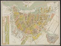
Alternative Title:
Platte grond van Amsterdam in 1880
Description:
Inzet: [1.] Vondels park ; [2.] Plan van uitbreiding der stad, vastgesteld in 1874., Verso: Gids voor de bezoekers van Amsterdam., and Verso: Lijst van straten, grachten enz.
Publisher:
Funke,
Subject (Geographic):
Amsterdam (Netherlands)--Maps
Found in:
Beinecke Rare Book and Manuscript Library > Amsterdam in 1880 / A. Braakensiek, fec.
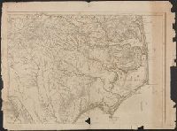
Published / Created:
1775
Call Number:
7855 1775C
Container / Volume:
BRBL_00515
Image Count:
1
Resource Type:
Maps, Atlases & Globes
Description:
Insets are described in booklet, Printed for Robt. Sayer and J. Bennett ... 1775., See booklet 785.1966 filed in corridor: W.P. Cumming, "North Carolina in Maps" ( Raleigh: State Dept. of Archives and History, 1966), Plate VIII., and See Roll Map 7855 +1794 for
Subject (Geographic):
North Carolina--Maps--Early works to 1800 and South Carolina--Maps--Early works to 1800
Found in:
Beinecke Rare Book and Manuscript Library > An Accurate Map of North and South Carolina With Their Indian Frontiers, Shewing ... from Actual Surveys by Henry Mouzon and Others.
Published / Created:
1749
Call Number:
3214 1749
Container / Volume:
BRBL_00056
Image Count:
1
Resource Type:
Maps, Atlases & Globes
Description:
Preliminary record.
Subject (Geographic):
Sussex (England)--Maps--Early works to 1800
Found in:
Beinecke Rare Book and Manuscript Library > An Accurate Map of the County of Sussex ... by Eman: Bowen ... 1749.
Published / Created:
[1778]
Call Number:
11 1778
Container / Volume:
BRBL_00005
Image Count:
1
Resource Type:
Maps, Atlases & Globes
Description:
Preliminary record.
Subject (Geographic):
World--Maps--Early works to 1800
Found in:
Beinecke Rare Book and Manuscript Library > An Accurate Map of the World ... By T. Conder. Engraved for Moore's New and Compleat Collection of Voyages and Travels.
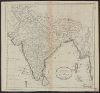
Published / Created:
1795].
Call Number:
59 1795B
Container / Volume:
BRBL_00316
Image Count:
1
Resource Type:
Maps, Atlases & Globes
Description:
From Carey's American Edition of Guthrie's Geography Improved.
Publisher:
Mathew Carey,
Subject (Geographic):
India--Maps--Early works to 1800
Found in:
Beinecke Rare Book and Manuscript Library > An Accurate map of Hindostan or India, from the Best Authorities. J.T. Scott, Sculp.
Branch:v1.61.6 ,Deployed:2024-06-12T09:55:37-04:00