Search
You Searched For
Search Results
- Creator:
- Cordier, Louis, d. 1711, engraver
Jaillot, Alexis Hubert, 1632?-1712, creator
Sanson, Guillaume
- Published / Created:
- [ca. 1692]
- Call Number:
- 1973 Folio 10
- Image Count:
- 1
- Resource Type:
- Maps, Atlases & Globes
- Found in:
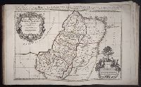
- Beinecke Rare Book and Manuscript Library > Iudea seu Terra Sancta quae Hebraeorum sive Israelitarum in suas duodecim tribus divisa : secretis ab invicem regnis Iuda et Israel expressis in super sex ultimi temporis ejusdem terrae provincijs
- Creator:
- Berry, William, fl. 1669-1708, creator
Sanson, Nicolas, 1600-1667
- Published / Created:
- 1680
- Call Number:
- 1973 Folio 10
- Image Count:
- 1
- Resource Type:
- Maps, Atlases & Globes
- Found in:
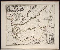
- Beinecke Rare Book and Manuscript Library > Africa : divided according to the extent of its principall parts in which are distinguished one from the other the empires, monarchies, kingdoms, states and peoples, which at this time inhabite Africa
- Creator:
- Blaeu, Joan, 1596-1673, creator
- Published / Created:
- [ca. 1670]
- Call Number:
- 1973 Folio 10
- Image Count:
- 1
- Resource Type:
- Maps, Atlases & Globes
- Found in:
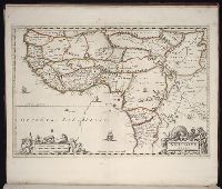
- Beinecke Rare Book and Manuscript Library > Nova Aegypti tabula
- Creator:
- Blaeu, Joan, 1596-1673, creator
- Published / Created:
- [1662?]
- Call Number:
- 1973 Folio 10
- Image Count:
- 1
- Resource Type:
- Maps, Atlases & Globes
- Found in:
- Beinecke Rare Book and Manuscript Library > Nigritarum regio
- Creator:
- Blaeu, Joan, 1596-1673, creator
- Published / Created:
- [ca. 1690?]
- Call Number:
- 1973 Folio 10
- Image Count:
- 1
- Resource Type:
- Maps, Atlases & Globes
- Found in:
- Beinecke Rare Book and Manuscript Library > Aethiopia superior vel interior, vulgo Abissinorum sive Presbiteri Ioannis imperium
- Creator:
- Blaeu, Joan, 1596-1673, creator
- Published / Created:
- [ca. 1690]
- Call Number:
- 1973 Folio 10
- Image Count:
- 1
- Resource Type:
- Maps, Atlases & Globes
- Found in:
- Beinecke Rare Book and Manuscript Library > Aethiopia inferior vel exterior: partes magis Septentrionales, quae hic desiderantur, vide in tabula Aethiopiae superioris
- Creator:
- Lea, Philip, fl. 1683-1700, creator
- Published / Created:
- [1696]
- Call Number:
- 1973 Folio 10
- Image Count:
- 1
- Resource Type:
- Maps, Atlases & Globes
- Found in:
- Beinecke Rare Book and Manuscript Library > The principall islands in America belonging to the English empire viz Iamaica, Barbados, Antegoa, St. Christophers [and] Bermudos
- Creator:
- Berry, William, fl. 1669-1708, creator
Sanson, Nicolas, 1600-1667
- Published / Created:
- 1680
- Call Number:
- 1973 Folio 10
- Image Count:
- 1
- Resource Type:
- Maps, Atlases & Globes
- Found in:
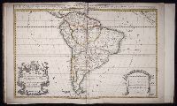
- Beinecke Rare Book and Manuscript Library > South America divided into its principall parts where are distinguished the severall states which belong to the Spanish, English, Portugals, and French
- Creator:
- Mortier, David
Mortier, Pierre
Sanson, Nicolas, 1600-1667, creator
- Published / Created:
- [1710]
- Call Number:
- 1973 Folio 10
- Image Count:
- 1
- Resource Type:
- Maps, Atlases & Globes
- Found in:
- Beinecke Rare Book and Manuscript Library > Teatre de la guerre en Flandre [et] Brabant, les pays conquis et le Bas-Rhein etc
- Published / Created:
- Undated
- Call Number:
- 1973 Folio 10
- Image Count:
- 1
- Resource Type:
- Maps, Atlases & Globes
- Found in:
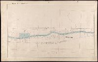
- Beinecke Rare Book and Manuscript Library > A view of Prince Charles's passage over ye Rhine being a new and correct plan of that river from ye city of Maintz to Fort Louis
- Published / Created:
- 1847 February 22
- Call Number:
- WA MSS S-1882
- Image Count:
- 1
- Resource Type:
- Maps, Atlases & Globes
- Found in:
- Beinecke Rare Book and Manuscript Library > Map of San Francisco, Calif., 1847
- Published / Created:
- 1632
- Call Number:
- BrSides Folio 2008 15
- Collection Title:
- Les voyages de la Novvelle France occidentale, dicte Canada / faits par le Sr. de Champlain
- Image Count:
- 1
- Found in:
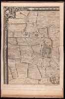
- Beinecke Rare Book and Manuscript Library > Carte de la Nouuelle France, augmentee depuis la derniere, seruant a la nauigation faicte en son vray Meridien, par le Sr. de Champlain pour le Roy en la Marine; lequel depuis l'an 1603 jusques en l'année 1629; a descouuert plusieurs costes, terres, lacs, ruineres, et Nations de Sauuages, par cy deuant incognuës, comme il se voit en ses relations quil a faict Imprimer en 1632, ou il se uoit cette marque [image of a flag] ce sont habitations qu'ont faict les françois. Faicte l'an 1632 par le sieur de Champlain. Scale [ca. 1:1,000,000].
- Creator:
- Kerby, E. R
- Published / Created:
- 1906 May
- Call Number:
- BrSides Zc41 906ke
- Image Count:
- 2
- Resource Type:
- Maps, Atlases & Globes
- Found in:
- Beinecke Rare Book and Manuscript Library > The Norman & Kerby map of Kiowa-Comanche Indian Reservations, Oklahoma opened for settlement 1906 : showing all lands allotted to Indians and leased for agricultrial purposes to date : carefully drawn and compiled from government survey plats and official information from U.S. Indian agent at Anadarko, Okla., and the U.S. Land Office at Lawton, Oklahoma / by E.R. Kerby
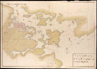
- Creator:
- Antoniszoon, Cornelis, b. ca. 1499
- Published / Created:
- Anno 1588.
- Call Number:
- Taylor 186
- Image Count:
- 18
- Found in:
- Beinecke Rare Book and Manuscript Library > Dit is de caerte vander Suyder Zee / tot dat Vlie toe / ende tot dat Marsdiep toe / om met schepen wt oft in te seylen / van Amstelredam ter zeewaert / ende wter zee wederom tot Amstelredam
- Creator:
- Colorado Midland Railway Company
- Published / Created:
- undated
- Call Number:
- WA MSS S-1741 BrSides
- Collection Title:
- Colorado Midland Railway Company maps
- Container / Volume:
- Folder 2
- Image Count:
- 10
- Resource Type:
- Maps, Atlases & Globes
- Found in:
- Beinecke Rare Book and Manuscript Library > [Maps of Garfield County, Colorado]
- Creator:
- Colorado Midland Railway Company
- Published / Created:
- undated
- Call Number:
- WA MSS S-1741 BrSides
- Collection Title:
- Colorado Midland Railway Company maps
- Container / Volume:
- Folder 3
- Image Count:
- 15
- Resource Type:
- Maps, Atlases & Globes
- Found in:
- Beinecke Rare Book and Manuscript Library > [Maps of Lake County, Colorado]
- Creator:
- Colorado Midland Railway Company
- Published / Created:
- undated
- Call Number:
- WA MSS S-1741 BrSides
- Collection Title:
- Colorado Midland Railway Company maps
- Container / Volume:
- Folder 4
- Image Count:
- 11
- Resource Type:
- Maps, Atlases & Globes
- Found in:
- Beinecke Rare Book and Manuscript Library > [Maps of Park and Chaffee Counties, Colorado]
- Creator:
- Colorado Midland Railway Company
- Published / Created:
- undated
- Call Number:
- WA MSS S-1741 BrSides
- Collection Title:
- Colorado Midland Railway Company maps
- Container / Volume:
- Folder 5
- Image Count:
- 12
- Resource Type:
- Maps, Atlases & Globes
- Found in:
- Beinecke Rare Book and Manuscript Library > [Maps of Park and Chaffee Counties, Colorado]
- Creator:
- Colorado Midland Railway Company
- Published / Created:
- undated
- Call Number:
- WA MSS S-1741 BrSides
- Collection Title:
- Colorado Midland Railway Company maps
- Container / Volume:
- Folder 6
- Image Count:
- 13
- Resource Type:
- Maps, Atlases & Globes
- Found in:
- Beinecke Rare Book and Manuscript Library > [Maps of Park and Chaffee Counties, Colorado]
- Creator:
- Colorado Midland Railway Company
- Published / Created:
- undated
- Call Number:
- WA MSS S-1741 BrSides
- Collection Title:
- Colorado Midland Railway Company maps
- Container / Volume:
- Folder 7
- Image Count:
- 10
- Resource Type:
- Maps, Atlases & Globes
- Found in:
- Beinecke Rare Book and Manuscript Library > [Maps of Pitkin and Eagle Counties, Colorado]
- Creator:
- Colorado Midland Railway Company
- Published / Created:
- undated
- Call Number:
- WA MSS S-1741 BrSides
- Collection Title:
- Colorado Midland Railway Company maps
- Container / Volume:
- Folder 8
- Image Count:
- 11
- Resource Type:
- Maps, Atlases & Globes
- Found in:
- Beinecke Rare Book and Manuscript Library > [Maps of Pitkin and Eagle Counties, Colorado]
- Creator:
- Colorado Midland Railway Company
- Published / Created:
- undated
- Call Number:
- WA MSS S-1741 BrSides
- Collection Title:
- Colorado Midland Railway Company maps
- Container / Volume:
- Folder 9
- Image Count:
- 22
- Resource Type:
- Maps, Atlases & Globes
- Found in:
- Beinecke Rare Book and Manuscript Library > [Maps of Aspen Branch, Jerome Park Branch, Pitkin-Garfield Counties, Colorado]
- Creator:
- Colorado Midland Railway Company
- Published / Created:
- undated
- Call Number:
- WA MSS S-1741 BrSides
- Collection Title:
- Colorado Midland Railway Company maps
- Container / Volume:
- Folder 1
- Image Count:
- 8
- Resource Type:
- Maps, Atlases & Globes
- Found in:
- Beinecke Rare Book and Manuscript Library > [Maps of Garfield County, Colorado]
- Creator:
- Pine, John, 1690-1756
Rocque, John, d. 1762
Tinney, John
- Published / Created:
- 1746
- Call Number:
- 2002 Folio 94
- Image Count:
- 24
- Resource Type:
- Maps, Atlases & Globes
- Found in:
- Beinecke Rare Book and Manuscript Library > A plan of the cities of London and Westminster, and borough of Southwark, with the contiguous buildings / from an actual survey, taken by John Rocque, land-surveyor, and engraved by John Pine ...
- Creator:
- Rease, W. H
- Published / Created:
- [ca. 1870?].
- Call Number:
- WA MSS S-2247 (BrSides)
- Image Count:
- 1
- Found in:
- Beinecke Rare Book and Manuscript Library > View of Lander Hill, Austin, Nevada / Lith. by W. H. Rease.
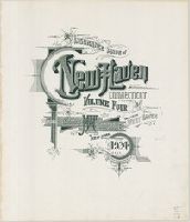
- Creator:
- Sanborn Map Company, issuing body
- Published / Created:
- 1924
- Call Number:
- 766 N46 1924
- Image Count:
- 92
- Resource Type:
- Maps, Atlases & Globes
- Found in:
- Beinecke Rare Book and Manuscript Library > Insurance maps of New Haven, Connecticut. Volume 2.
- Creator:
- Sanborn Map Company, issuing body
- Published / Created:
- 1924
- Call Number:
- 766 N46 1924
- Image Count:
- 55
- Resource Type:
- Maps, Atlases & Globes
- Found in:
- Beinecke Rare Book and Manuscript Library > Insurance maps of New Haven, Connecticut. Volume 5.
- Creator:
- Sanborn Map Company, issuing body
- Published / Created:
- 1924
- Call Number:
- 766 N46 1924
- Image Count:
- 92
- Resource Type:
- Maps, Atlases & Globes
- Found in:
- Beinecke Rare Book and Manuscript Library > Insurance maps of New Haven, Connecticut. Volume 4.
- Creator:
- Chorpenning, George, 1820-1894
- Published / Created:
- Undated
- Call Number:
- WA MSS S-2767
- Collection Title:
- George Chorpenning papers
- Container / Volume:
- 6 (Broadside) | Folder 64
- Image Count:
- 1
- Found in:
- Beinecke Rare Book and Manuscript Library > Maps
- Creator:
- Morgan, William, d. 1690
Ogilby, John, 1600-1676
- Published / Created:
- 1689
- Call Number:
- 1973 425
- Image Count:
- 29
- Found in:
- Beinecke Rare Book and Manuscript Library > Mr. Ogilby's and William Morgan's Pocket book of the roads : with their computed and measured distances, and the distinction of market and post-towns / by William Morgan ...
- Creator:
- Crublier d'Opterre, Henri, 1739-1799
- Published / Created:
- 1783
- Call Number:
- GEN MSS 499
- Collection Title:
- Henri Crublier d'Opterre journal and maps, [1776]-1783.
- Container / Volume:
- Bsd folder 10
- Image Count:
- 3
- Found in:
- Beinecke Rare Book and Manuscript Library > Unidentified. 'Amérique Septentrionale, 1783. Plan de la Ville et du Port de Ports-mouth, dans le newhampshire.'
- Creator:
- Sanborn Map Company, issuing body
- Published / Created:
- 1924
- Call Number:
- 766 N46 1924
- Image Count:
- 82
- Resource Type:
- Maps, Atlases & Globes
- Found in:
- Beinecke Rare Book and Manuscript Library > Insurance maps of New Haven, Connecticut. Volume 3.