Search
You Searched For
Search Results
- Call Number:
- 766 N46 1917
- Container / Volume:
- BRBL_00473A
- Image Count:
- 15
- Resource Type:
- Maps, Atlases & Globes
- Found in:
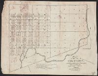
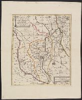
- Beinecke Rare Book and Manuscript Library > [City of New Haven] 1913-1917.
- Creator:
- Li, Mengquan (Cartographer), cartographer.
李蒙泉 (Cartographer), cartographer.
- Call Number:
- Covers 5626 +1880
- Image Count:
- 13
- Resource Type:
- Maps, Atlases & Globes
- Found in:
- Beinecke Rare Book and Manuscript Library > Su Sheng yu di ying wu quan tu / ji yong zhi xian Li Mengquan, Chen Jiaxun tong jian hua.
- Creator:
- Woerl, Joseph Edmund, creator
- Call Number:
- 37 1835
- Container / Volume:
- BRBL_00148
- Image Count:
- 19
- Resource Type:
- Maps, Atlases & Globes
- Found in:
- Beinecke Rare Book and Manuscript Library > Karte der Schweiz / von Dr. I. Woerl.
- Creator:
- Månsson, Johan, -1659
- Call Number:
- Double Covers 303cea +1645
- Image Count:
- 7
- Resource Type:
- Maps, Atlases & Globes
- Found in:
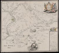
- Beinecke Rare Book and Manuscript Library > [Chart of the Baltic Sea] / Siegismuntlus von Vogell fecit.
- Creator:
- Tuttle-Ayers-Woodward Co
- Call Number:
- 816ad K134 1925
- Container / Volume:
- BRBL_00563
- Image Count:
- 29
- Resource Type:
- Maps, Atlases & Globes
- Found in:
- Beinecke Rare Book and Manuscript Library > Atlas of Kansas City, Missouri, and environs, 1925.
- Creator:
- Hood, Washington, 1808-1840
- Published / Created:
- before 1835
- Call Number:
- WA MSS S-2687
- Collection Title:
- Washington Hood papers
- Container / Volume:
- 5 Broadside
- Image Count:
- 1
- Resource Type:
- Maps, Atlases & Globes
- Found in:
- Beinecke Rare Book and Manuscript Library > Manuscript map of Nebraska and Iowa
- Creator:
- Rhode, Johann Christoph, cartographer
- Call Number:
- 755 1755AA
- Container / Volume:
- BRBL_00427
- Image Count:
- 1
- Resource Type:
- Maps, Atlases & Globes
- Found in:
- Beinecke Rare Book and Manuscript Library > Theatrum belli in America Septentrionali / II. foliis comprehensum jussu Acad. Reg. Scient. et Eleg. Litt. exhibet I. C. Rhode Ac: Geogr. ; Berger, sculpsit berol.
- Creator:
- Robert Sayer and John Bennett (Firm)
- Call Number:
- 755 1776K
- Container / Volume:
- BRBL_00430
- Image Count:
- 1
- Resource Type:
- Maps, Atlases & Globes
- Found in:
- Beinecke Rare Book and Manuscript Library > A general map of the northern British colonies in America : which comprehends the province of Quebec, the government of Newfoundland, Nova-Scotia, New-England and New-York, from the maps published by the Admiralty and Board of Trade, regulated by the astr
- Call Number:
- 3369 1839
- Container / Volume:
- BRBL_00089
- Image Count:
- 1
- Resource Type:
- Maps, Atlases & Globes
- Found in:
- Beinecke Rare Book and Manuscript Library > Croquis annexè á la note relative á Martelange.
- Creator:
- Mortier, Pierre, author
- Call Number:
- 462 1721
- Container / Volume:
- BRBL_00260
- Image Count:
- 1
- Resource Type:
- Maps, Atlases & Globes
- Found in:
- Beinecke Rare Book and Manuscript Library > Castell-novo : aux Venetiens dans le Dalmatie / par Pierre Mortier.
- Creator:
- Great Britain. Hydrographic Department, author
- Call Number:
- 254cea 1886
- Container / Volume:
- BRBL_00021
- Image Count:
- 1
- Resource Type:
- Maps, Atlases & Globes
- Found in:
- Beinecke Rare Book and Manuscript Library > Australia, Coral Sea and Great Barrier Reefs, showing the Inner and Outer routes to Torres Strait. Sheet 2 / engraved by Edwd. Weller.
- Creator:
- Güldenstädt, Johann Anton, 1745-1781, author
- Call Number:
- 494 1776
- Container / Volume:
- BRBL_00270
- Image Count:
- 1
- Resource Type:
- Maps, Atlases & Globes
- Found in:
- Beinecke Rare Book and Manuscript Library > Carte de la Mer Caspienne : dressée en 7bre 1776 d'après les dernieres observations / par D. Guldenstaedt ; gravé par P.F. Tardieu.
- Call Number:
- 11hcf 1919-53
- Container / Volume:
- BRBL_00010L
- Image Count:
- 1
- Resource Type:
- Maps, Atlases & Globes
- Found in:
- Beinecke Rare Book and Manuscript Library > Map of the Adriatic Sea and surrounding countries showing territorial demarcations based on Treaty of London, 1915.
- Call Number:
- 40 1860B
- Container / Volume:
- BRBL_00201
- Image Count:
- 1
- Resource Type:
- Maps, Atlases & Globes
- Found in:
- Beinecke Rare Book and Manuscript Library > Carte routiere des differents passages des Alpes et du Piemont = Carta postale dei diversi passaggi delle Alpi e del Piemonte.
- Creator:
- Tardieu, P. F. (Pierre François), 1757-1822, author
- Call Number:
- 451 1785
- Container / Volume:
- BRBL_00258
- Image Count:
- 1
- Resource Type:
- Maps, Atlases & Globes
- Found in:
- Beinecke Rare Book and Manuscript Library > Plan de la bataille & de la victoire remporteé par les Russes sur les Turcs commandés par le Grand Visir près de la riviere Kagul en Bessarabie, le 21 Juillet, 1770 / gravé par P.F. Tardieu.
- Creator:
- Tardieu, P. F. (Pierre François), 1757-1822, author
- Call Number:
- 45 1785
- Container / Volume:
- BRBL_00258
- Image Count:
- 1
- Resource Type:
- Maps, Atlases & Globes
- Found in:
- Beinecke Rare Book and Manuscript Library > Plan des Expéditions faites par le Gal. Weissman de l'autre côté du Danube contre Tultschi & Isaktschi / gravé par P.F. Tardieu.
- Creator:
- Ukert, F. A. (Friedrich August), 1780-1851
- Call Number:
- 390 1820
- Container / Volume:
- BRBL_00192
- Image Count:
- 1
- Resource Type:
- Maps, Atlases & Globes
- Found in:
- Beinecke Rare Book and Manuscript Library > Hispania.
- Creator:
- Tardieu, P. F. (Pierre François), 1757-1822, author
- Call Number:
- 451 1770
- Container / Volume:
- BRBL_00258
- Image Count:
- 1
- Resource Type:
- Maps, Atlases & Globes
- Found in:
- Beinecke Rare Book and Manuscript Library > Bender : assiege & pris par les Russes en 1770 / gravé par P.F. Tardieu.
- Creator:
- Tardieu, P. F. (Pierre François), 1757-1822, author
- Call Number:
- 45 1771
- Container / Volume:
- BRBL_00258
- Image Count:
- 1
- Resource Type:
- Maps, Atlases & Globes
- Found in:
- Beinecke Rare Book and Manuscript Library > Plan de l'Attaque du Retranchement, du Camp, et de la Flotte des Turcs par le Gal. Weisman, près de Tultschi, le 30 Juin 1771 / gravé par P.F. Tardieu.
- Creator:
- Tardieu, P. F. (Pierre François), 1757-1822, author
- Call Number:
- 3543 1785
- Container / Volume:
- BRBL_00113
- Image Count:
- 1
- Resource Type:
- Maps, Atlases & Globes
- Found in:
- Beinecke Rare Book and Manuscript Library > Tereki Fluvii Cursus, Kabarda major minor-que, et Caucaso adjacentes regiones / gravé par P.F. Tardieu.
- Creator:
- Blaeu, Willem Janszoon, 1571-1638, cartographer
- Call Number:
- 33 1635
- Container / Volume:
- BRBL_00077
- Image Count:
- 1
- Resource Type:
- Maps, Atlases & Globes
- Found in:
- Beinecke Rare Book and Manuscript Library > Novus XVII inferioris Germaniae provinciarum typus / de integro multis in locis emendatus à Guliel. Ianssonio ; Josua van den Ende, sculpsit.
- Call Number:
- 771hc B796 1776A
- Container / Volume:
- BRBL_00495
- Image Count:
- 1
- Resource Type:
- Maps, Atlases & Globes
- Found in:
- Beinecke Rare Book and Manuscript Library > [Map of Brooklyn, N.Y., showing the battle in this area in 1776, superimposed upon a modern street map.]
- Call Number:
- 8075cea 1848
- Container / Volume:
- BRBL_00551
- Image Count:
- 1
- Resource Type:
- Maps, Atlases & Globes
- Found in:
- Beinecke Rare Book and Manuscript Library > A Chart of Lake Erie ... Buffalo, A. Burke, 1848.
- Published / Created:
- .
- Call Number:
- 9417 1913M
- Container / Volume:
- BRBL_00675
- Image Count:
- 1
- Resource Type:
- Maps, Atlases & Globes
- Found in:
- Beinecke Rare Book and Manuscript Library > República Argentina : Informe sobre el estado de la minería en el territorio de los Andes / por ... Luciano Caplain.
- Call Number:
- 94fb 1869
- Container / Volume:
- BRBL_00675
- Image Count:
- 1
- Resource Type:
- Maps, Atlases & Globes
- Found in:
- Beinecke Rare Book and Manuscript Library > Proyecto de la limitacion de las Provincias de la Republica de Argentina y Demarcacion de los Territorios Nacionales presentado al Honorable Congreso por el Senador D. Nicasio Oroño,1869. Lit. á vapor, Moreno 130 Bs. As.
- Call Number:
- 734 M769 1906
- Container / Volume:
- BRBL_00380
- Image Count:
- 1
- Resource Type:
- Maps, Atlases & Globes
- Found in:
- Beinecke Rare Book and Manuscript Library > Map of Montreal, Canada [cartographic material].
- Call Number:
- 774 P53 1794
- Container / Volume:
- BRBL_00499
- Image Count:
- 1
- Resource Type:
- Maps, Atlases & Globes
- Found in:
- Beinecke Rare Book and Manuscript Library > To Thomas Mifflin / Governor and Commander in Chief of The State of Pennsylvania / This Plan of the City and Suburbs of Philadelphia Is respectfully inscribed by the Editor [Folie?] 1794.
- Creator:
- Rand McNally and Company
- Call Number:
- 75gme 1872
- Container / Volume:
- BRBL_00412
- Image Count:
- 1
- Resource Type:
- Maps, Atlases & Globes
- Found in:
- Beinecke Rare Book and Manuscript Library > Railway and distance map accompanying Rand, McNally & Co.'s Railway Guide.
- Call Number:
- 776 1801
- Container / Volume:
- BRBL_00502
- Image Count:
- 1
- Resource Type:
- Maps, Atlases & Globes
- Found in:
- Beinecke Rare Book and Manuscript Library > A map of Delaware and eastern shore of Maryland with the soundings of the Bay of Delaware from actual survey & soundings made in 1799, 1800 & 1801 by the Author.
- Call Number:
- 774gme 1840B
- Container / Volume:
- BRBL_00501A
- Image Count:
- 1
- Resource Type:
- Maps, Atlases & Globes
- Found in:
- Beinecke Rare Book and Manuscript Library > Map exhibiting that portion of the state of Pennsylvania traversed by the surveys for a continous railroad from Harrisburg to Pittsburg, 1839-40.
- Call Number:
- 779 W27 1792A
- Container / Volume:
- BRBL_00505
- Image Count:
- 1
- Resource Type:
- Maps, Atlases & Globes
- Found in:
- Beinecke Rare Book and Manuscript Library > Plan of the City of Washington in the territory of Columbia. Ceded by the States of Virginia and Maryland to the United States of America and by them established as the Seat of their Government. After the year MDCCC.
- Call Number:
- 777 C425 1799
- Container / Volume:
- BRBL_00503
- Image Count:
- 1
- Resource Type:
- Maps, Atlases & Globes
- Found in:
- Beinecke Rare Book and Manuscript Library > A map of the head of the Chesapeake Bay and Susquehanna River shewing the navigation of the same with a topographical description of the surrounding country from an actual survey by C.P. Hauducoeur 1799.
- Call Number:
- 779hc W27 1861
- Container / Volume:
- BRBL_00505A
- Image Count:
- 1
- Resource Type:
- Maps, Atlases & Globes
- Found in:
- Beinecke Rare Book and Manuscript Library > Plan of "Cantonment Spargue" near Washington D.C. occupied by 1st Regiment, R.I. Detached Militia. as laid out under the direction of Col. A.E. Burnside ... by Lieut. H.A. DeWitt, Engineer. May 1861.
- Call Number:
- 783 1809
- Container / Volume:
- BRBL_00508
- Image Count:
- 1
- Resource Type:
- Maps, Atlases & Globes
- Found in:
- Beinecke Rare Book and Manuscript Library > The State of Virginia from the best Authorities, By Samuel Lewis. 1809.
- Call Number:
- 783 1673D
- Container / Volume:
- BRBL_00507
- Image Count:
- 1
- Resource Type:
- Maps, Atlases & Globes
- Found in:
- Beinecke Rare Book and Manuscript Library > virginia and Maryland. As it is planted and inhabited this present year 1670. Surveyed and Exactly Drawne by ... Augustin Herrman, 1673.
- Call Number:
- 779 W27 1792A
- Container / Volume:
- BRBL_00505
- Image Count:
- 1
- Resource Type:
- Maps, Atlases & Globes
- Found in:
- Beinecke Rare Book and Manuscript Library > Plan of the City of Washington in the territory of Columbia. Ceded by the States of Virginia and Maryland to the United States of America and by them established as the Seat of their Government. After the year MDCCC.
- Call Number:
- 783 C899 1863B
- Container / Volume:
- BRBL_00510
- Image Count:
- 1
- Resource Type:
- Maps, Atlases & Globes
- Found in:
- Beinecke Rare Book and Manuscript Library > Military and topographic map of region about Culpepper Courthouse, Va.
- Creator:
- United States. General Land Office
- Call Number:
- 833 1879
- Container / Volume:
- BRBL_00584
- Image Count:
- 1
- Resource Type:
- Maps, Atlases & Globes
- Found in:
- Beinecke Rare Book and Manuscript Library > Territory of Wyoming : 1879 / compiled from the official records of the General Land Office and other sources by C. Roeser, Principal Draughtsman, G.L.O.
- Creator:
- Alaska Communication System
- Call Number:
- 848gmh 1950
- Container / Volume:
- BRBL_00635
- Image Count:
- 1
- Resource Type:
- Maps, Atlases & Globes
- Found in:
- Beinecke Rare Book and Manuscript Library > Alaska Communications System : chart of Alaska showing stations to which commercial communication service is available / prepared by Alaska Communication System [and] Signal Corps, Department of the Army ; Cartography and format Northwest Mapping Service.
- Creator:
- Moll, Herman, d. 1732
- Call Number:
- 85 1745A
- Container / Volume:
- BRBL_00636
- Image Count:
- 1
- Resource Type:
- Maps, Atlases & Globes
- Found in:
- Beinecke Rare Book and Manuscript Library > A chart of ye West-Indies or the islands of America in the North Sea &c., being ye present seat of war / by Herman Moll, geographer.
- Creator:
- Mayer, Tobias, 1723-1762
- Call Number:
- BrSides Double Folio 2019 29
- Image Count:
- 1
- Resource Type:
- Maps, Atlases & Globes
- Found in:
- Beinecke Rare Book and Manuscript Library > Belgivm Catholicvm seu decem provinciae Germaniae inferioris : cum confiniis Germaniae svp. et Franciae legitime omnia delineata et ad ductum observationum astronomicarum, nec non geometricarum operationum a Cassinio Snellio Muschenbrokio aliisqve rite ha
- Creator:
- Née, François Denis, 1732-1817, artist
- Call Number:
- 35 1783
- Container / Volume:
- BRBL_00100
- Image Count:
- 1
- Resource Type:
- Maps, Atlases & Globes
- Found in:
- Beinecke Rare Book and Manuscript Library > Vue d'une Partie de la Ville d'Iakoutsk Sur le Rive Occidentale de la Léna, et des Rochers Colonniformes appellés Stolbi / Gravé par Neé.
- Creator:
- Rand McNally and Company
- Call Number:
- 771 1883
- Container / Volume:
- BRBL_00479
- Image Count:
- 1
- Resource Type:
- Maps, Atlases & Globes
- Found in:
- Beinecke Rare Book and Manuscript Library > Rand, McNally & Co.'s new railroad, county and township map of New York : showing every railroad station and post office in the state.
- Creator:
- Royal Geographical Society (Great Britain). Geographical Section, cartographer
- Call Number:
- 11hcf 1919E-23
- Container / Volume:
- BRBL_00010ZA
- Image Count:
- 1
- Resource Type:
- Maps, Atlases & Globes
- Found in:
- Beinecke Rare Book and Manuscript Library > Milano [cartographic material] : North L. 32. / compiled at the Royal Geographical Society under the direction of the Geographical Section; drawn and printed by Ordnance Survey.
- Call Number:
- 32gme L84 1836
- Container / Volume:
- BRBL_00076
- Image Count:
- 1
- Resource Type:
- Maps, Atlases & Globes
- Found in:
- Beinecke Rare Book and Manuscript Library > Map showing elevation between Parish of Harlow and Parish of Birchanger.
- Call Number:
- 804 C599 1853
- Container / Volume:
- BRBL_00544
- Image Count:
- 1
- Resource Type:
- Maps, Atlases & Globes
- Found in:
- Beinecke Rare Book and Manuscript Library > Survey of the Harbor of Cleveland Ohio [map]
- Creator:
- Dunn, Samuel, d. 1794
- Call Number:
- 71 1776
- Container / Volume:
- BRBL_00687
- Image Count:
- 1
- Resource Type:
- Maps, Atlases & Globes
- Found in:
- Beinecke Rare Book and Manuscript Library > A map of the British Empire, in North America / by Samuel Dunn, mathematician, improved from the surveys of Capt. Carver.
- Call Number:
- 735 1790
- Container / Volume:
- BRBL_00689
- Image Count:
- 1
- Resource Type:
- Maps, Atlases & Globes
- Found in:
- Beinecke Rare Book and Manuscript Library > A map shewing the communication of the lakes and the rivers between Lake Superior and Slave Lake in North America.
- Creator:
- Robert Sayer and John Bennett (Firm)
- Call Number:
- 755 1776G
- Container / Volume:
- BRBL_00430
- Image Count:
- 1
- Resource Type:
- Maps, Atlases & Globes
- Found in:
- Beinecke Rare Book and Manuscript Library > A general map of the Northern British Colonies in America, which comprehends the Province of Quebec, the government of Newfoundland, Nova-Scotia, New-England and New York : from the surveys of Capt. Cook & Capt. Carver, regulated by the astronomic & trigo
- Creator:
- Colton, G. Woolworth (George Woolworth), 1827-1901
- Call Number:
- 771 1869C
- Container / Volume:
- BRBL_00479
- Image Count:
- 1
- Resource Type:
- Maps, Atlases & Globes
- Found in:
- Beinecke Rare Book and Manuscript Library > Colton's railroad & township map of the state of New York : with parts of the adjoining states & Canada / drawn by Geo. W. Colton ; J.M. Atwood, sculpt.
- Call Number:
- 771 ON8 1797
- Container / Volume:
- BRBL_00490
- Image Count:
- 1
- Resource Type:
- Maps, Atlases & Globes
- Found in:
- Beinecke Rare Book and Manuscript Library > A map of Messrs. Gorham and Phelp's Purchase; now the County of Ontario in the State of New York From actual survey by A. Porter Engraved by A. Doolitle, New Haven.
- Call Number:
- 774CA AL53 1824
- Container / Volume:
- BRBL_00501
- Image Count:
- 1
- Resource Type:
- Maps, Atlases & Globes
- Found in:
- Beinecke Rare Book and Manuscript Library > Plan and Profile of the Allegany Mountain between the head waters of Blair's Greek, a branch of the Juniata and the mountain branch of the Conemaugh 1824.
- Creator:
- Texas. General Land Office
- Call Number:
- 796 B468 1879
- Container / Volume:
- BRBL_00527
- Image Count:
- 1
- Resource Type:
- Maps, Atlases & Globes
- Found in:
- Beinecke Rare Book and Manuscript Library > Map of Bexar County.
- Creator:
- New Haven (Conn.). Civic Improvement Committee
- Call Number:
- 766 N46 1910
- Container / Volume:
- BRBL_00473A
- Image Count:
- 1
- Resource Type:
- Maps, Atlases & Globes
- Found in:
- Beinecke Rare Book and Manuscript Library > City of New Haven map.
- Call Number:
- 766 1827
- Container / Volume:
- BRBL_00465
- Image Count:
- 1
- Resource Type:
- Maps, Atlases & Globes
- Found in:
- Beinecke Rare Book and Manuscript Library > Geographical, statistical and historical map of Connecticut.
- Call Number:
- 774 B856 1820
- Container / Volume:
- BRBL_00499
- Image Count:
- 1
- Resource Type:
- Maps, Atlases & Globes
- Found in:
- Beinecke Rare Book and Manuscript Library > A map of Buck Mountain coal company mines exhibiting their relative position to the Lehigh slack water navigation and the different coal mines now opened in the region. Drawn by A.L. Foster of J. Collins 1820 (?) Lith.
- Call Number:
- 803 1855
- Container / Volume:
- BRBL_00542
- Image Count:
- 1
- Resource Type:
- Maps, Atlases & Globes
- Found in:
- Beinecke Rare Book and Manuscript Library > Sketch of the Ohio River at Cumberland Dam [map]
- Call Number:
- 805fcm C723 1841
- Container / Volume:
- BRBL_00546
- Image Count:
- 1
- Resource Type:
- Maps, Atlases & Globes
- Found in:
- Beinecke Rare Book and Manuscript Library > Plat of the Town of Columbia ... Whitley county. Elihu Chauncey, Proprietor.
- Call Number:
- 11ba 1915
- Container / Volume:
- BRBL_00010A
- Image Count:
- 1
- Resource Type:
- Maps, Atlases & Globes
- Found in:
- Beinecke Rare Book and Manuscript Library > [Philips' 12 inch terrestrial globe.]
- Call Number:
- BrSides Folio 2019 56
- Image Count:
- 1
- Resource Type:
- Maps, Atlases & Globes
- Found in:
- Beinecke Rare Book and Manuscript Library > Karta : opisi i promeru glubiny, chasti dnieprovskago Limana i reki Buga do Nikolaeva / sochinena flota gospodinom kapitanʺ leĭtnantomʺ Aleksandrom Savit︠s︡kimʺ 1793 goda.
- Call Number:
- BrSides Folio 2019 53
- Image Count:
- 1
- Resource Type:
- Maps, Atlases & Globes
- Found in:
- Beinecke Rare Book and Manuscript Library > Charte der Krieges operation am Donn und Dniper ihro Russisch Kayserl. Maist. glorieusen Armeen, 1736.
- Published / Created:
- .
- Call Number:
- 75H 1895
- Container / Volume:
- BRBL_00414A
- Image Count:
- 1
- Resource Type:
- Maps, Atlases & Globes
- Found in:
- Beinecke Rare Book and Manuscript Library > Map of the United States showing Military Posts and Principal Lines of Communication / Prepared by direction of the Secretary of War in the Office of the Chief of Engineers U.S.A.
- Call Number:
- 771 R297 1767
- Container / Volume:
- BRBL_00490
- Image Count:
- 1
- Resource Type:
- Maps, Atlases & Globes
- Found in:
- Beinecke Rare Book and Manuscript Library > Map of the Manor Rensel aerwick surveyed and laid down by a scale of 100 chains to an inch by Jno. R. Bleeker, Surveyor 1767.
- Call Number:
- 771 OS9 1836
- Container / Volume:
- BRBL_00490
- Image Count:
- 1
- Resource Type:
- Maps, Atlases & Globes
- Found in:
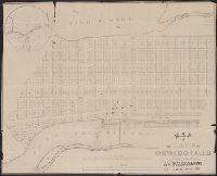
- Beinecke Rare Book and Manuscript Library > map of the Village of Oswego Falls to be Sold on hte Premises by Jas. Bleecker & Sons on the 18th October 1836.
- Call Number:
- 771 Og21 1836
- Image Count:
- 1
- Resource Type:
- Maps, Atlases & Globes
- Found in:
- Beinecke Rare Book and Manuscript Library > Map of Ogdensburgh in the County of St. Lawrence New-York. From Surveys by R. Tate and Sons Civil Engineers. 1836.
- Call Number:
- 771 R297 1767
- Container / Volume:
- BRBL_00490
- Image Count:
- 1
- Resource Type:
- Maps, Atlases & Globes
- Found in:
- Beinecke Rare Book and Manuscript Library > Map of the Manor Rensel aerwick surveyed and laid down by a scale of 100 chains to an inch by Jno. R. Bleeker, Surveyor 1767.
- Creator:
- Liechtenstern, Joseph M., 1765-1828, cartographer
- Call Number:
- 403 1805
- Container / Volume:
- BRBL_00234
- Image Count:
- 1
- Resource Type:
- Maps, Atlases & Globes
- Found in:
- Beinecke Rare Book and Manuscript Library > Charte von der Provinz Venedig und den Oesterreichischen Küstelaendern Istrien und Dalmatien, dann von dem Adriatischen Meere = Carte de la Province de Venise, des pays maritimes autrichiens d'Istrie et de Dalmatie, ainsi que de la Mer Adriatique / entwo
- Call Number:
- 401 1849B
- Container / Volume:
- BRBL_00233
- Image Count:
- 1
- Resource Type:
- Maps, Atlases & Globes
- Found in:
- Beinecke Rare Book and Manuscript Library > Carta postale del Piemonte, Savoja e Genovesato.
- Call Number:
- 402 1829
- Container / Volume:
- BRBL_00233
- Image Count:
- 1
- Resource Type:
- Maps, Atlases & Globes
- Found in:
- Beinecke Rare Book and Manuscript Library > Carta dei confini delle Provincie Lombarde : ordinata da sua eccellenza il sigr. Conte di Strassoldo, Presidente dell'I.R. Governo della Lombardia, nel 1829.
- Call Number:
- 403 1600
- Container / Volume:
- BRBL_00234
- Image Count:
- 1
- Resource Type:
- Maps, Atlases & Globes
- Found in:
- Beinecke Rare Book and Manuscript Library > Dominio Veneto nell'Italia.
- Call Number:
- 4035 1780
- Container / Volume:
- BRBL_00234
- Image Count:
- 1
- Resource Type:
- Maps, Atlases & Globes
- Found in:
- Beinecke Rare Book and Manuscript Library > Tyrolis pars meridionalis, episcopatum, et principatum Tridentinum continens.
- Call Number:
- 403 1825
- Container / Volume:
- BRBL_00234
- Image Count:
- 1
- Resource Type:
- Maps, Atlases & Globes
- Found in:
- Beinecke Rare Book and Manuscript Library > Strassen Karte des Lombardisch-Venezianischen Koenigreiches. Gouvernement Venedig / C. Stein sc.
- Call Number:
- 4035 1846
- Container / Volume:
- BRBL_00234
- Image Count:
- 1
- Resource Type:
- Maps, Atlases & Globes
- Found in:
- Beinecke Rare Book and Manuscript Library > Contea principesca del Tirolo e Vorarlberg / Gio. Battista Bordiga inc.
- Call Number:
- 401 1820
- Container / Volume:
- BRBL_00233
- Image Count:
- 1
- Resource Type:
- Maps, Atlases & Globes
- Found in:
- Beinecke Rare Book and Manuscript Library > Carte chorographique d'une partie du Piémont et de la Savoie : comprenant le réseau trigonométrique fait pour joindre la grande triangulation de France avec celle de l'Italie.
- Creator:
- Cary, John, approximately 1754-1835, cartographer
- Call Number:
- 401 1811
- Container / Volume:
- BRBL_00233
- Image Count:
- 1
- Resource Type:
- Maps, Atlases & Globes
- Found in:
- Beinecke Rare Book and Manuscript Library > A new map of Piedmont, the duchies of Savoy and Milan, and the republic of Genoa, with their subdivisions : from the latest authorities / by John Cary.
- Creator:
- Moulart-Sanson, Pierre, -1730, cartographer
- Call Number:
- 402 B75 1720
- Container / Volume:
- BRBL_00233A
- Image Count:
- 1
- Resource Type:
- Maps, Atlases & Globes
- Found in:
- Beinecke Rare Book and Manuscript Library > Carte particulière du Bressan, faisant partie des états dela République de Venise ... / par le sr. Sanson, Géograp. du Roy.
- Creator:
- Moulart-Sanson, Pierre, -1730, cartographer
- Call Number:
- 402 B45 1720
- Container / Volume:
- BRBL_00233A
- Image Count:
- 1
- Resource Type:
- Maps, Atlases & Globes
- Found in:
- Beinecke Rare Book and Manuscript Library > Carte nouvelle du Bergamasco, faisant partie des états de la République de Venise ... / par le sr. Sanson, Géographe du Roy.
- Call Number:
- 402eb 1836
- Container / Volume:
- BRBL_00233A
- Image Count:
- 1
- Resource Type:
- Maps, Atlases & Globes
- Found in:
- Beinecke Rare Book and Manuscript Library > Mappa di popolazione della Lombardia ...
- Call Number:
- 4035 1805
- Container / Volume:
- BRBL_00234
- Image Count:
- 1
- Resource Type:
- Maps, Atlases & Globes
- Found in:
- Beinecke Rare Book and Manuscript Library > Karte von Tyrol und Vorarlberg / F. Reisser sculp.
- Call Number:
- 4035 1729
- Container / Volume:
- BRBL_00234
- Image Count:
- 1
- Resource Type:
- Maps, Atlases & Globes
- Found in:
- Beinecke Rare Book and Manuscript Library > Évêché de Trente.
- Call Number:
- 402 1827
- Container / Volume:
- BRBL_00233
- Image Count:
- 1
- Resource Type:
- Maps, Atlases & Globes
- Found in:
- Beinecke Rare Book and Manuscript Library > Carta del Regno Lombardo-Veneto / compilata da Gaeto. Monticelli.
- Call Number:
- 771ed 1614
- Container / Volume:
- BRBL_00493
- Image Count:
- 1
- Resource Type:
- Maps, Atlases & Globes
- Found in:
- Beinecke Rare Book and Manuscript Library > The original Carte Figurative of which the above is an accurate facsimile was found on the 26th June 1841 in the Loket Kas of the States General in the Royal Archives at the Haque, It may be the one referred to in Octroy of the States General dated 11th O
- Published / Created:
- [n.d.]
- Call Number:
- Cc5 5 2.1
- Image Count:
- 1
- Found in:
- Beinecke Rare Book and Manuscript Library > Map showing the relative position of Rock Island, with the North Western states and territories
- Creator:
- Hewitt, N. R., cartographer
- Call Number:
- 4037 1816
- Container / Volume:
- BRBL_00234A
- Image Count:
- 1
- Resource Type:
- Maps, Atlases & Globes
- Found in:
- Beinecke Rare Book and Manuscript Library > Venetian States [cartographic material] / drawn & engraved by N.R. Hewitt, Charlotte Strt., Fitzroy Square ; drawn and engraved for Thomson's New general atlas, 1816.
- Call Number:
- 403cb Ad45 1840
- Container / Volume:
- BRBL_00234
- Image Count:
- 1
- Resource Type:
- Maps, Atlases & Globes
- Found in:
- Beinecke Rare Book and Manuscript Library > Corso generale delle acque fra Adige, la r. strada da Venezia a Treviso, i monte, ed il mare / Pietro Zuliani inci.
- Call Number:
- 402gm 1840
- Container / Volume:
- BRBL_00233A
- Image Count:
- 1
- Resource Type:
- Maps, Atlases & Globes
- Found in:
- Beinecke Rare Book and Manuscript Library > Strassen-Karte des Lombardisch-Venezianischen Koenigreiches. Gouvernement Lombardei.
- Call Number:
- 401 1849
- Container / Volume:
- BRBL_00233
- Image Count:
- 1
- Resource Type:
- Maps, Atlases & Globes
- Found in:
- Beinecke Rare Book and Manuscript Library > Carta del Piemonte, Savoja e Genovesato / da B. Dalbe.
- Call Number:
- 402 1832
- Container / Volume:
- BRBL_00233
- Image Count:
- 1
- Resource Type:
- Maps, Atlases & Globes
- Found in:
- Beinecke Rare Book and Manuscript Library > Carta itineraria del Regno Lombardo-Veneto indicante tutte le stazioni postali e militari ... / Ant. Magnarón incise.
- Call Number:
- 4035 1830
- Container / Volume:
- BRBL_00234
- Image Count:
- 1
- Resource Type:
- Maps, Atlases & Globes
- Found in:
- Beinecke Rare Book and Manuscript Library > Karte von der gefürsteten Grafschaft Tyrol : nach der neuesten und bewaehrtesten Hülfsmitteln entworfen.
- Call Number:
- 402 M59 300
- Container / Volume:
- BRBL_00233A
- Image Count:
- 1
- Resource Type:
- Maps, Atlases & Globes
- Found in:
- Beinecke Rare Book and Manuscript Library > Ager Mediolanensis medii aevi / Demczynski inc.
- Call Number:
- 403 1838
- Container / Volume:
- BRBL_00234
- Image Count:
- 1
- Resource Type:
- Maps, Atlases & Globes
- Found in:
- Beinecke Rare Book and Manuscript Library > Carta della Venezia terrestre e marittima alle epoche Etrusche e Romane : col confronto dello stato presente.
- Creator:
- Moulart-Sanson, Pierre, -1730, cartographer
- Call Number:
- 4037 1720
- Container / Volume:
- BRBL_00234A
- Image Count:
- 1
- Resource Type:
- Maps, Atlases & Globes
- Found in:
- Beinecke Rare Book and Manuscript Library > Carte nouvelle du Padouan, et le Polsin de Rovigo, de la République de Venise ... / par le Sr. Sanson, Géograp. du Roy.
- Creator:
- Moulart-Sanson, Pierre, -1730, cartographer
- Call Number:
- 402 C86 1720
- Container / Volume:
- BRBL_00233A
- Image Count:
- 1
- Resource Type:
- Maps, Atlases & Globes
- Found in:
- Beinecke Rare Book and Manuscript Library > Carte nouvelle du Cremasco a la République de Venise ... / par le sr. Sanson, Géog. du Roy.
- Call Number:
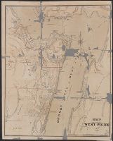
- 771 W528 1867
- Container / Volume:
- BRBL_00492
- Image Count:
- 1
- Resource Type:
- Maps, Atlases & Globes
- Found in:
- Beinecke Rare Book and Manuscript Library > Map of West Point.
- Call Number:
- 771gma ER41 1811
- Container / Volume:
- BRBL_00494
- Image Count:
- 1
- Resource Type:
- Maps, Atlases & Globes
- Found in:
- Beinecke Rare Book and Manuscript Library > Map of the Western Part of the State of New York shewing the route of a proposed Canal from Lake Erie to Hudson's River Compiled by John H. Eddy from the best authorities 1811.
- Call Number:
- 771gmb 1808
- Container / Volume:
- BRBL_00494
- Image Count:
- 1
- Resource Type:
- Maps, Atlases & Globes
- Found in:
- Beinecke Rare Book and Manuscript Library > A map of the State of New York ... including the Turnpike Roads ... By Wm. McGalpin, Oxford, 1808.
- Published / Created:
- .
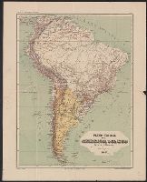
- Call Number:
- 90 1892
- Container / Volume:
- BRBL_00664
- Image Count:
- 1
- Resource Type:
- Maps, Atlases & Globes
- Found in:
- Beinecke Rare Book and Manuscript Library > Plano General de la America del Sud.
- Creator:
- C. van Baarsel et Fils, (cartographer)
- Call Number:
- BrSides Double Folio 2017 36
- Image Count:
- 1
- Resource Type:
- Maps, Atlases & Globes
- Found in:
- Beinecke Rare Book and Manuscript Library > Limbourg : divisé en arrondissements et cantons de justice de paix / dressé et grave par C. van Baarsel et Fils.