Uytenbogaart, J. W. H. (Johannes Wilhelmus Huybert) Wit, Frederik de., creator
Published / Created:
[1680?]
Call Number:
1973 Folio 10
Image Count:
1
Resource Type:
Maps, Atlases & Globes
Description:
Appears in the Wit's Atlas from 1680., Dedication: Amplissimo Doctissimoque Viro Domino Do. Joanni Uytenbogaert Jcto. nomine Illustrium et praepotent. DD. ordinum Hollandiae et Westvrisiae Aerary Publici Amstelodamensis Tribuno., Includes color illustrated views of Messina, Catania, and Trapano, and ancillary maps of Milazzo and Palermo., No. 21 of 69 maps bound together in composite atlas., Oriented with north toward the upper left., Relief shown pictorially., Scale indeterminable., and Urbibus praecipuis exornatum et novissime editum per F. de Wit.
Publisher:
Gedruckt tot Amsterdam by Frederik de Wit inde Kalverstraet by den Dam inde Witte Paskaert
Bar scales given in Stadia, mille Passus, milliaria unius horae, leucae Gallicae, and Dietce., Ferro meridian., No. 55 of 69 maps bound together in composite atlas., Relief shown pictorially., and Scale [ca 1:650 000].
No. 13 of 69 maps bound together in composite atlas., Oriented with north towards upper left., Relief shown pictorially., Scale not given., and Title in Latin; place names in French.
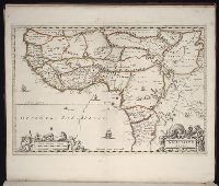
Bar scale given in milliaria Germanica communia., Covers west Africa from Tropic of Cancer southward., Ferro meridian., Map includes decorative title and scale statement cartouches with native figures and local fauna. Map interior displays three elephants., No. 59 of 69 maps bound together in composite atlas., Place names in Latin and Portuguese., Relief shown pictorially., and Scale [ca. 1:12 000 000].
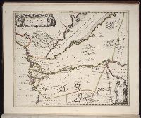
Bar scale given in milliaria Germanica., Ferro meridian., From Bleau's Atlas major (German ed.). Zu Amsterdam : Bey Johannem Blaeu, [ca. 1670]., No. 57 of 69 maps bound together in composite atlas., Oriented with north to the left., Relief shown pictorially., and Scale [ca 1:3 000 000].
Ferro meridian., Gemeene Duytsche mylen van 15 in een graedt., No. 53 of 69 maps bound together in composite atlas., Relief shown pictorially., and Scale [ca 1:8 750 000].
Publisher:
By Frederick de Wit in de Kalversbraet in de Witte Pascaert
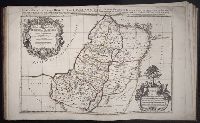
Appears in Wit's Atlas major., Includes coats of arms., No. 22 of 69 maps bound together in composite atlas., Relief shown pictorially., and Scale [ca. 1:1 100 000].
Publisher:
[Frederik de Wit]
Subject (Geographic):
Italy, Southern --Maps --Early works to 1800 and Naples (Kingdom) --Maps --Early works to 1800
Bar scales in Milliaria Germanica communia 15 in uno gradu, Milliaria Gallica magna, sive horae itineris, and milliaria Italica magna 60 in uno gradu., No. 19 of 69 maps bound together in composite atlas., Relief shown pictorially., and Scale [ca. 1:860 000].
Publisher:
[Frederik de Wit?]
Subject (Geographic):
Tuscany (Grand Duchy) --Maps --Early works to 1800