Search
You Searched For
Search Results
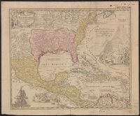
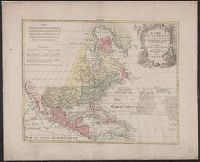
- Creator:
- Homann, Johann Baptist, 1663-1724
- Published / Created:
- between 1716 and 1737?]
- Call Number:
- 71 1737B
- Container / Volume:
- BRBL_00725
- Image Count:
- 1
- Resource Type:
- Maps, Atlases & Globes
- Found in:
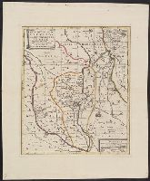
- Beinecke Rare Book and Manuscript Library > Regni Mexicani seu Novae Hispaniae, Ludovicianae, N. Angliae, Carolinae, Virginiae et Pensylvaniae necnon insularum archipelagi Mexicani in America Septentrionali / accurata tabula exhibita â Ioh. Baptista Homanno.
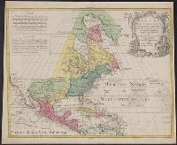
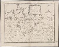
- Creator:
- L'Isle, Guillaume de, 1675-1726
- Published / Created:
- [176-?]
- Call Number:
- 70 1780L
- Container / Volume:
- BRBL_00724
- Image Count:
- 1
- Resource Type:
- Maps, Atlases & Globes
- Found in:
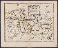
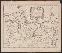
- Beinecke Rare Book and Manuscript Library > America Septentrionalis : concinnata juxta observationes Dnñ Academiae Regalis Scientiarum et nonnullorum aliorum, et juxta annotationes recentissimas / per G. de L'Isle, geographum ; G.F. Lotter, sculps.
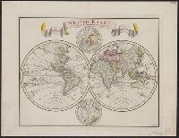
- Creator:
- Tirion, Isaak
- Published / Created:
- 1744
- Call Number:
- 11 1744A
- Container / Volume:
- BRBL_00681
- Image Count:
- 1
- Resource Type:
- Maps, Atlases & Globes
- Found in:
- Beinecke Rare Book and Manuscript Library > Wereld kaart [cartographic material] : na de alderlaatste ontdekking in't licht gebragt / by Isaak Tirion.
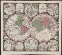
- Creator:
- Seutter, Matthaeus, 1678-1756
- Published / Created:
- [1742?]
- Call Number:
- 11 1730A
- Container / Volume:
- BRBL_00681
- Image Count:
- 1
- Resource Type:
- Maps, Atlases & Globes
- Found in:
- Beinecke Rare Book and Manuscript Library > Diversi globi terr-aquei : statione variante et visu intercedente, per coluros tropicorum, per ambos polos et particul. sphaerae zenith in planum delineati orthographici prospectus : quibis additae, pro mutatione horizontis differentes sphaerae positiones
- Creator:
- L'Isle, Guillaume de, 1675-1726
- Published / Created:
- [176-?]
- Call Number:
- 71 1750A
- Container / Volume:
- BRBL_00687
- Image Count:
- 1
- Resource Type:
- Maps, Atlases & Globes
- Found in:
- Beinecke Rare Book and Manuscript Library > America Septentrionalis : concinnata juxta observationes Dnñ Academiae Regalis Scientiarum et nonnullorum aliorum, et juxta annotationes recentissimas / per G. de L'Isle, geographum ; G.F. Lotter, sculps.
- Creator:
- Bellin, Jacques Nicolas, 1703-1772
- Published / Created:
- 1745
- Call Number:
- 73 1745
- Container / Volume:
- BRBL_00688
- Image Count:
- 1
- Resource Type:
- Maps, Atlases & Globes
- Found in:
- Beinecke Rare Book and Manuscript Library > Partie orientale de la Nouvelle France ou du Canada / [cartographic material] / par Mr. Bellin, Ingenieur du Roy et de la marine.
- Creator:
- Homann Erben (Firm)
- Published / Created:
- 1737?]
- Call Number:
- 85 1740A
- Container / Volume:
- BRBL_00693
- Image Count:
- 1
- Resource Type:
- Maps, Atlases & Globes
- Found in:
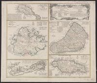
- Beinecke Rare Book and Manuscript Library > Dominia anglorum in praecipuis insulis Americae ut sunt insula : S. Christophori, Antegoa, Iamaica, Barbados, nec non insulae Bermudes vel Sommers dictae, singulari mappa omnia a exhibita et edita ab Homannianis Heredibus = Die englische Colonie-Laender a
- Creator:
- Bellin, Jacques Nicolas, 1703-1772, cartographer
- Published / Created:
- 1755
- Call Number:
- 8075 1755
- Container / Volume:
- BRBL_00731
- Image Count:
- 1
- Resource Type:
- Maps, Atlases & Globes
- Found in:
- Beinecke Rare Book and Manuscript Library > Partie occidentale de la Nouvelle France ou du Canada / par Mr. Bellin, ingenieur du Roy et de la Marine, pour seruir à l'intelligence des affaires et de l'etat present en Amerique, communiquée au public par les Heritiers de Homanen l'an 1755.
- Call Number:
- 4035 1780
- Container / Volume:
- BRBL_00234
- Image Count:
- 1
- Resource Type:
- Maps, Atlases & Globes
- Found in:
- Beinecke Rare Book and Manuscript Library > Tyrolis pars meridionalis, episcopatum, et principatum Tridentinum continens.
- Creator:
- Moulart-Sanson, Pierre, -1730, cartographer
- Call Number:
- 402 B75 1720
- Container / Volume:
- BRBL_00233A
- Image Count:
- 1
- Resource Type:
- Maps, Atlases & Globes
- Found in:
- Beinecke Rare Book and Manuscript Library > Carte particulière du Bressan, faisant partie des états dela République de Venise ... / par le sr. Sanson, Géograp. du Roy.
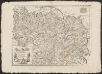
- Creator:
- Moulart-Sanson, Pierre, -1730, cartographer
- Call Number:
- 402 B45 1720
- Container / Volume:
- BRBL_00233A
- Image Count:
- 1
- Resource Type:
- Maps, Atlases & Globes
- Found in:
- Beinecke Rare Book and Manuscript Library > Carte nouvelle du Bergamasco, faisant partie des états de la République de Venise ... / par le sr. Sanson, Géographe du Roy.
- Creator:
- Sperges, Joseph, Freiherr von, 1725-1791
- Published / Created:
- [ca. 1762?]
- Call Number:
- 4035 1762
- Container / Volume:
- BRBL_00234
- Image Count:
- 1
- Resource Type:
- Maps, Atlases & Globes
- Found in:
- Beinecke Rare Book and Manuscript Library > Tyrolis pars meridionalis cum Espicopatu Tridentino finitimisque vallibus et limitibus Venetis / accurate descripta a Iosepho de Spergs in Palenz et Reisdorf.
- Call Number:
- 4035 1729
- Container / Volume:
- BRBL_00234
- Image Count:
- 1
- Resource Type:
- Maps, Atlases & Globes
- Found in:
- Beinecke Rare Book and Manuscript Library > Évêché de Trente.
- Creator:
- Moulart-Sanson, Pierre, -1730, cartographer
- Call Number:
- 4037 1720
- Container / Volume:
- BRBL_00234A
- Image Count:
- 1
- Resource Type:
- Maps, Atlases & Globes
- Found in:
- Beinecke Rare Book and Manuscript Library > Carte nouvelle du Padouan, et le Polsin de Rovigo, de la République de Venise ... / par le Sr. Sanson, Géograp. du Roy.
- Creator:
- Moulart-Sanson, Pierre, -1730, cartographer
- Call Number:
- 402 C86 1720
- Container / Volume:
- BRBL_00233A
- Image Count:
- 1
- Resource Type:
- Maps, Atlases & Globes
- Found in:
- Beinecke Rare Book and Manuscript Library > Carte nouvelle du Cremasco a la République de Venise ... / par le sr. Sanson, Géog. du Roy.
- Creator:
- Bellin, Jacques Nicolas, 1703-1772, cartographer
- Published / Created:
- 1755
- Call Number:
- 755 1755M
- Container / Volume:
- BRBL_00427
- Image Count:
- 1
- Resource Type:
- Maps, Atlases & Globes
- Found in:
- Beinecke Rare Book and Manuscript Library > Partie occidentale de la Nouvelle France ou du Canada / par Mr. Bellin, ingenieur du Roy et de la Marine, pour seruir à l'intelligence des affaires et de l'etat present en Amerique, communiquée au public par les Heritiers de Homanen l'an 1755.
- Creator:
- Bellin, Jacques Nicolas, 1703-1772
- Published / Created:
- 1745
- Call Number:
- 755 1745A
- Container / Volume:
- BRBL_00426
- Image Count:
- 1
- Resource Type:
- Maps, Atlases & Globes
- Found in:
- Beinecke Rare Book and Manuscript Library > Partie orientale de la Nouvelle France ou du Canada / [cartographic material] / par Mr. Bellin, Ingenieur du Roy et de la marine.
- Creator:
- Homann Erben (Firm)
- Published / Created:
- 1737?]
- Call Number:
- 85 1759
- Container / Volume:
- BRBL_00693
- Image Count:
- 1
- Resource Type:
- Maps, Atlases & Globes
- Found in:
- Beinecke Rare Book and Manuscript Library > Dominia anglorum in praecipuis insulis Americae ut sunt insula : S. Christophori, Antegoa, Iamaica, Barbados, nec non insulae Bermudes vel Sommers dictae, singulari mappa omnia a exhibita et edita ab Homannianis Heredibus = Die englische Colonie-Laender a
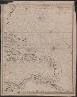
- Creator:
- Bellin, Jacques Nicolas, 1703-1772, cartographer
- Published / Created:
- [approximately 1720?]
- Call Number:
- 85 1720B
- Container / Volume:
- BRBL_00636
- Image Count:
- 1
- Resource Type:
- Maps, Atlases & Globes
- Found in:
- Beinecke Rare Book and Manuscript Library > Archipelague du Mexique : ou sont les isles de Cuba, Espagnole, Iamaique &c.
- Creator:
- Kitchin, Thomas, d. 1784
Kitchin, Thomas, d. 1784. General atlas describing the whole universe
Sayer, Robert, 1725-1794
- Published / Created:
- January 1st, 1787.
- Call Number:
- 356 1787
- Container / Volume:
- BRBL_00114
- Image Count:
- 1
- Resource Type:
- Maps, Atlases & Globes
- Found in:
- Beinecke Rare Book and Manuscript Library > A new map of the Kingdom of Poland with its dismembered provinces / [by Thomas Kitchin].
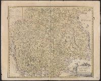
- Creator:
- Sanson, Nicolas, 1600-1667
- Published / Created:
- 1665
- Call Number:
- 38 1665
- Container / Volume:
- BRBL_00151
- Image Count:
- 1
- Resource Type:
- Maps, Atlases & Globes
- Found in:
- Beinecke Rare Book and Manuscript Library > Le Royaume de France : et ses acquisitions vers les Pays Bas, l'Allemagne, l'Italie et l'Espagne, avecq les pays circomvoisins, &c. ... / par le Sr. Sanson ...
- Creator:
- Baillieux, C., cartographer
- Call Number:
- 39hc Sa54 1719
- Container / Volume:
- BRBL_00192
- Image Count:
- 1
- Resource Type:
- Maps, Atlases & Globes
- Found in:
- Beinecke Rare Book and Manuscript Library > Plan de St. Sebastien et de ses environs : capitalle de la province de Gupuzcoa : attaqué par l'armée du Roy commande par le Marechal Duc de Barwick le 19 Juillet 1719.
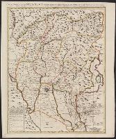
- Creator:
- L'Isle, Guillaume de, 1675-1726
- Call Number:
- 54 1706
- Container / Volume:
- BRBL_00290
- Image Count:
- 1
- Resource Type:
- Maps, Atlases & Globes
- Found in:
- Beinecke Rare Book and Manuscript Library > Carte de Tartarie : dressée sur les relations de plusieurs voyageurs de differentes nations et sur quelques observations qui ont été faites dans ce païs la / par Guillaume Del'Isle premier geog. du Roy de l'Academie Royale des Sciences.
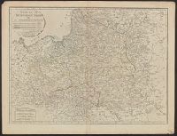
- Call Number:
- 40 B45 1770
- Container / Volume:
- BRBL_00205
- Image Count:
- 1
- Resource Type:
- Maps, Atlases & Globes
- Found in:
- Beinecke Rare Book and Manuscript Library > La provincia di Bergamo = Bergomensis provincia = La province de Bergamo.
- Creator:
- L'Isle, Guillaume de, 1675-1726
- Published / Created:
- [176-?]
- Call Number:
- 71 1750A
- Container / Volume:
- BRBL_00362
- Image Count:
- 1
- Resource Type:
- Maps, Atlases & Globes
- Found in:
- Beinecke Rare Book and Manuscript Library > America Septentrionalis : concinnata juxta observationes Dnñ Academiae Regalis Scientiarum et nonnullorum aliorum, et juxta annotationes recentissimas / per G. de L'Isle, geographum ; G.F. Lotter, sculps.
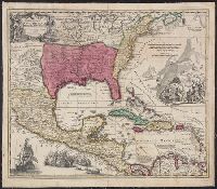
- Creator:
- Homann, Johann Baptist, 1663-1724
- Published / Created:
- between 1716 and 1737?]
- Call Number:
- 71 1716
- Container / Volume:
- BRBL_00361
- Image Count:
- 1
- Resource Type:
- Maps, Atlases & Globes
- Found in:
- Beinecke Rare Book and Manuscript Library > Regni Mexicani seu Novae Hispaniae, Ludovicianae, N. Angliae, Carolinae, Virginiae et Pensylvaniae necnon insularum archipelagi Mexicani in America Septentrionali / accurata tabula exhibita â Ioh. Baptista Homanno.
- Creator:
- L'Isle, Guillaume de, 1675-1726
- Published / Created:
- [176-?]
- Call Number:
- 71 1750A
- Container / Volume:
- BRBL_00362
- Image Count:
- 1
- Resource Type:
- Maps, Atlases & Globes
- Found in:
- Beinecke Rare Book and Manuscript Library > America Septentrionalis : concinnata juxta observationes Dnñ Academiae Regalis Scientiarum et nonnullorum aliorum, et juxta annotationes recentissimas / per G. de L'Isle, geographum ; G.F. Lotter, sculps.