Search
You Searched For
Search Results
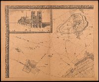
- Creator:
- Jouvin, Albert, active 1672
- Published / Created:
- 1908
- Call Number:
- 38 P21 1675
- Image Count:
- 17
- Resource Type:
- Maps, Atlases & Globes
- Found in:
- Beinecke Rare Book and Manuscript Library > Paris vers 1675 [cartographic material] : grand plan de Paris et de ses environs / par Jouvin de Rochefort, dédié à Messire Simon Arnaud.
- Creator:
- Jefferys, Thomas, -1771
- Published / Created:
- 20 Feby., 1775.
- Call Number:
- 792cea 1775C
- Container / Volume:
- BRBL_00519
- Image Count:
- 1
- Resource Type:
- Maps, Atlases & Globes
- Found in:
- Beinecke Rare Book and Manuscript Library > The island of Cuba with part of the Bahama banks & the Martyrs / by Thos. Jefferys.
- Creator:
- Bellin, Jacques Nicolas, 1703-1772
- Published / Created:
- 1757
- Call Number:
- BrSides 2019 64
- Image Count:
- 1
- Resource Type:
- Maps, Atlases & Globes
- Found in:
- Beinecke Rare Book and Manuscript Library > Carte de la Floride, de la Louisiane, et pays voisins : pour servir à l'Historie générale des voyages / par M.B. ing. de la marine.
- Creator:
- Gibson, J. (John), active 1750-1792
- Published / Created:
- [1749]
- Call Number:
- BrSides 2019 63
- Image Count:
- 1
- Resource Type:
- Maps, Atlases & Globes
- Found in:
- Beinecke Rare Book and Manuscript Library > A map of New Scotland with its dependencies and a succint account of the country.
- Creator:
- Jaillot, Alexis Hubert, 1632?-1712
- Published / Created:
- 1722
- Call Number:
- BrSides Double Folio 2019 86
- Image Count:
- 1
- Resource Type:
- Maps, Atlases & Globes
- Found in:
- Beinecke Rare Book and Manuscript Library > Generalité de La Rochelle divisée en cinq elections : sçavoir La Rochelle dans le pays d'Aunis, St. Jean d'Angely, Saintes, Marennes en Saintonge, Cognac en Angoumois : dressée sur les memoires les plus nouveaux / par le Sr. Jaillot ; Delahaye sculpsit.
- Creator:
- Goos, Abraham
- Published / Created:
- [between 1652 and 1680]
- Call Number:
- BrSides Double Folio 2019 96
- Image Count:
- 1
- Resource Type:
- Maps, Atlases & Globes
- Found in:
- Beinecke Rare Book and Manuscript Library > Hispaniae veteris descriptio / Abraham Goos sculpsit.
- Creator:
- Keere, Pieter van den, 1571-approximately 1646
- Published / Created:
- [1652?]
- Call Number:
- BrSides Double Folio 2019 66
- Image Count:
- 1
- Resource Type:
- Maps, Atlases & Globes
- Found in:
- Beinecke Rare Book and Manuscript Library > Pontos Euxeinos = Pontus Euxinus : æquor Iasonio pulsatum remige primum / ex conatibus Abrahami Ortelii ; Petrus Kaerius caelavit.
- Creator:
- Lauremberg, Johann, 1590-1658
- Published / Created:
- [approximately 1700]
- Call Number:
- BrSides Double Folio 2019 52
- Image Count:
- 1
- Resource Type:
- Maps, Atlases & Globes
- Found in:
- Beinecke Rare Book and Manuscript Library > Macedonia Alexandri M. patria illustris / autore I. Laurenbergio.
- Creator:
- Homann, Johann Baptist, 1663-1724
- Published / Created:
- [1707?]
- Call Number:
- BrSides Double Folio 2019 30
- Image Count:
- 1
- Resource Type:
- Maps, Atlases & Globes
- Found in:
- Beinecke Rare Book and Manuscript Library > Magna Britannia complectens Angliae, Scotiae et Hiberniae Regna in suas provincias et comitatus divisa repraesentate / Io. Bapt. Homann.
- Creator:
- Seutter, Matthaeus, 1678-1756
- Published / Created:
- [1735]
- Call Number:
- BrSides Double Folio 2019 25
- Image Count:
- 1
- Resource Type:
- Maps, Atlases & Globes
- Found in:
- Beinecke Rare Book and Manuscript Library > Neapolis, regni hujus maxima, ornatissima, siti amoenissima, multisq[ue] castellis munita, metropolis et emporium maritimum florentissimum : cum illustrissimis aedificiis / delineata, cura, et caelo Matthaei Seutteri, Sac. Cæs. Majest. Geogr.
- Creator:
- Seutter, Matthaeus, 1678-1756
- Published / Created:
- [after 1741]
- Call Number:
- BrSides Double Folio 2019 44
- Image Count:
- 1
- Resource Type:
- Maps, Atlases & Globes
- Found in:
- Beinecke Rare Book and Manuscript Library > Provincia Austriaca Societatis Iesu / aeri incisa et RRdis Patribus eiusdem Societat. in dicta Provincia decenti observantia oblata a Matthaeo Seutter, S.C.M.G. ; P.I.B. Maÿr S.I. delineavit.
- Creator:
- Dodsley, Robert, 1703-1764.
- Published / Created:
- [1761]
- Call Number:
- 32 L84 1761
- Image Count:
- 1
- Resource Type:
- Maps, Atlases & Globes
- Found in:
- Beinecke Rare Book and Manuscript Library > A new and correct plan of London, Westminster and Southwark [cartographic material] : with several additional improvements not in any former survey.
- Creator:
- Homann, Johann Baptist, 1663-1724
- Published / Created:
- [approximately 1730]
- Call Number:
- BrSides Double Folio 2019 34
- Image Count:
- 1
- Resource Type:
- Maps, Atlases & Globes
- Found in:
- Beinecke Rare Book and Manuscript Library > Tabula geographica qua pars Russiae Magnae, Pontus Euxinus seu Mare Nigrum et Tartaria Minor : cum finitimis Bulgariae, Romaniae et Natoliae Provinciis exhibe[n]tur / a Ioh. Baptista Homanno, Sac. Caes. Maiestatis Geographo.
- Creator:
- Mayer, Tobias, 1723-1762
- Published / Created:
- [after 1772]
- Call Number:
- BrSides Double Folio 2019 28
- Image Count:
- 1
- Resource Type:
- Maps, Atlases & Globes
- Found in:
- Beinecke Rare Book and Manuscript Library > Mappa geographica Regni Poloniae : ex novissimis quotquot sunt mappis specialibus composita et ad L.L. stereographica projectionis / revocata à Tob. Mayero.
- Creator:
- Seutter, Matthaeus, 1678-1756
- Published / Created:
- [approximately 1740]
- Call Number:
- BrSides Double Folio 2019 39
- Image Count:
- 1
- Resource Type:
- Maps, Atlases & Globes
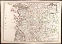
- Found in:
- Beinecke Rare Book and Manuscript Library > Synopsis Circuli Rhenani Inferioris sive Electorum Rheni : exhibens Archi Episcopatum Moguntinum, Coloniensem, Trevirensem et Palatinatum Rheni, comitatus Beilstein, Newenaer, Isenburg Infer. et Reifferscheid. / ob oculos posita à Matth. Seutter, Sac. Cae
- Creator:
- Hole, William, -1624
- Published / Created:
- [1614]
- Call Number:
- BrSides 2019 83
- Image Count:
- 1
- Resource Type:
- Maps, Atlases & Globes
- Found in:
- Beinecke Rare Book and Manuscript Library > The great desert of Arabia.
- Creator:
- Arrowsmith, John, 1790-1873, cartographer
- Published / Created:
- 1846
- Call Number:
- BrSides 2019 95
- Image Count:
- 1
- Resource Type:
- Maps, Atlases & Globes
- Found in:
- Beinecke Rare Book and Manuscript Library > Part of the west coast of Australia, surveyed by the officers of H.M.S. Beagle [cartographic material] : with Captn. J. Lort Stokes' route into the interior Decr. 1841 / J. Arrowsmith.
- Creator:
- Kitchin, Thomas, 1718-1784
- Published / Created:
- [1764]
- Call Number:
- BrSides Folio 2019 92
- Collection Title:
- Navigantium atque itinerantium bibliotheca ; Or, A complete collection of voyages and travels
- Image Count:
- 1
- Resource Type:
- Maps, Atlases & Globes
- Found in:
- Beinecke Rare Book and Manuscript Library > A new & accurate map of China : drawn from surveys made by the Jesuit Missionaries, by order of the Emperor, regulated by numerous astronomical observations / by Thos. Kitchin Geogr.
- Creator:
- De Witt, Simeon, 1756-1834
- Published / Created:
- [1793?]
- Call Number:
- 771 1793
- Container / Volume:
- BRBL_00477
- Image Count:
- 1
- Resource Type:
- Maps, Atlases & Globes
- Found in:
- Beinecke Rare Book and Manuscript Library > 1st sheet of De Witt's state-map of New-York / C. Tiebout sculp. NYork.
- Creator:
- Seutter, Matthaeus, 1678-1756
- Published / Created:
- [1736]
- Call Number:
- BrSides Double Folio 2019 19
- Image Count:
- 1
- Resource Type:
- Maps, Atlases & Globes
- Found in:
- Beinecke Rare Book and Manuscript Library > Charte der Kriegs Operationen am Donn u. Dnieper Ihro russich kayserl. Majestaet glorieusen Armeen A. 1736 / gestochen bey der Kayserl. Wissensch. Acad. in St. Petersburg.
- Creator:
- Carl, Rupert, 1682-1751
- Published / Created:
- a MDCCL [1750]
- Call Number:
- BrSides Double Folio 2019 32
- Image Count:
- 1
- Resource Type:
- Maps, Atlases & Globes
- Found in:
- Beinecke Rare Book and Manuscript Library > Hispania Benedictina seu Monasteria et alia pia loca Ord. S. Benedicti quae in Regnis Hispaniae et Portugalliae nec non America in hodiernum usque diem florent / in lucem edita a Ruperto Carl, Monacho Benedictino Weichenstephanensis.
- Creator:
- Homann Erben (Firm)
- Published / Created:
- [between 1745 and 1750]
- Call Number:
- BrSides Double Folio 2019 38
- Image Count:
- 1
- Resource Type:
- Maps, Atlases & Globes
- Found in:
- Beinecke Rare Book and Manuscript Library > Italia Benedictina / delineata A.P.R.C.P.W.
- Creator:
- Seutter, Matthaeus, 1678-1756
- Published / Created:
- [approximately 1752]
- Call Number:
- BrSides Double Folio 2019 20
- Image Count:
- 1
- Resource Type:
- Maps, Atlases & Globes
- Found in:
- Beinecke Rare Book and Manuscript Library > Wratislavia antiquissima et celeberrima Ducat. Silesiaci metropolis ac florentissimum bonarum artium et mercium emporium ad amnem viadrum = Breslau die uhralte u[nd] hochberühmte Haupt Statt des Herzogth. Schlesien auch vortrefflicher aufenthalt der Muse
- Creator:
- Seutter, Matthaeus, 1678-1756
- Published / Created:
- [1735]
- Call Number:
- BrSides Double Folio 2019 47
- Image Count:
- 1
- Resource Type:
- Maps, Atlases & Globes
- Found in:
- Beinecke Rare Book and Manuscript Library > Lisabona magnificentissima Regia sedes Portugalliae et florentissimum Emorium ad oftia tagi situm / aeri incisium per Matth. Seutter S. Cæs. et Reg. Cathol. Maj. Geogr. Aug. Vindel. = Lisabon die prächtigste Königl. Residenz Statt in Portugall u. floris
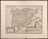
- Creator:
- Wit, Frederik de,
- Published / Created:
- [1688?]
- Call Number:
- BrSides Double Folio 2018 10
- Image Count:
- 1
- Resource Type:
- Maps, Atlases & Globes
- Found in:
- Beinecke Rare Book and Manuscript Library > Accuratissima totius Asiae tabula [cartographic material] : in omnes partes divisa, de nova correcta, ac in lucem edita / per Fredericum de Witt Amstelodami cum privilegio D.D. ordinum Hollandiae Westristacq[ue] ; F. de Wit excudit.
- Creator:
- Homann, Johann Baptist, 1663-1724
- Published / Created:
- [approximately 1730]
- Call Number:
- BrSides Double Folio 2019 33
- Image Count:
- 1
- Resource Type:
- Maps, Atlases & Globes
- Found in:
- Beinecke Rare Book and Manuscript Library > Nova tabula Scaniae quae est Gothia Australis, provincias Scaniam, Hallandiam, et Blekingiam complectens / accuratè exhibita à Ioh. Bapt. Homanno.
- Creator:
- Carl, Rupert
- Published / Created:
- [1738]
- Call Number:
- BrSides Double Folio 2019 41
- Image Count:
- 1
- Resource Type:
- Maps, Atlases & Globes
- Found in:
- Beinecke Rare Book and Manuscript Library > Gallia benedictina : La France benedictine : seu abbatiae & prioratus tam monachorum quam monialium ord. S. Benedicti. ibide[.] existe[n]tes iuxta exemplar parisiense / cura & opera p. Ruperti Carl, professi weiche[n]steph.
- Creator:
- Seutter, Matthaeus, 1678-1756
- Published / Created:
- [1740?]
- Call Number:
- BrSides Double Folio 2019 40
- Image Count:
- 1
- Resource Type:
- Maps, Atlases & Globes
- Found in:
- Beinecke Rare Book and Manuscript Library > Provincia Gallis la Provence dicta : determinata in omnes suas praefecturas cum terris confinibus et alluentib. Maris Mediterranei partibus / cura et caelo Matthaei Seutteri, S.C.M. Geogr. Augustani ; Gottfr. Rogg inv. et delin.
- Creator:
- Homann Erben (Firm)
- Published / Created:
- a MDCCXXXII [1732]
- Call Number:
- BrSides Double Folio 2019 49
- Image Count:
- 1
- Resource Type:
- Maps, Atlases & Globes
- Found in:
- Beinecke Rare Book and Manuscript Library > Germania Benedictina quae in illa sunt monasteria Ord. S. Benedicti monstrans. exacte ita delineata per P.R.C.P.W.C.B.S. / excusa studio et sumtibus Homannianorum Heredum.
- Creator:
- Linschoten, Jan Huygen van, 1563-1611
- Published / Created:
- [1596?]
- Call Number:
- BrSides Folio 2019 95
- Image Count:
- 1
- Resource Type:
- Maps, Atlases & Globes
- Found in:
- Beinecke Rare Book and Manuscript Library > Deliniantur in hac tabula, Orae maritimae Abexiae, freti Mecani ; al. Maris Rubri ; Arabiae, Ormi, Persiae, suprà Sindam usque Fluminis Indi, Cambaiae Indiae & Malabaris, Insulae Ceylon, Choromandeliae, & Orixae, fluvii Gangis, & Regni Bengalae, situs item Sinuum, Insularum ... = Afbeeldinge der custen van Abex, der engte van Mecha, anders ghenaempt de Roode Zee, Item de custen van Arabien, Ormus, Persen tot Sinde toe / [Jan Huygen van Linschoten, Henricus F. ab Langren].
- Creator:
- Lauremberg, Johann, 1590-1658
- Published / Created:
- [between 1680 and 1700]
- Call Number:
- BrSides Double Folio 2019 54
- Image Count:
- 1
- Resource Type:
- Maps, Atlases & Globes
- Found in:
- Beinecke Rare Book and Manuscript Library > Epirus, hodie vulgò Albania / autore I. Laurenbergio.
- Creator:
- Münster, Sebastian, 1489-1552
- Published / Created:
- [1532]
- Call Number:
- 11 1509A
- Image Count:
- 1
- Resource Type:
- Maps, Atlases & Globes
- Found in:
- Beinecke Rare Book and Manuscript Library > Typus cosmographicus uniuersalis.
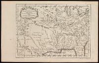
- Creator:
- Bellin, Jacques Nicolas, 1703-1772
- Published / Created:
- 1757
- Call Number:
- BrSides 2018 139
- Image Count:
- 1
- Resource Type:
- Maps, Atlases & Globes
- Found in:
- Beinecke Rare Book and Manuscript Library > Carte de la Nouvelle Angleterre, Nouvelle Yorck, et Pensilvanie / pour servir à l'Histoire générale des voyages. Par M.B., ing. de la mare.
- Creator:
- Ross, John, active 1762-1789
- Published / Created:
- 1 June 1775.
- Call Number:
- BrSides Folio 2018 122
- Image Count:
- 1
- Resource Type:
- Maps, Atlases & Globes
- Found in:
- Beinecke Rare Book and Manuscript Library > Course of the river Mississipi [sic] from the Balise to Fort Chartres [cartographic material] ; taken on an expedition to the Illinois, in the latter end of the year 1765. / By Lieut. Ross of the 34th Regiment: Improved from the surveys of the river made
- Published / Created:
- 1st June 1776.
- Call Number:
- 771cea N49 1776
- Container / Volume:
- BRBL_00493
- Image Count:
- 1
- Resource Type:
- Maps, Atlases & Globes
- Found in:
- Beinecke Rare Book and Manuscript Library > Chart of the entrance of Hudson's River, from Sandy Hook to New York [cartographic material] : with the banks, depths of water, sailing-marks, & ca.
- Creator:
- Goos, Abraham
- Published / Created:
- [between 1652 and 1680]
- Call Number:
- 390 1660
- Container / Volume:
- BRBL_00192
- Image Count:
- 1
- Resource Type:
- Maps, Atlases & Globes
- Found in:
- Beinecke Rare Book and Manuscript Library > Hispaniae veteris descriptio / Abraham Goos sculpsit.