Skip to search
Skip to main content
Skip to first result
Search
You Searched For
Extent of Digitization
Completely digitized
Genre
Maps
Genre
Maps in books
New Search
Search Results
Creator:
Published / Created:
ca. 1730?
Call Number:
1975 Folio 31
Collection Title:
[Atlas factice of 42 maps, produced by the Homann Erben firm]
Image Count:
2
Alternative Title:
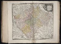
Bohemiae Regnum in duodecim Circulos divisum and Royaume de Boheme divise en XII cercles
Publisher:
Homann Erbe
Subject (Geographic):
Bohemia (Czech Republic) --Maps --Early works to 1800
Subject (Topic):
Atlases, German --Early works to 1800
Collection Created:
[Nuremberg,
Found in:
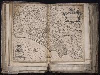
Beinecke Rare Book and Manuscript Library > Bohemiae Regnum in XII Circulos divisum [cartographic material] : cum Com. Glac. et Distr. Egerano ceterisq[ue] circumjacentibiis terris / ex Muellerianis aliisq[ue] chorographicis subsidys delineatum nunc noviter revisum et emendatius per Homannianos Her
Creator:
Published / Created:
[ca. 1730?]
Call Number:
1983 Folio 23
Collection Title:
[Atlas factice of 50 maps, primarily by Johann Baptist Homann and/or issued by the Homann Erben
Image Count:
1
Alternative Title:
Bohemiae Regnum in duodecim Circulos divisum and Royaume de Boheme divise en XII cercles
Publisher:
[Homann Erben]
Subject (Geographic):
Bohemia (Czech Republic) --Maps --Early works to 1800
Collection Created:
[Nuremberg : Homann Erben, 1710-1786]
Found in:
Beinecke Rare Book and Manuscript Library > Bohemiae Regnum in XII Circulos divisum [cartographic material] : cum Com. Glac. et Distr. Egerano ceterisq[ue] circumjacentibiis terris / ex Muellerianis aliisq[ue] chorographicis subsidys delineatum nunc noviter revisum et emendatum per Homannianos Here
Creator:
Published / Created:
1780
Call Number:
1983 Folio 23
Collection Title:
[Atlas factice of 50 maps, primarily by Johann Baptist Homann and/or issued by the Homann Erben
Image Count:
1
Publisher:
Impensis Heredum Homannianorum
Subject (Geographic):
Prussia, West (Poland) --Maps --Early works to 1800
Collection Created:
[Nuremberg : Homann Erben, 1710-1786]
Found in:
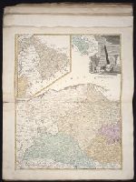
Beinecke Rare Book and Manuscript Library > Borussiae occidentalis tabula [cartographic material] / a Franc. Ludov. Guessefeld
Creator:
Published / Created:
1645
Call Number:
1983 Folio 19
Collection Title:
[Atlas factice of 96 maps by Blaeu, Visscher, Jansson, Hondius and others]
Image Count:
1
Description:
Numbered 58 on verso. and Reinforced along lower edges with manuscript waste. Sheet measures 39.5 x 51.7 cm. No. 54 of 92 maps bound together.
Publisher:
N. Berey
Subject (Geographic):
Boulonnais (France) --Maps --Early works to 1800 and Pas-de-Calais (France) --Maps --Early works to 1800
Found in:
Beinecke Rare Book and Manuscript Library > Boulonnois, Pontieu, Artois, Comte de S. Paul et Pays de la Locoue
Creator:
Published / Created:
[ca. 1633]
Call Number:
1983 Folio 19
Collection Title:
[Atlas factice of 96 maps by Blaeu, Visscher, Jansson, Hondius and others]
Image Count:
1
Description:
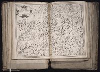
Imperfect: mutilated along fold, with some loss of text; bar scale cut out and replaced in ms. Reinforced along edges with printed waste. Sheet measures 39.1 x 50.4 cm. No. 78 of 92 maps bound together. and Numbered 84 [80, cancelled] on verso.
Publisher:
Excudebat Ioannes Ianssonius
Subject (Geographic):
Brandenburg (Germany : Landkreis) --Maps --Early works to 1800s, Mecklenburg-Vorpommern (Germany) --Maps --Early works to 1800, and Pomerania (Poland and Germany) --Maps --Early works to 1800
Collection Created:
[1556-1680]
Found in:
Beinecke Rare Book and Manuscript Library > Brandeburgum Marchionatus, cum Ducatibus Pomeraniae et Meklenburgi
Creator:
Published / Created:
[164-?]
Call Number:
1983 Folio 19
Collection Title:
[Atlas factice of 96 maps by Blaeu, Visscher, Jansson, Hondius and others]
Image Count:
1
Description:
Imperfect: torn along fold, with some loss of text.. Sheet measures 38.9 x 49.2 cm. No. 15 of 92 maps bound together.
Publisher:
Willem Janszoon Blaeu
Subject (Geographic):
Lazio (Italy) --Maps --Early works to 1800
Subject (Name):
Blaeu, Cornelis, dedicator and Dal Pozzo, Cassiano, 1588-1657, dedicatee
Collection Created:
[1556-1680]
Found in:
Beinecke Rare Book and Manuscript Library > Campagna di Roma, olim Latium : patrimonio di S. Pietro
Creator:
Published / Created:
1743
Call Number:
1975 Folio 31
Collection Title:
[Atlas factice of 42 maps, produced by the Homann Erben firm]
Image Count:
1
Alternative Title:
Staat von der Republic Genova, nach seiner Eintheilung in die ost- u. west-Revier
Publisher:
Homann Erben
Subject (Geographic):
Genoa (Italy) --Maps --Early works to 1800
Subject (Topic):
Atlases, German --Early works to 1800
Collection Created:
[Nuremberg,
Found in:
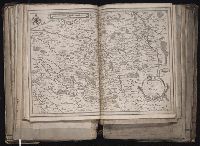
Beinecke Rare Book and Manuscript Library > Carta Geographica, la quale rappresenta lo Stato della Republica di Genova partita nella Riviera di Levante et di Ponente / [cartographic material] / data in publico per gli Heredi d'Homann ; con privil. imp le 1743 = Staat von der Republic Genova, nach s
Creator:
Published / Created:
1643
Call Number:
1983 Folio 19
Collection Title:
[Atlas factice of 96 maps by Blaeu, Visscher, Jansson, Hondius and others]
Image Count:
1
Description:
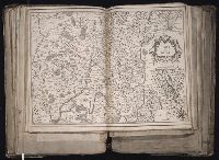
Sheet measures 39.1 x 51.3 cm. Reinforced along lower edges with manuscript waste. No. 37 of 92 maps bound together.
Publisher:
[Pierre Mariette]
Subject (Geographic):
Auvergne (France) --Maps --Early works to 1800
Collection Created:
[1556-1680]
Found in:
Beinecke Rare Book and Manuscript Library > Carte d'Auuergne
Creator:
Published / Created:
[ca. 1634]
Call Number:
1983 Folio 19
Collection Title:
[Atlas factice of 96 maps by Blaeu, Visscher, Jansson, Hondius and others]
Image Count:
1
Description:
Sheet measures 39.1 x 51.3 cm. Reinforced along lower edges with manuscript waste. No. 38 of 92 maps bound together.
Publisher:
Christophe Tassin
Subject (Geographic):
Berry (France) --Maps --Early works to 1800
Found in:
Beinecke Rare Book and Manuscript Library > Carte de Berry
Creator:
Published / Created:
[1634]
Call Number:
1983 Folio 19
Collection Title:
[Atlas factice of 96 maps by Blaeu, Visscher, Jansson, Hondius and others]
Image Count:
1
Description:
Imperfect: wormhole in center crease, with some loss of text. Reinforced along lower edges with manuscript waste. Sheet measures 38.8 x 51.6 cm. No. 34 of 92 maps bound together.
Publisher:
Christophe Tassin
Subject (Geographic):
Bresse (France : Region) --Maps --Early works to 1800
Found in:
Beinecke Rare Book and Manuscript Library > Carte de Bresse
Branch:v1.61.6 ,Deployed:2024-06-12T09:55:31-04:00