Search
You Searched For
Search Results
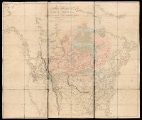
- Creator:
- Arrowsmith, Aaron, 1750-1823, cartographer
- Published / Created:
- [1820]
- Call Number:
- 71 1820B
- Image Count:
- 1
- Resource Type:
- cartographic image
- Found in:
- Beinecke Rare Book and Manuscript Library > A map exhibiting all the new discoveries in the interior parts of North America : inscribed by permission to the honorable governor and company of adventurers of England trading into Hudsons Bay, in testimony of their liberal communications to their most obedient and very humble servant, A. Arrowsmith, Hydrographer to His Majesty
- Creator:
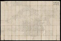
- Lehman, Christian, creator
- Published / Created:
- [1857]
- Call Number:
- 2018 Folio 173
- Image Count:
- 93
- Resource Type:
- cartographic image
- Found in:
- Beinecke Rare Book and Manuscript Library > An explanation of the original location and general plan or draught of the lands and lots of Germantown and Creesam Townships, copied from Matthias Zimmerman's original dated June 26th A.D. 1746, and of the several districts and divisions thereof, part extracted from original and former draughts and part done and taken from actual mensuration drawn by Christian Lehman, July 28, 1776, recopied by his grandson Joseph Lehman, January 1, 1824, from which recopy this copy was taken, August 1857, for Peter E. Keyser
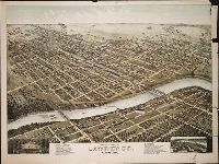
- Creator:
- Morse, D. D., artist
- Published / Created:
- ©1880.
- Call Number:
- BrSides Zc39 880mo
- Image Count:
- 1
- Resource Type:
- cartographic image
- Found in:
- Beinecke Rare Book and Manuscript Library > Bird's eye view of Lawrence, Kansas, 1880 [cartographic material]
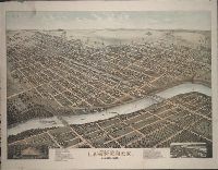
- Creator:
- Morse, D. D., artist
- Published / Created:
- ©1880.
- Call Number:
- BrSides Zc39 880mo
- Image Count:
- 1
- Resource Type:
- cartographic image
- Found in:
- Beinecke Rare Book and Manuscript Library > Bird's eye view of Lawrence, Kansas, 1880 [cartographic material]
- Creator:
- Dong, Fangli, active 19th century, cartographer
董方立, active 19th century, cartographer
- Published / Created:
- Daoguang 12 [1842]
- Call Number:
- Covers 56 +1842
- Image Count:
- 1
- Resource Type:
- cartographic image
- Found in:
- Beinecke Rare Book and Manuscript Library > Huang chao yi tong yu di quan tu, 皇朝壹統輿地全圖
- Published / Created:
- 1852.
- Call Number:
- 28 1852B
- Image Count:
- 2
- Resource Type:
- cartographic image
- Found in:
- Beinecke Rare Book and Manuscript Library > Islas Filipinas [cartographic material]
- Creator:
- Mitchell, Donald Grant, 1822-1908, cartographer
- Published / Created:
- [not before 1876]
- Call Number:
- Manuscript 766 N46 1870E
- Image Count:
- 1
- Resource Type:
- cartographic image
- Found in:
- Beinecke Rare Book and Manuscript Library > Manuscript map of New Haven Green to Edgewood by Donald G. Mitchell
- Creator:
- Mitchell, Donald Grant, 1822-1908, cartographer
- Published / Created:
- [1870?]
- Call Number:
- Manuscript 766 N46 1870F
- Image Count:
- 1
- Resource Type:
- cartographic image
- Found in:
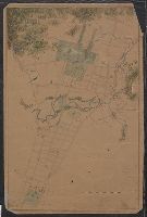
- Beinecke Rare Book and Manuscript Library > Map of Horse Railroad, Westville, & part of New Haven : enlarged four-fold from the county survey
- Creator:
- Walker, John, 1786-1873, cartographer
- Published / Created:
- 1882.
- Call Number:
- Covers 59 +1882
- Image Count:
- 2
- Resource Type:
- cartographic image
- Found in:
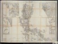
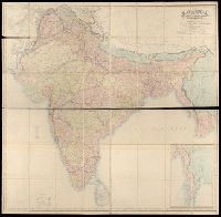
- Beinecke Rare Book and Manuscript Library > Map of India : shewing the British territories, subdivided into collectorates and including British Burmah, with the position and boundary of each native state
- Creator:
- Mitchell, Donald Grant, 1822-1908, cartographer
- Published / Created:
- Decr. 1863.
- Call Number:
- Roll Map 78
- Image Count:
- 2
- Resource Type:
- cartographic image
- Found in:
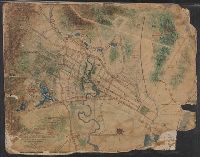
- Beinecke Rare Book and Manuscript Library > Map of a portion of Westville & New Haven