Skip to search
Skip to main content
Skip to first result
Search
You Searched For
Extent of Digitization
Completely digitized
Genre
Maps
Subject (Geographic)
Asia--Maps
New Search
Search Results
Creator:
Published / Created:
c1921.
Call Number:
50 1921
Container / Volume:
BRBL_00273
Image Count:
1
Resource Type:
Maps, Atlases & Globes
Description:
"Engraved and Printed at The Matthews-Northrup Works, Buffalo, N.Y." and Relief shown by hachures.
Publisher:
The Society,
Subject (Geographic):
Africa, North--Maps, Asia--Maps, and Eurasia--Maps
Subject (Name):
Matthews-Northrup Works
Found in:
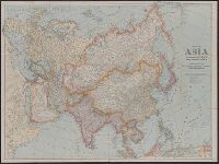
Beinecke Rare Book and Manuscript Library > Map of Asia and adjoining Europe with a portion of Africa / prepared especially for the National Geographic Magazine, Gilbert Grosvenor, editor.
Creator:
Published / Created:
1840
Call Number:
50 1870A
Container / Volume:
BRBL_00272
Image Count:
1
Resource Type:
Maps, Atlases & Globes
Description:
col. photocopy. and Relief shown by hachures.
Publisher:
Published by Js. Wyld, Geographer to Her Majesty ...,
Subject (Geographic):
Asia--Maps
Found in:
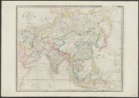
Beinecke Rare Book and Manuscript Library > Map of Asia.
Creator:
Call Number:
13 1873A
Container / Volume:
BRBL_00011
Image Count:
1
Resource Type:
Maps, Atlases & Globes
Alternative Title:
Map of the countries between England and India
Description:
Borders are hand colored.
Subject (Geographic):
Asia--Maps, England--Maps, Europe--Maps, and India--Maps
Found in:
Beinecke Rare Book and Manuscript Library > Map of the countries between England & India : designed to shew the over-land and sea-routes to the east, and the relative position of Russia to England & Hindostan / by James Wyld.
Creator:
Published / Created:
[1912?]
Call Number:
50 1912C
Container / Volume:
BRBL_00273
Image Count:
1
Resource Type:
Maps, Atlases & Globes
Publisher:
Macmillan & Co.
Subject (Geographic):
Asia--Maps
Found in:
Beinecke Rare Book and Manuscript Library > Northern Asia.
Published / Created:
[1845?]
Call Number:
50CB 1845
Container / Volume:
BRBL_00274
Image Count:
1
Resource Type:
Maps, Atlases & Globes
Description:
"Platt's grosser Atlas der Erde No. 43".
Publisher:
Verlag der Rubach'schen Buchhandlung (E. Fabricius),
Subject (Geographic):
Asia--Maps
Found in:
Beinecke Rare Book and Manuscript Library > Oro- und hydrographische Karte von Asien nach Berghaus / lith. u. gedr. im geog. lith. Institut von Albr. Platt.
Published / Created:
1917
Call Number:
11hcf 1919B-25
Container / Volume:
BRBL_00010Q
Image Count:
1
Resource Type:
Maps, Atlases & Globes
Description:
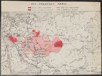
In lower left: Aug. 1917.
Publisher:
The Geogr. Review,
Subject (Geographic):
Asia--Maps
Subject (Topic):
Pan-Turanianism--Asia--Maps
Found in:
Beinecke Rare Book and Manuscript Library > Pan-Turanian Area.
Creator:
Published / Created:
c1904.
Call Number:
56 1904
Container / Volume:
BRBL_00296
Image Count:
2
Resource Type:
Maps, Atlases & Globes
Alternative Title:
1904 war map of Japan, Korea, and China, 1904 war map of Russia and the continent of Asia, and Rand, McNally & Co.'s 1904 war map of Russia and the continent of Asia
Description:
Indexed. and Relief shown by hachures and spot heights.
Publisher:
Rand McNally & Co.,
Subject (Geographic):
Asia--Maps and East Asia--Maps
Found in:
Beinecke Rare Book and Manuscript Library > Rand, McNally & Co.'s 1904 war map of Japan, Korea, and China ; Rand, McNally & Co.'s 1904 war map of Russia and the continent of Asia.
Creator:
Published / Created:
c1904.
Call Number:
50 1904
Container / Volume:
BRBL_00273
Image Count:
2
Resource Type:
Maps, Atlases & Globes
Alternative Title:
1904 war map of Japan, Korea, and China, 1904 war map of Russia and the continent of Asia, and Rand, McNally & Co.'s 1904 war map of Russia and the continent of Asia
Description:
Indexed. and Relief shown by hachures and spot heights.
Publisher:
Rand McNally & Co.,
Subject (Geographic):
Asia--Maps and East Asia--Maps
Found in:
Beinecke Rare Book and Manuscript Library > Rand, McNally & Co.'s 1904 war map of Japan, Korea, and China ; Rand, McNally & Co.'s 1904 war map of Russia and the continent of Asia.
Creator:
Published / Created:
c1904.
Call Number:
57hc 1904
Container / Volume:
BRBL_00307
Image Count:
2
Resource Type:
Maps, Atlases & Globes
Alternative Title:
1904 war map of Japan, Korea, and China, 1904 war map of Russia and the continent of Asia, and Rand, McNally & Co.'s 1904 war map of Russia and the continent of Asia
Description:
Indexed. and Relief shown by hachures and spot heights.
Publisher:
Rand McNally & Co.,
Subject (Geographic):
Asia--Maps and East Asia--Maps
Found in:
Beinecke Rare Book and Manuscript Library > Rand, McNally & Co.'s 1904 war map of Japan, Korea, and China ; Rand, McNally & Co.'s 1904 war map of Russia and the continent of Asia.
Published / Created:
1919?]
Call Number:
11hcf 1919B-36
Container / Volume:
BRBL_00010Q
Image Count:
1
Resource Type:
Maps, Atlases & Globes
Publisher:
s.n.,
Subject (Geographic):
Asia--Maps
Found in:
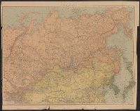
Beinecke Rare Book and Manuscript Library > Siberia.
Branch:v1.61.6 ,Deployed:2024-06-12T09:55:33-04:00