Skip to search
Skip to main content
Skip to first result
Search
You Searched For
Extent of Digitization
Completely digitized
Genre
Maps
Subject (Geographic)
Mexico
Search Results
Published / Created:
1826.
Call Number:
Manuscript 88 M41 1826
Image Count:
2
Description:
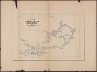
Rough tracing showing the four leagues granted by the State of Tamaulipas in 1826, as Ejidos of the City of Matamoros and the relative positions ... of the City of Matamoros, City of Brownsville and the U.S. Military Reservation of Fort Brown.
Subject (Geographic):
Mexico
Found in:
Beinecke Rare Book and Manuscript Library > Ejidos of City of Matamoros
Published / Created:
1883]
Call Number:
881gme 1883
Image Count:
1
Description:
Relief shown by hachures.
Publisher:
s.n.
Subject (Geographic):
Mexico and Jalisco
Subject (Topic):
Railroads
Found in:
Beinecke Rare Book and Manuscript Library > F.C.C.M. linea del Pacifico, division oriental : lineas y reconocimientos entre Guadalajara y Lagos
Creator:
Published / Created:
[between 1741 and 1760]
Call Number:
71 1737A
Image Count:
1
Resource Type:
cartographic image
Description:
BEIN 85 1740D: Stamp on verso: Yale, Horace Brown, 1900S.
Publisher:
Tobias Conrad Seutter
Subject (Geographic):
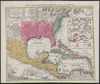
North America, United States, Mexico, Central America, and Caribbean Area
Found in:
Beinecke Rare Book and Manuscript Library > Mappa geographica regionem Mexicanam et Floridam terrasque adjacentes, ut et anteriores Americae insulas, cursus itidem et reditus navigantium versus flumen Missisipi et alias colonias ob oculos ponens / [cartographic material]
Creator:
Published / Created:
[between 1741 and 1760]
Call Number:
85 1740D
Image Count:
1
Resource Type:
cartographic image
Description:
BEIN 85 1740D: Stamp on verso: Yale, Horace Brown, 1900S.
Publisher:
Tobias Conrad Seutter
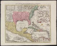
Subject (Geographic):
North America, United States, Mexico, Central America, and Caribbean Area
Found in:
Beinecke Rare Book and Manuscript Library > Mappa geographica regionem Mexicanam et Floridam terrasque adjacentes, ut et anteriores Americae insulas, cursus itidem et reditus navigantium versus flumen Missisipi et alias colonias ob oculos ponens / [cartographic material]
Creator:
Published / Created:
[1847]
Image Count:
1
Resource Type:
still image
Abstract:
Sailing ships in the harbor watch over American troops camped in tents on the island
Description:
Title from caption below image.
Publisher:
Published by P.S. Duval, no. 7 Bank Alley
Subject (Geographic):
Mexico and Veracruz-Llave (State)
Subject (Topic):
Islands, Military camps, Mexican War, 1846-1848, and Campaigns
Found in:
Beinecke Rare Book and Manuscript Library > The island of Lobos : rendezvous of the U.S. Army under General Scott, previous to the attack on Vera Cruz, February 9th, 1847
Branch:v1.68.6 ,Deployed:2025-07-02T08:09:28-04:00