Skip to search
Skip to main content
Skip to first result
Search
You Searched For
Extent of Digitization
Completely digitized
Genre
Maps
New Search
Search Results
Creator:
Published / Created:
ann. 1605.
Call Number:
1976 Folio 46
Image Count:
125
Resource Type:
Books, Journals & Pamphlets
Found in:
Beinecke Rare Book and Manuscript Library > The mariners mirrovr wherin may playnly be seen the courses, heights, distances, depths, sounding, flouds and ebs, risings of lands, rocks ... of the harbouroughs, havens and ports of the greatest part of Europe: ... together w.th the rules and instrumeíÄ
Creator:
Published / Created:
1879
Call Number:
BrSides Zc19 N82k 879it
Image Count:
2
Resource Type:
Maps, Atlases & Globes
Found in:
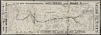
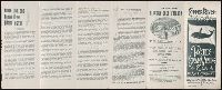
Beinecke Rare Book and Manuscript Library > It is the shortest, quickest and best route : and the fare is always as low as the lowest
Creator:
Published / Created:
[1921]
Call Number:
1992 Folio 7
Image Count:
1
Resource Type:
Books, Journals & Pamphlets
Found in:
Beinecke Rare Book and Manuscript Library > Librairie six, 5, avenue Lowendal, Paris 7e, Exposition dada Man Ray, du 3 au 31 decembre 1921 ...
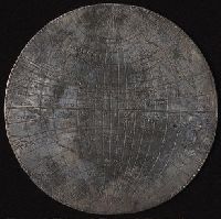
Creator:
Published / Created:
[1589]
Call Number:
Taylor 15
Image Count:
5
Resource Type:
Maps, Atlases & Globes
Found in:
Beinecke Rare Book and Manuscript Library > [Silver map of the world showing the track of Sir Francis Drakes circumnavigation engraved or struck on a flat silver disc by Michael Mercator]
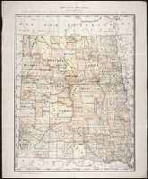
Creator:
Published / Created:
c1884
Call Number:
BrSides Zc35 876rae
Image Count:
1
Resource Type:
Maps, Atlases & Globes
Found in:
Beinecke Rare Book and Manuscript Library > Map of Dakota / printed expressly for E.P. Gates, president Merchants Bank and negotiator of farm loans, Grand Forks, Dakota
Creator:
Published / Created:
undated
Call Number:
Zc18 A11 856db
Image Count:
2
Resource Type:
Books, Journals & Pamphlets
Found in:
Beinecke Rare Book and Manuscript Library > D.B. Cooke & Cos great western railway guide : exhibiting all stations with distances from each other.
Creator:
Published / Created:
1934]
Call Number:
ZZa L588 G934
Image Count:
2
Resource Type:
Maps, Atlases & Globes
Found in:
Beinecke Rare Book and Manuscript Library > A map of Sinclair Lewis United States as it appears in his novels
Published / Created:
[1897?]
Call Number:
Zc86 897cq
Image Count:
5
Resource Type:
Books, Journals & Pamphlets
Found in:
Beinecke Rare Book and Manuscript Library > Copper River, Alaska : Pacific Steam Whaling Co., all American Route ...
Creator:
Published / Created:
1875-1908
Call Number:
WA MSS S-1314
Collection Title:
Charles F. Bates papers
Container / Volume:
Box 15 | Folder 200
Image Count:
109
Found in:
Beinecke Rare Book and Manuscript Library > [Scrapbook]
Creator:
Published / Created:
[United States : and 1989]
Call Number:
BrSides Folio 2005 20
Image Count:
1
Resource Type:
Maps, Atlases & Globes
Found in:
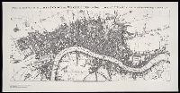
Beinecke Rare Book and Manuscript Library > A new and exact plan of the cities of London and Westminster, and borough of Southwark, with the additional buildings to the year 1756
Creator:
Published / Created:
1806 January
Call Number:
ZZ35 5 4
Image Count:
1
Resource Type:
Maps, Atlases & Globes
Found in:
Beinecke Rare Book and Manuscript Library > A plan of the town of New Haven with all the buildings in 1748 taken by the Hon. Gen. Wadsworth of Durham ... : respectfully inscribed to the Connecticut Academy of Arts and Sciences / by ... Wm. Lyon
Creator:
Published / Created:
1860 February 17-November 26
Call Number:
WA MSS S-2490
Collection Title:
William Downie papers relating to exploration of British Columbia
Container / Volume:
Box 1 | 1a
Image Count:
153
Resource Type:
Archives or Manuscripts
Found in:
Beinecke Rare Book and Manuscript Library > Family Register, manuscript diary
Creator:
Published / Created:
[1886?]
Call Number:
BrSides Zc39 886fr
Image Count:
2
Resource Type:
Books, Journals & Pamphlets
Found in:
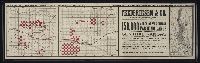
Beinecke Rare Book and Manuscript Library > Frederiksen & Co. own and offer for sale in central Kansas : 150,000 acres of the choicest farming lands ...
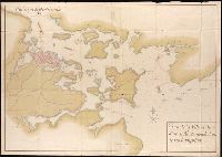
Creator:
Published / Created:
1795
Call Number:
Osborn pc259
Image Count:
4
Resource Type:
Maps, Atlases & Globes
Found in:
Beinecke Rare Book and Manuscript Library > Bowles's European geographical amusement, or, Game of geography ; designed from The grand tour of Europe, by Dr. Nugent
Creator:
Published / Created:
ca. 1892]
Call Number:
Zc70 885nof 949
Image Count:
3
Resource Type:
Maps, Atlases & Globes
Found in:
Beinecke Rare Book and Manuscript Library > Sectional land map showing the lands of the Northern Pacific Railroad Co. in western Washington and northern Oregon : with condensed information relating to the Pacific Northwest
Creator:
Published / Created:
[1680?]
Call Number:
1973 Folio 10
Image Count:
1
Resource Type:
Maps, Atlases & Globes
Found in:
Beinecke Rare Book and Manuscript Library > Insula sive regnum Siciliae
Creator:
Published / Created:
[ca. 1670]
Call Number:
1973 Folio 10
Image Count:
1
Resource Type:
Maps, Atlases & Globes
Found in:
Beinecke Rare Book and Manuscript Library > Barbaria
Creator:
Published / Created:
1680
Call Number:
1973 Folio 10
Image Count:
1
Resource Type:
Maps, Atlases & Globes
Found in:
Beinecke Rare Book and Manuscript Library > A mapp of all the world in two hemispheres in which are exactly described all the parts of the earth and seas
Creator:
Published / Created:
1680
Call Number:
1973 Folio 10
Image Count:
1
Resource Type:
Maps, Atlases & Globes
Found in:
Beinecke Rare Book and Manuscript Library > Europe divided into its principall states, which are subdivided into their principall provinces
Creator:
Published / Created:
[ca. 1700]
Call Number:
1973 Folio 10
Image Count:
1
Resource Type:
Maps, Atlases & Globes
Found in:
Beinecke Rare Book and Manuscript Library > A new mapp of the sea coasts of England, Scotland, and Ireland: with the adjacent coasts of France, Holand, Denmark & Norway, shewing the scituation and distance of the several ports, harbors, havens, creeks, sands &c
Creator:
Published / Created:
[1689?]
Call Number:
1973 Folio 10
Image Count:
1
Resource Type:
Maps, Atlases & Globes
Found in:
Beinecke Rare Book and Manuscript Library > A new mapp of the kingdome of England and Wales: containing all the cities, market towns, with the roades from town to town, and the numbers of reputed miles between them, are given by inspection without scale or compass
Creator:
Published / Created:
1700
Call Number:
1973 Folio 10
Image Count:
1
Resource Type:
Maps, Atlases & Globes
Found in:
Beinecke Rare Book and Manuscript Library > This actuall survey of London, Westminster & Southwark is humbly dedicated to ye Ld. Mayor [and] Court of Aldermen by Ro. Morden, Phil. Lea, Chr. Browne
Creator:
Published / Created:
[169-?]
Call Number:
1973 Folio 10
Image Count:
1
Resource Type:
Maps, Atlases & Globes
Found in:
Beinecke Rare Book and Manuscript Library > A new chart of the sea coasts of France: together with the English Chanell describing ye severall harbors, sands, rocks, and anchoridges, etc. on the said coasts
Creator:
Published / Created:
[ca. 1689]
Call Number:
1973 Folio 10
Image Count:
1
Resource Type:
Maps, Atlases & Globes
Found in:
Beinecke Rare Book and Manuscript Library > Exactissima Regni Scotiae tabula tam in septentrionalem et meriodionalem quam in minores earundem provincias, insulasq[ue], ei undique praetensas accurate divisa
Creator:
Published / Created:
[ca. 1700]
Call Number:
1973 Folio 10
Image Count:
1
Resource Type:
Maps, Atlases & Globes
Found in:
Beinecke Rare Book and Manuscript Library > A new map of Ireland
Creator:
Published / Created:
[1704?]
Call Number:
1973 Folio 10
Image Count:
1
Resource Type:
Maps, Atlases & Globes
Found in:
Beinecke Rare Book and Manuscript Library > The war in Portugall and Spain: with the harbours of the Groyne, Vigo & Bayonna, Porto, Lisbon [and] St. Ubes, Cadiz, and a chart from England to the streights
Creator:
Published / Created:
[1682]
Call Number:
1973 Folio 10
Image Count:
1
Resource Type:
Maps, Atlases & Globes
Found in:
Beinecke Rare Book and Manuscript Library > Spain divided into its severall kingdoms and principalities, according as they are comprehended under the crowns of Castile and Aragon, in the possession of his Catholick Majesty and under the crown of Portugal, in the possession of the king of Portugal
Creator:
Published / Created:
[168-]
Call Number:
1973 Folio 10
Image Count:
1
Resource Type:
Maps, Atlases & Globes
Found in:
Beinecke Rare Book and Manuscript Library > Principality of Catalonia: in which are comprehended the counties of Rossillion and of Cerdagne divided into its severall vigueries or provost-ship
Creator:
Published / Created:
[168-]
Call Number:
1973 Folio 10
Image Count:
1
Resource Type:
Maps, Atlases & Globes
Found in:
Beinecke Rare Book and Manuscript Library > The kingdom of France: distinguished according to the extent of all its provinces and conquests in Spain, Italy, Germany, Flanders, Artoise, Haynoult, Namur, and Luxembourg, provinces of the low countries
Creator:
Published / Created:
[168-?]
Call Number:
1973 Folio 10
Image Count:
1
Resource Type:
Maps, Atlases & Globes
Found in:
Beinecke Rare Book and Manuscript Library > Lutetiae Parisiorum universae Galliae metropolis novissima [et] accuratissima
Creator:
Published / Created:
[ca. 1700]
Call Number:
1973 Folio 10
Image Count:
1
Resource Type:
Maps, Atlases & Globes
Found in:
Beinecke Rare Book and Manuscript Library > Gouvernement General de Languedoc: divise en ses vint deux Diocesez
Creator:
Published / Created:
1693
Call Number:
1973 Folio 10
Image Count:
1
Resource Type:
Maps, Atlases & Globes
Found in:
Beinecke Rare Book and Manuscript Library > La Suisse divisee en ses treze cantons, ses alliez [et] ses sujets
Creator:
Published / Created:
1682
Call Number:
1973 Folio 10
Image Count:
1
Resource Type:
Maps, Atlases & Globes
Found in:
Beinecke Rare Book and Manuscript Library > Italy: distinguished according to the extent of all the states, kingdoms, republicks, dukedoms, principalities etc. that doe at present divide it
Creator:
Published / Created:
[168-?]
Call Number:
1973 Folio 10
Image Count:
1
Resource Type:
Maps, Atlases & Globes
Found in:
Beinecke Rare Book and Manuscript Library > A new map of the estates of Savoy [and] Piedmont: with the countries adjacent
Creator:
Published / Created:
[ca. 1701]
Call Number:
1973 Folio 10
Image Count:
1
Resource Type:
Maps, Atlases & Globes
Found in:
Beinecke Rare Book and Manuscript Library > H. Jalliots map of the seat of war in Italy cont. ye duchyes of Milan, Mantua, Parma, etc. with the Venetian territoryes
Creator:
Published / Created:
[ca. 1680]
Call Number:
1973 Folio 10
Image Count:
1
Resource Type:
Maps, Atlases & Globes
Found in:
Beinecke Rare Book and Manuscript Library > Status ecclesiasticus et magnus ducatus Thoscanae
Creator:
Published / Created:
[ca. 1700?]
Call Number:
1973 Folio 10
Image Count:
1
Resource Type:
Maps, Atlases & Globes
Found in:
Beinecke Rare Book and Manuscript Library > A new mapp of Rome shewing its antient and present scituation
Creator:
Published / Created:
[1706?]
Call Number:
1973 Folio 10
Image Count:
1
Resource Type:
Maps, Atlases & Globes
Found in:
Beinecke Rare Book and Manuscript Library > Regnum Neapolis: in quo sunt Aprutium ulterius et citerius, Comitatus Molisius, Terra Laboris, Capitaniata Principatus ulterior et citerior, Terra Bariensis et Hidruntina, Basilicata, Calabria citerior et ulterior
Creator:
Published / Created:
[ca. 1680]
Call Number:
1973 Folio 10
Image Count:
1
Resource Type:
Maps, Atlases & Globes
Found in:
Beinecke Rare Book and Manuscript Library > Mediterranean Sea divided into its principal parts or seas
Creator:
Published / Created:
1683
Call Number:
1973 Folio 10
Image Count:
1
Resource Type:
Maps, Atlases & Globes
Found in:
Beinecke Rare Book and Manuscript Library > The states of the empire of the Turks in Europe: subdivided according to ye extent of its governments
Creator:
Published / Created:
[168-?]
Call Number:
1973 Folio 10
Image Count:
1
Resource Type:
Maps, Atlases & Globes
Found in:
Beinecke Rare Book and Manuscript Library > The kingdom of Hungary and the states that have been subject to it which are now the northern parts of Turkey in Europe
Creator:
Published / Created:
[ca. 1686]
Call Number:
1973 Folio 10
Image Count:
1
Resource Type:
Maps, Atlases & Globes
Found in:
Beinecke Rare Book and Manuscript Library > The empire of Germany divided according to the extent of all the estates, principalities and soveraignities that are or have been comprehended under the name of Germany
Creator:
Published / Created:
[ca. 1686]
Call Number:
1973 Folio 10
Image Count:
1
Resource Type:
Maps, Atlases & Globes
Found in:
Beinecke Rare Book and Manuscript Library > Part of the circle of Austria viz the Archdukedom of Austria, divided into the higher and lower
Creator:
Published / Created:
1688
Call Number:
1973 Folio 10
Image Count:
1
Resource Type:
Maps, Atlases & Globes
Found in:
Beinecke Rare Book and Manuscript Library > Part of the circle of Austria in which are the Dukedomes of Stiria, and Carinthia, of Carniola, and other heriditary countrys of the house of Austria
Creator:
Published / Created:
[ca. 1686]
Call Number:
1973 Folio 10
Image Count:
1
Resource Type:
Maps, Atlases & Globes
Found in:
Beinecke Rare Book and Manuscript Library > The circle of Bavaria subdivided into all ye territories it's composed of
Creator:
Published / Created:
1696
Call Number:
1973 Folio 10
Image Count:
1
Resource Type:
Maps, Atlases & Globes
Found in:
Beinecke Rare Book and Manuscript Library > Le cercle de Franconie : subdivise en tous les estats qui le composent
Creator:
Published / Created:
[ca. 1686]
Call Number:
1973 Folio 10
Image Count:
1
Resource Type:
Maps, Atlases & Globes
Found in:
Beinecke Rare Book and Manuscript Library > The circle of Swabia subdivided into all the territories it's composed of
Creator:
Published / Created:
1689
Call Number:
1973 Folio 10
Image Count:
1
Resource Type:
Maps, Atlases & Globes
Found in:
Beinecke Rare Book and Manuscript Library > The circle and electorat of the Rhine : subdivided into all the states that it's composed off [sic]
Creator:
Published / Created:
[ca. 1689]
Call Number:
1973 Folio 10
Image Count:
1
Resource Type:
Maps, Atlases & Globes
Found in:
Beinecke Rare Book and Manuscript Library > The course of the river Rhine : from its fountain to its runing into the sea in which is distinguish't all the estates and soveraignities which are upon it and about it
Creator:
Published / Created:
[ca. 1689]
Call Number:
1973 Folio 10
Image Count:
1
Resource Type:
Maps, Atlases & Globes
Found in:
Beinecke Rare Book and Manuscript Library > The circle of Westphalia : divided into all it's states and soveranities
Creator:
Published / Created:
[ca. 1684?]
Call Number:
1973 Folio 10
Image Count:
1
Resource Type:
Maps, Atlases & Globes
Found in:
Beinecke Rare Book and Manuscript Library > The dukedom and electorat of Brandenbourg: which is part of the circle of the higher Saxony, divided into its principall parts
Creator:
Published / Created:
[ca. 1689?]
Call Number:
1973 Folio 10
Image Count:
1
Resource Type:
Maps, Atlases & Globes
Found in:
Beinecke Rare Book and Manuscript Library > The dukedom of Pomerania : divided into it's principall parts
Creator:
Published / Created:
[ca. 1696]
Call Number:
1973 Folio 10
Image Count:
1
Resource Type:
Maps, Atlases & Globes
Found in:
Beinecke Rare Book and Manuscript Library > Ducatus Prussiae tam Polono Regiae quam Brandenburgo Ducalis : correcta descriptio et divisio Regiae scilicet in tres Palatinatus, et Ducalis in totidem circulos, cum utrius[que] subdivisione in tractus minores
Creator:
Published / Created:
[169-?]
Call Number:
1973 Folio 10
Image Count:
1
Resource Type:
Maps, Atlases & Globes
Found in:
Beinecke Rare Book and Manuscript Library > Tabula ducatuum Livoniae et Curlandiae: recentior incisa editaque
Creator:
Published / Created:
[ca. 1683]
Call Number:
1973 Folio 10
Image Count:
1
Resource Type:
Maps, Atlases & Globes
Found in:
Beinecke Rare Book and Manuscript Library > Poland : subdivided according to the extent of its severall palatinates
Creator:
Published / Created:
1682
Call Number:
1973 Folio 10
Image Count:
1
Resource Type:
Maps, Atlases & Globes
Found in:
Beinecke Rare Book and Manuscript Library > Russia Alba, or, Moscovia : divided according to the extent of the kingdoms, dukedoms, principalities, provinces, and peoples that are at present under the dominion of the Czar of Russia, known by the name of Great Duke of Moscovia
Creator:
Published / Created:
1684
Call Number:
1973 Folio 10
Image Count:
1
Resource Type:
Maps, Atlases & Globes
Found in:
Beinecke Rare Book and Manuscript Library > Scandinavia and its confines in which are the kingdoms of Sweden, Denmark, and Norway divided into their principall provinces
Creator:
Published / Created:
[1684?]
Call Number:
1973 Folio 10
Image Count:
1
Resource Type:
Maps, Atlases & Globes
Found in:
Beinecke Rare Book and Manuscript Library > The kingdom of Denmark : subdivided into its principall provinces
Creator:
Published / Created:
[1684?]
Call Number:
1973 Folio 10
Image Count:
1
Resource Type:
Maps, Atlases & Globes
Found in:
Beinecke Rare Book and Manuscript Library > The United Provinces of the Netherlands : with their conquests in Flanders, Brabant, Limbourg, and Liege, and the places they possessed upon the Rhine in the Dutchy of Cleve and in the Arch-Bishoprick and elector of Colen
Creator:
Published / Created:
[1690?]
Call Number:
1973 Folio 10
Image Count:
1
Resource Type:
Maps, Atlases & Globes
Found in:
Beinecke Rare Book and Manuscript Library > Hollandiae Comitatus in ejusdem subjacentes ditiones : una cum toto ultrjectino dominio, nec non maximus partibus Geldriae Ducatus, Frisiae Comitatus, aliarumq[ue] vicinarum provinciarum foederatarum
Creator:
Published / Created:
[ca. 1680]
Call Number:
1973 Folio 10
Image Count:
1
Resource Type:
Maps, Atlases & Globes
Found in:
Beinecke Rare Book and Manuscript Library > Exactissima Amstelodami veteris et novissimi delineatio
Creator:
Published / Created:
[1704?]
Call Number:
1973 Folio 10
Image Count:
1
Resource Type:
Maps, Atlases & Globes
Found in:
Beinecke Rare Book and Manuscript Library > A new mapp of the theatre of the warr in Flanders and on the Rhine: together with the Dutch and French frontiers and their conquests in the same
Creator:
Published / Created:
[1700?]
Call Number:
1973 Folio 10
Image Count:
1
Resource Type:
Maps, Atlases & Globes
Found in:
Beinecke Rare Book and Manuscript Library > Flandriae comitatus : in suastoparchias optime distinctus, una cum vicinis et finitimis
Creator:
Published / Created:
1680
Call Number:
1973 Folio 10
Image Count:
1
Resource Type:
Maps, Atlases & Globes
Found in:
Beinecke Rare Book and Manuscript Library > Asia divided into its principall regions in which may be seen the extent of the empires, monarchies, kingdoms and states which at present divide Asia
Creator:
Published / Created:
[ca. 1689?]
Call Number:
1973 Folio 10
Image Count:
1
Resource Type:
Maps, Atlases & Globes
Found in:
Beinecke Rare Book and Manuscript Library > The empire of the great Turke [sic] in Europe, Asia, [and] Africa : divided into all its Beglerbeglicz or governments in which are also distinguished the states that are tributary to him
Creator:
Published / Created:
[1700?]
Call Number:
1973 Folio 10
Image Count:
1
Resource Type:
Maps, Atlases & Globes
Found in:
Beinecke Rare Book and Manuscript Library > Magnae Tartariae : magni Mogolis imperii, Iaponiae et Chinae : nova descriptio ex tabula ampliss viri D.N. Witsen pro majori parte aliis auctoribus excerpta et dita
Creator:
Published / Created:
[1662]
Call Number:
1973 Folio 10
Image Count:
1
Resource Type:
Maps, Atlases & Globes
Found in:
Beinecke Rare Book and Manuscript Library > Tabula Indiae orientalis
Creator:
Published / Created:
[1666?]
Call Number:
1973 Folio 10
Image Count:
1
Resource Type:
Maps, Atlases & Globes
Found in:
Beinecke Rare Book and Manuscript Library > Nova Persiae, Armeniae, Natoliae, et Arabiae descriptio
Creator:
Published / Created:
[ca. 1657?]
Call Number:
1973 Folio 10
Image Count:
1
Resource Type:
Maps, Atlases & Globes
Found in:
Beinecke Rare Book and Manuscript Library > Syriae sive Soriae : nova et accurata descriptio
Creator:
Published / Created:
[ca. 1692]
Call Number:
1973 Folio 10
Image Count:
1
Resource Type:
Maps, Atlases & Globes
Found in:
Beinecke Rare Book and Manuscript Library > Iudea seu Terra Sancta quae Hebraeorum sive Israelitarum in suas duodecim tribus divisa : secretis ab invicem regnis Iuda et Israel expressis in super sex ultimi temporis ejusdem terrae provincijs
Creator:
Published / Created:
1680
Call Number:
1973 Folio 10
Image Count:
1
Resource Type:
Maps, Atlases & Globes
Found in:
Beinecke Rare Book and Manuscript Library > Africa : divided according to the extent of its principall parts in which are distinguished one from the other the empires, monarchies, kingdoms, states and peoples, which at this time inhabite Africa
Creator:
Published / Created:
[ca. 1670]
Call Number:
1973 Folio 10
Image Count:
1
Resource Type:
Maps, Atlases & Globes
Found in:
Beinecke Rare Book and Manuscript Library > Nova Aegypti tabula
Creator:
Published / Created:
[1662?]
Call Number:
1973 Folio 10
Image Count:
1
Resource Type:
Maps, Atlases & Globes
Found in:
Beinecke Rare Book and Manuscript Library > Nigritarum regio
Creator:
Published / Created:
[ca. 1690?]
Call Number:
1973 Folio 10
Image Count:
1
Resource Type:
Maps, Atlases & Globes
Found in:
Beinecke Rare Book and Manuscript Library > Aethiopia superior vel interior, vulgo Abissinorum sive Presbiteri Ioannis imperium
Creator:
Published / Created:
[ca. 1690]
Call Number:
1973 Folio 10
Image Count:
1
Resource Type:
Maps, Atlases & Globes
Found in:
Beinecke Rare Book and Manuscript Library > Aethiopia inferior vel exterior: partes magis Septentrionales, quae hic desiderantur, vide in tabula Aethiopiae superioris
Creator:
Published / Created:
[1696]
Call Number:
1973 Folio 10
Image Count:
1
Resource Type:
Maps, Atlases & Globes
Found in:
Beinecke Rare Book and Manuscript Library > The principall islands in America belonging to the English empire viz Iamaica, Barbados, Antegoa, St. Christophers [and] Bermudos
Creator:
Published / Created:
1680
Call Number:
1973 Folio 10
Image Count:
1
Resource Type:
Maps, Atlases & Globes
Found in:
Beinecke Rare Book and Manuscript Library > South America divided into its principall parts where are distinguished the severall states which belong to the Spanish, English, Portugals, and French
Creator:
Published / Created:
[1710]
Call Number:
1973 Folio 10
Image Count:
1
Resource Type:
Maps, Atlases & Globes
Found in:
Beinecke Rare Book and Manuscript Library > Teatre de la guerre en Flandre [et] Brabant, les pays conquis et le Bas-Rhein etc
Published / Created:
Undated
Call Number:
1973 Folio 10
Image Count:
1
Resource Type:
Maps, Atlases & Globes
Found in:
Beinecke Rare Book and Manuscript Library > A view of Prince Charles's passage over ye Rhine being a new and correct plan of that river from ye city of Maintz to Fort Louis
Published / Created:
1847 February 22
Call Number:
WA MSS S-1882
Image Count:
1
Resource Type:
Maps, Atlases & Globes
Found in:
Beinecke Rare Book and Manuscript Library > Map of San Francisco, Calif., 1847
Published / Created:
1632
Call Number:
BrSides Folio 2008 15
Collection Title:
Les voyages de la Novvelle France occidentale, dicte Canada / faits par le Sr. de Champlain
Image Count:
1
Found in:
Beinecke Rare Book and Manuscript Library > Carte de la Nouuelle France, augmentee depuis la derniere, seruant a la nauigation faicte en son vray Meridien, par le Sr. de Champlain pour le Roy en la Marine; lequel depuis l'an 1603 jusques en l'année 1629; a descouuert plusieurs costes, terres, lacs, ruineres, et Nations de Sauuages, par cy deuant incognuës, comme il se voit en ses relations quil a faict Imprimer en 1632, ou il se uoit cette marque [image of a flag] ce sont habitations qu'ont faict les françois. Faicte l'an 1632 par le sieur de Champlain. Scale [ca. 1:1,000,000].
Creator:
Published / Created:
1906 May
Call Number:
BrSides Zc41 906ke
Image Count:
2
Resource Type:
Maps, Atlases & Globes
Found in:
Beinecke Rare Book and Manuscript Library > The Norman & Kerby map of Kiowa-Comanche Indian Reservations, Oklahoma opened for settlement 1906 : showing all lands allotted to Indians and leased for agricultrial purposes to date : carefully drawn and compiled from government survey plats and official information from U.S. Indian agent at Anadarko, Okla., and the U.S. Land Office at Lawton, Oklahoma / by E.R. Kerby
Creator:
Published / Created:
1746
Call Number:
2002 Folio 94
Image Count:
24
Resource Type:
Maps, Atlases & Globes
Found in:
Beinecke Rare Book and Manuscript Library > A plan of the cities of London and Westminster, and borough of Southwark, with the contiguous buildings / from an actual survey, taken by John Rocque, land-surveyor, and engraved by John Pine ...
Creator:
Published / Created:
[ca. 1870?].
Call Number:
WA MSS S-2247 (BrSides)
Image Count:
1
Found in:
Beinecke Rare Book and Manuscript Library > View of Lander Hill, Austin, Nevada / Lith. by W. H. Rease.
Creator:
Published / Created:
1973.
Call Number:
Folio G1244 N48 S26 1973 (LC)
Image Count:
445
Resource Type:
cartographic image
Found in:
Beinecke Rare Book and Manuscript Library > Sanborn maps of New Haven
Creator:
Published / Created:
Undated
Call Number:
WA MSS S-2767
Collection Title:
George Chorpenning papers
Container / Volume:
6 (Broadside) | Folder 64
Image Count:
1
Found in:
Beinecke Rare Book and Manuscript Library > Maps
Creator:
Published / Created:
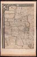
1783
Call Number:
GEN MSS 499
Collection Title:
Henri Crublier d'Opterre journal and maps, [1776]-1783.
Container / Volume:
Bsd folder 10
Image Count:
3
Found in:
Beinecke Rare Book and Manuscript Library > Unidentified. 'Amérique Septentrionale, 1783. Plan de la Ville et du Port de Ports-mouth, dans le newhampshire.'
Creator:
Published / Created:
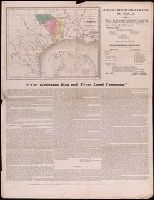
1835]
Call Number:
BrSides Zc52 835ga
Image Count:
2
Found in:
Beinecke Rare Book and Manuscript Library > The Galveston Bay and Texas Land Company
Creator:
Published / Created:
1881-
Call Number:
1997 Folio 77
Image Count:
47
Found in:
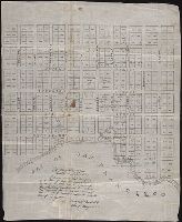
Beinecke Rare Book and Manuscript Library > Insurance maps of San Francisco, California
Branch:v1.60.98 ,Deployed:2024-04-24T10:14:36-04:00