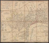
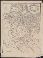
Abteilung II. Oro- und hydrographische Karte der Pyrenäischen Halbinsel, nach Berghaus, Oro- und hydrographische Karte der Pyrenäischen Halbinsel, nach Berghaus, and Platt's grosser Atlas der Erde.
Description:
Relief shown by hachures. and Stamp: Karpinski-von Wieser Map Collection.
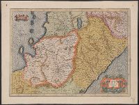
Appeared in Jansson's Accuratissima orbis antiqui delineatio., Covers also a portion of Libya., Manuscript notes on map. Manuscript number in upper left corner: 52., Oriented with north to the right., and Relief shown pictorially.
Subject (Geographic):
Egypt--Maps--Early works to 1800
Subject (Name):
Jansson, Jan, 1588-1664. Accuratissima orbis antiqui delineatio
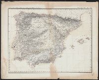
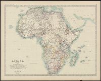
Boundaries hand colored., From Johnston's Royal atlas of modern geography., Prime meridian: Greenwich., Relief shown by hachures., Upper left: Keith Johnston's general atlas., and Upper right: 39.
Subject (Geographic):
Africa--Maps
Subject (Name):
Johnston, Alexander Keith, 1804-1871. Royal atlas of modern geography and W. & A.K. Johnston Limited
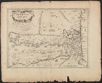
Boundaries hand colored., From Johnston's Royal atlas of modern geography?, Prime meridian: Greenwich., Relief shown by hachures., and Upper right: 36.
Subject (Geographic):
Africa--Maps
Subject (Name):
Johnston, Alexander Keith, 1804-1871. Royal atlas of modern geography and W. & A.K. Johnston Limited, publisher