Search
You Searched For
Search Results
- Published / Created:
- 1857
- Call Number:
- 75gme 1857
- Container / Volume:
- BRBL_00412
- Image Count:
- 2
- Resource Type:
- Maps, Atlases & Globes
- Found in:
- Beinecke Rare Book and Manuscript Library > A new and complete Rail Road map of the United States / compiled from reliable sources by William Perris ; presented by the Home Insurance Company of New York ; Korff Brothers, Practical Lithographers, New York.
- Published / Created:
- 1776]
- Call Number:
- 766 1776
- Container / Volume:
- BRBL_00690
- Image Count:
- 1
- Resource Type:
- Maps, Atlases & Globes
- Found in:
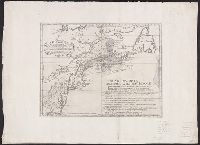
- Beinecke Rare Book and Manuscript Library > A map of Connecticut and Rhode Island with Long Island Sound, &c.
- Published / Created:
- 1776]
- Call Number:
- 766 1776
- Container / Volume:
- BRBL_00690
- Image Count:
- 1
- Resource Type:
- Maps, Atlases & Globes
- Found in:
- Beinecke Rare Book and Manuscript Library > A map of Connecticut and Rhode Island with Long Island Sound, &c.
- Creator:
- Tirion, Isaak
- Published / Created:
- [1769]
- Call Number:
- 755 1755F
- Container / Volume:
- BRBL_00427
- Image Count:
- 1
- Resource Type:
- Maps, Atlases & Globes
- Found in:
- Beinecke Rare Book and Manuscript Library > Nieuwe kaart van de grootbrittannische Volkplantingen in Noort America .../ Isaak Tirion 1755.
- Creator:
- Tirion, Isaak
- Published / Created:
- [1769]
- Call Number:
- 755 1755Z
- Container / Volume:
- BRBL_00427
- Image Count:
- 1
- Resource Type:
- Maps, Atlases & Globes
- Found in:
- Beinecke Rare Book and Manuscript Library > Nieuwe kaart van de grootbrittannische Volkplantingen in Noort America .../ Isaak Tirion 1755.
- Creator:
- Robert Sayer and John Bennett (Firm)
- Call Number:
- 755 1776K
- Container / Volume:
- BRBL_00430
- Image Count:
- 1
- Resource Type:
- Maps, Atlases & Globes
- Alternative Title:
- , Nova-Scotia, New-England, New-York, New
- Subject (Geographic):
- New England--Maps--Early works to 1800
- Found in:
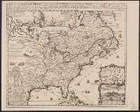
- Beinecke Rare Book and Manuscript Library > A general map of the northern British colonies in America : which comprehends the province of Quebec, the government of Newfoundland, Nova-Scotia, New-England and New-York, from the maps published by the Admiralty and Board of Trade, regulated by the astr
- Published / Created:
- [1755?]
- Call Number:
- 71 1755G
- Container / Volume:
- BRBL_00363
- Image Count:
- 1
- Resource Type:
- Maps, Atlases & Globes
- Subject (Geographic):
- New England--Maps--Early works to 1800
- Found in:
- Beinecke Rare Book and Manuscript Library > Carta d'una parte dell' America Settentrionale : che serve per ben poter intendere le pretensioni delli Inglesi, esposte ne loro memoriali in occasione della regolazione de limiti con la Francia nell' America svdetta.
- Creator:
- Fer, Nicolas de, 1646-1720
- Published / Created:
- 1719?]
- Call Number:
- 71 1719B
- Container / Volume:
- BRBL_00687
- Image Count:
- 1
- Resource Type:
- Maps, Atlases & Globes
- Found in:
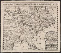
- Beinecke Rare Book and Manuscript Library > Carte de la Nouvelle France : où se voit le cours des grandes rivieres de S. Laurens & de Mississipi, aujour d'hui S. Louïs, aux environs des-quelles se trouvent les etats, païs, nations, peuples &c. de la Floride, de la Louïsiane, de la Virginie, de
- Creator:
- Fer, Nicolas de, 1646-1720
- Published / Created:
- 1719?]
- Call Number:
- 71 1719B
- Container / Volume:
- BRBL_00361
- Image Count:
- 1
- Resource Type:
- Maps, Atlases & Globes
- Found in:
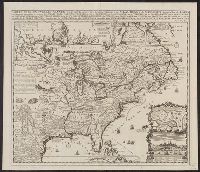
- Beinecke Rare Book and Manuscript Library > Carte de la Nouvelle France : où se voit le cours des grandes rivieres de S. Laurens & de Mississipi, aujour d'hui S. Louïs, aux environs des-quelles se trouvent les etats, païs, nations, peuples &c. de la Floride, de la Louïsiane, de la Virginie, de
- Creator:
- Fer, Nicolas de, 1646-1720
- Published / Created:
- 1719?]
- Call Number:
- 71 1719B
- Container / Volume:
- BRBL_00361
- Image Count:
- 1
- Resource Type:
- Maps, Atlases & Globes
- Found in:
- Beinecke Rare Book and Manuscript Library > Carte de la Nouvelle France : où se voit le cours des grandes rivieres de S. Laurens & de Mississipi, aujour d'hui S. Louïs, aux environs des-quelles se trouvent les etats, païs, nations, peuples &c. de la Floride, de la Louïsiane, de la Virginie, de