Search
You Searched For
Search Results
- Creator:
- Smith, J. L
- Published / Created:
- 1886 c1882.
- Call Number:
- 774 P53 1886
- Container / Volume:
- BRBL_00500
- Image Count:
- 1
- Resource Type:
- Maps, Atlases & Globes
- Found in:
- Beinecke Rare Book and Manuscript Library > 12 miles around Philadelphia.
- Published / Created:
- ca. 1880]
- Call Number:
- 30 1880A
- Container / Volume:
- BRBL_00032
- Image Count:
- 1
- Resource Type:
- Maps, Atlases & Globes
- Found in:
- Beinecke Rare Book and Manuscript Library > A Europa em 1877 : mappa burlesco da guerra / por Abdul-Azis ; Livrarie Ferreira, editora ... ; Lith. Palhares ...
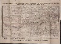
- Creator:
- Atchison, Topeka, and Santa Fe Railway Company.
- Published / Created:
- [1881?]
- Call Number:
- Zc39 881av
- Image Count:
- 2
- Resource Type:
- Books, Journals & Pamphlets
- Found in:
- Beinecke Rare Book and Manuscript Library > A correct county map of Kansas, showing the land grant of the Atchison, Topeka & Santa Fé Rail Road. A.S. Johnson, land commissioner, Topeka, Kan
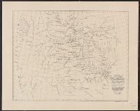
- Creator:
- Rand McNally and Company
- Published / Created:
- [1882]
- Call Number:
- 75gme 1882B
- Container / Volume:
- BRBL_00413
- Image Count:
- 2
- Resource Type:
- Maps, Atlases & Globes
- Found in:
- Beinecke Rare Book and Manuscript Library > A correct map of the United States of America showing the Atchison, Topeka and Santa Fe R.R. and connections.
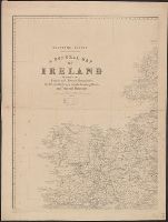
- Creator:
- Ordnance Survey of Ireland
- Published / Created:
- [188-]
- Call Number:
- 327 1875
- Container / Volume:
- BRBL_00073
- Image Count:
- 4
- Resource Type:
- Maps, Atlases & Globes
- Found in:
- Beinecke Rare Book and Manuscript Library > A general map of Ireland : showing the county and barony boundaries, the rivers, railways, canals, leading roads and principal demesnes ... (New Edition).
- Creator:
- Lyman, Benjamin Smith, 1835-1920
- Published / Created:
- 1889
- Call Number:
- 774ca Sch89 1889
- Container / Volume:
- BRBL_00501
- Image Count:
- 1
- Resource Type:
- Maps, Atlases & Globes
- Found in:
- Beinecke Rare Book and Manuscript Library > A geological and topographical map of the New Boston and Morea coal lands, in Schuylkill County, Penn'a.; by Benj. Smith Lyman ... aided by Amos P. Brown and J. S. Elverson.
- Creator:
- Lewis, Meriwether, 1774-1809
- Published / Created:
- 1887].
- Call Number:
- 71 1806A
- Container / Volume:
- BRBL_00368
- Image Count:
- 1
- Resource Type:
- Maps, Atlases & Globes
- Found in:
- Beinecke Rare Book and Manuscript Library > A map of part of the continent of North America : between the 35th and 51st degrees of north latitude, and extending from 80 degrees of west longitude to the Pacific Ocean / compiled from the authorities of the best informed travellers by M. Lewis ; copie
- Published / Created:
- [1880?]
- Call Number:
- 59FAC 1880
- Container / Volume:
- BRBL_00318
- Image Count:
- 1
- Resource Type:
- Maps, Atlases & Globes
- Found in:
- Beinecke Rare Book and Manuscript Library > A map of the Civil Divisions of India ... Trel. Saunders geogr. Stanford's Geogl. estabt. London.
- Creator:
- Parker, John Henry, 1806-1884
- Published / Created:
- 1882]
- Call Number:
- 40 R66 1882
- Container / Volume:
- BRBL_00219
- Image Count:
- 1
- Resource Type:
- Maps, Atlases & Globes
- Found in:
- Beinecke Rare Book and Manuscript Library > A plan of Rome, ancient and modern [cartographic material] : with indications of the ancient walls, streets and gates according to Pliny / by John Henry Parker.
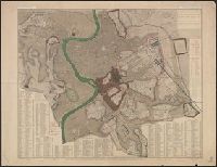
- Published / Created:
- [1880?]
- Call Number:
- 766 N46 1748D
- Container / Volume:
- BRBL_00469A
- Image Count:
- 1
- Resource Type:
- Maps, Atlases & Globes
- Found in:
- Beinecke Rare Book and Manuscript Library > A plan of the town of New Haven with all the buildings in 1748. Taken by ... Gen. Wadsworth.